My Store
Antique Philadelphia, Pennsylvania 1894 U.S. Geological Survey Map - Germantown, Manayunk, Mt Airy, Chestnut Hill, Ambler, Lower Merion, PA
Antique Philadelphia, Pennsylvania 1894 U.S. Geological Survey Map - Germantown, Manayunk, Mt Airy, Chestnut Hill, Ambler, Lower Merion, PA
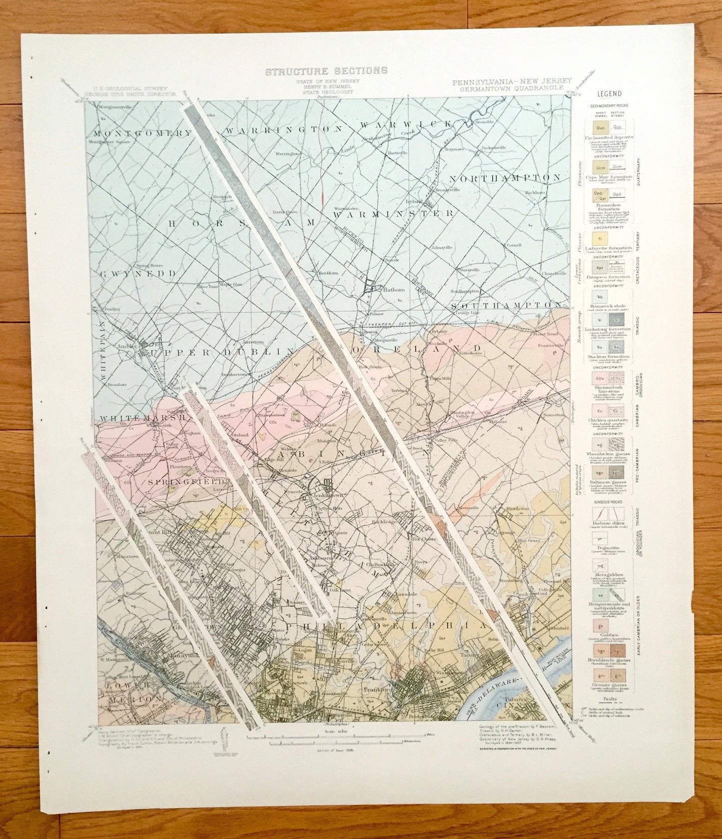
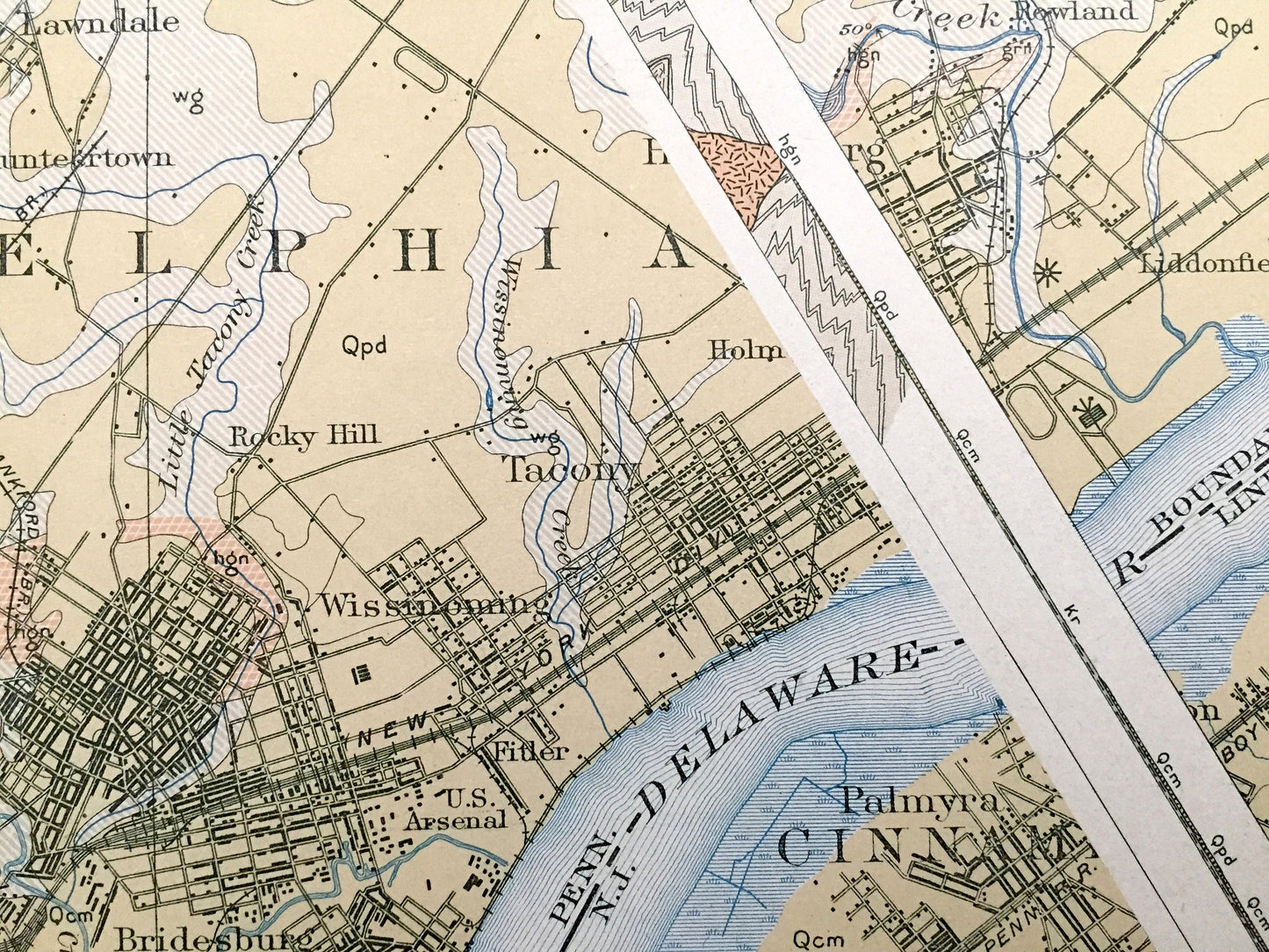
Beautiful, antique map of the sedimentary rock formations of North Philadelphia, Germantown and surrounding Montgomery County and Bucks County area. This is an authentic 1894 edition, 1908 print from a U.S. Geological Survey folio and NOT a computer reproduction.
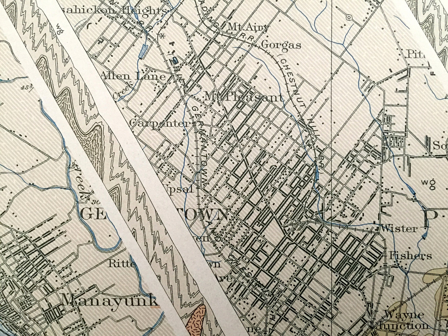
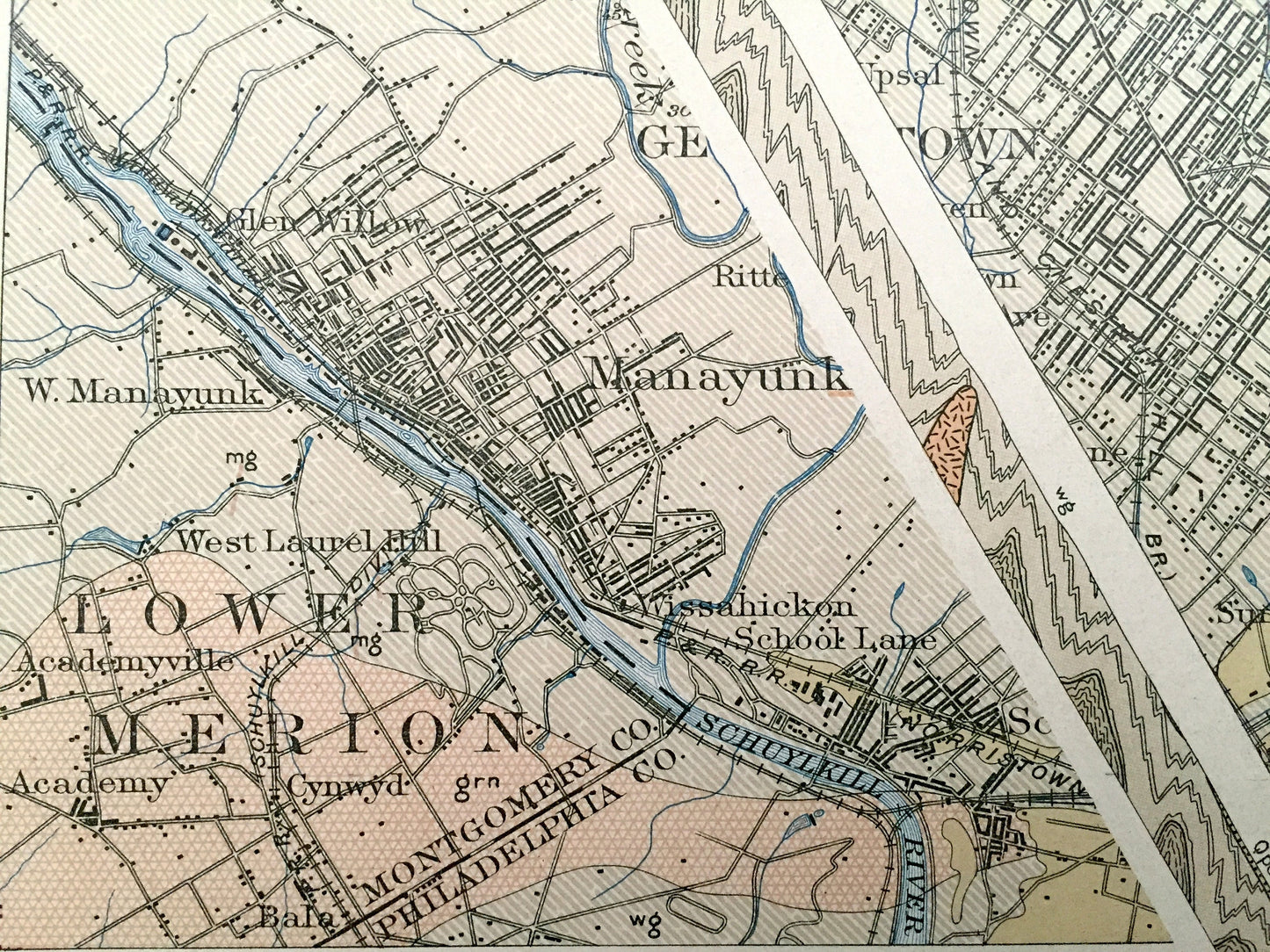
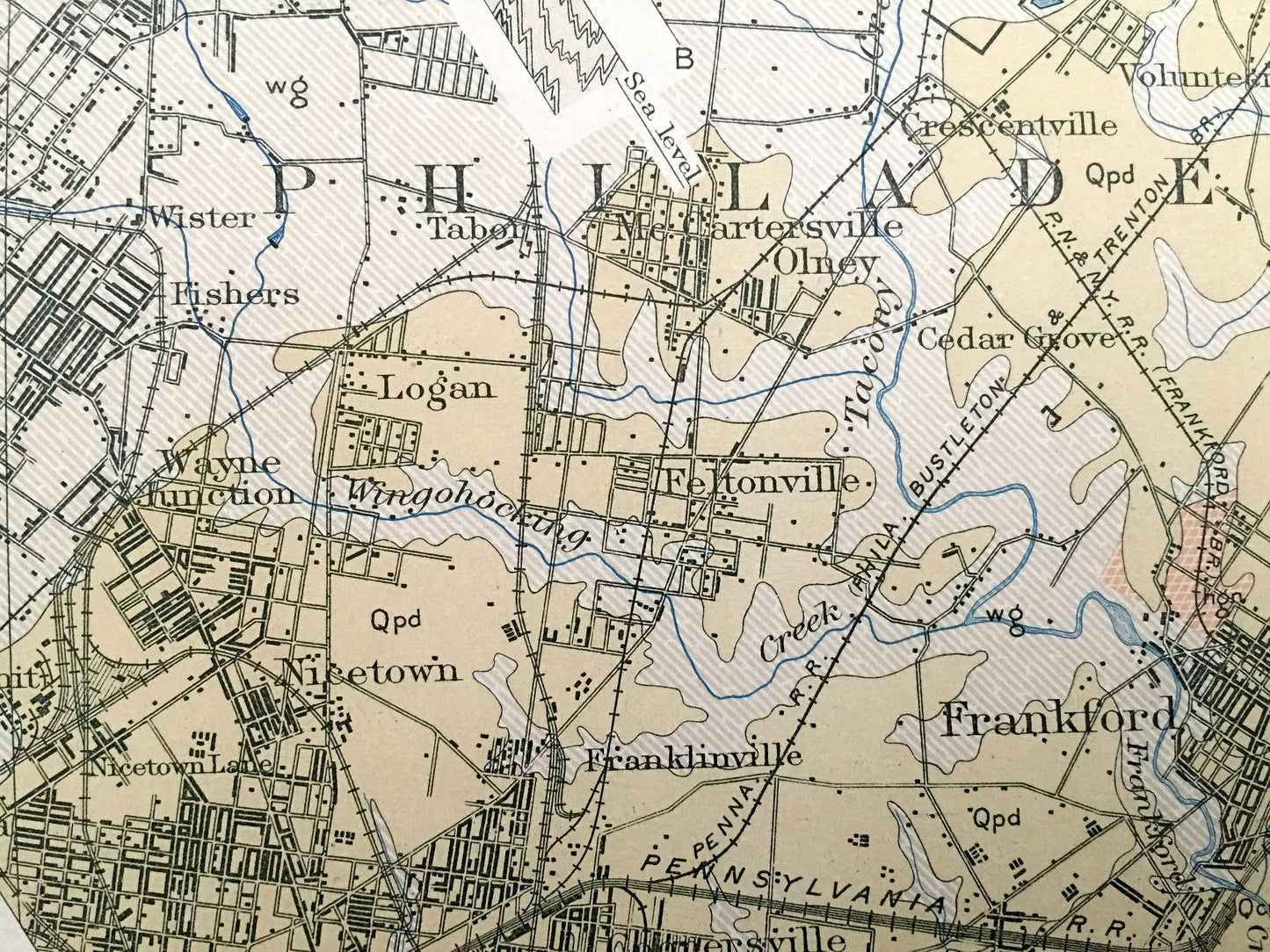
See what Philadelphia looked like more than 125 years ago—including three striata diagrams. Lots of intricate details and geological contours. Map even has little squares for every house that existed. The USGS cartographers were very thorough back then! This is also one of the rare maps that has the map legend on the front.
Perfect for the historian, map-lover, the curious or just as a conversation starter. Wonderful and rare. Maps such as this make great gifts.
Edition of 1894, printed 1908
Dimensions: 18 1/2" width x 21 3/4" height
----
Cities & Towns:
PENNSYLVANIA: Montgomery, Warrington, Warwick, Northampton, Gwynedd, Whitpain, Upper Dublin, Moreland, Southampton, Springfield, Abington, Cheltenham, Lower Merion, Philadelphia, Montgomery Square, Eureka, Prospectville, Spring House, Three Tuns, Maple Glen, Penllyn, Hartsville, Davis Grove, Horsham, Warminster, Hatboro, Bonair, Ivyland, Breadysville, Traymore, Grenoble, Jacksonville, Richboro, Davisville, Cornell, Churchville, Ambler, Jarrettown, Forth Washington, Dreshertown, Broadaxe, Fort Hill, Whitemarsh, Arlingham, Valley Green, Flourtown, Five Point, Roslyn Height, Laverock, Hill Crest, Williams, Fulmor, Morganville, WIllow Grove, Rubicam, Terwood, Fitzwatertown, Hillside, Weldon, Edge Hill, Glenside, Wyncote, Jenkintown, Chelten Hills, Rydal, Noble, Meadow Brook, Byberry, County Line, Street Road, Feasterville, Sorrelhorse, Paper Mills, Huntington Valley, Bethayres, Valley Falls, Philmont, Somerton, Harpers, Verreeville, Bustleton, Chestunt Hill, Manatawna, Highland, Gravers, Ivy Hill, Wyndmoor, Mermaid, Wissahickeon Heights, Mt. Airy, Gorgas, Allen Lane, Carpenter, Mt. Pleasant, Roxboro, Glen Will, Manayunk, Upsal, Germantown, Tulpohocken, Rittenhouse Town, Chelten Ave, Queen Lane, Wissahickon School Lane, Falls of Schuylkill, West Manayunk, West Laurel Hill, Academyville, Academy, Cynwyd, Bala Cynwyd, Ogontz, Rockledge, Ashbourne, Pittville, Melrose, Oak Lane, Somerville, Fern Rock, Lawndale, Volunteertown, Crescentville, Wister, Fishers, Tabor, Fern Rock, McCartersville, Olney, Cedar Grove, Logan, Wayne Junction, Nicetown, Franklinville, Frankford, Nicetown Lane, Fox Chase, Lagrange, Blue Grass, Ryers, Harrisburg, Pleasant Hill, Collegeville, Holmesburg, Liddonfield, Rocky Hill, Tacony, Wissinoming, Fitler, Bridesburg.
NEW JERSEY: Cinnaminson, Palmyra, Riverton.
Points of Interest: Delaware River, Schuylkill River, Wissahickon Creek, Pennypack Creek, Tacony Creek, Philadelphia and Reading Railroad, and many more small towns, roads, train tracks, train stations, hills, houses, islands and creeks.
Condition: Very Good Vintage condition, commensurate with age. This map is in great shape for being more than 120 years old. Has folio staple marks on the left margin, but these are easily concealed with framing.
----
We will happily adjust shipping price for multiple purchases. Maps are rolled up and shipped in sturdy mailing tubes, never folded.
Couldn't load pickup availability
Share