My Store
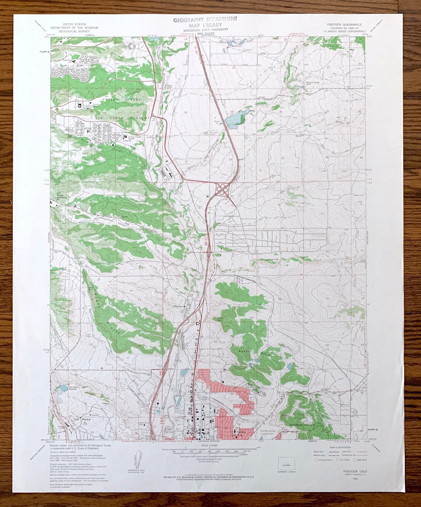
Antique Pikeview, Colorado 1961 US Geological Survey Topographic Map – El Paso County, Edgerton, Breed, Woodmen, Papeton, Wilsons Ranch, CO
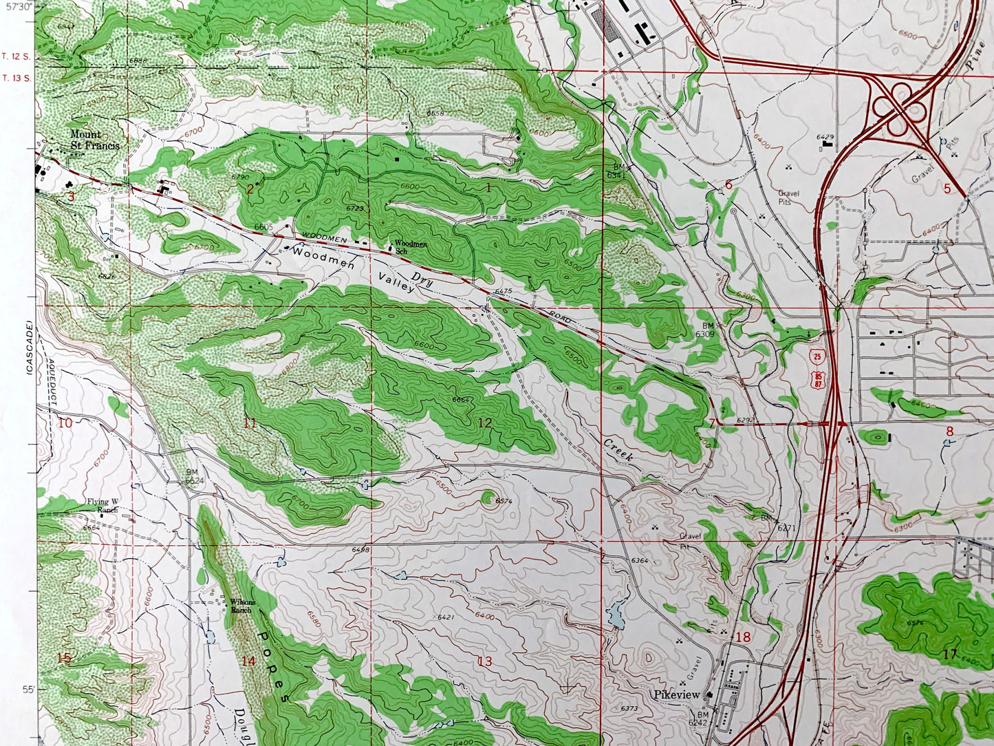
Antique Pikeview, Colorado 1961 US Geological Survey Topographic Map – El Paso County, Edgerton, Breed, Woodmen, Papeton, Wilsons Ranch, CO
Beautiful, antique map of Pikeview, Colorado and surrounding El Paso County area. This is an authentic 1961 edition, 1963 print from the U.S. Geological Survey and NOT a computer reproduction.
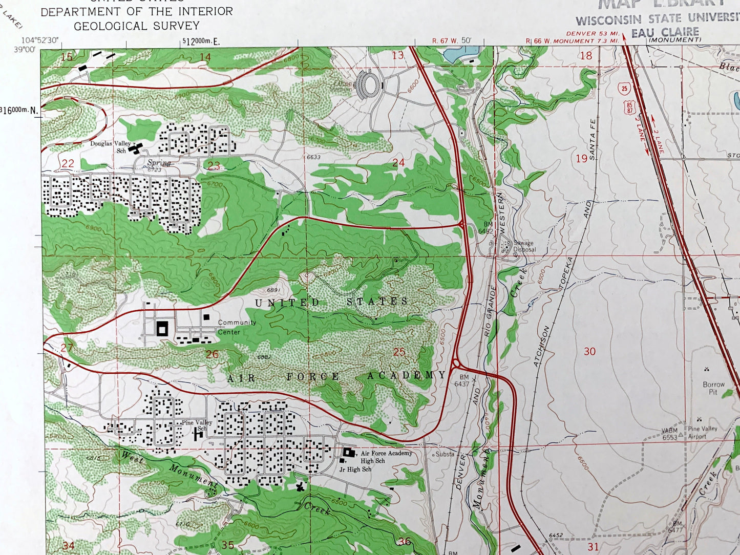
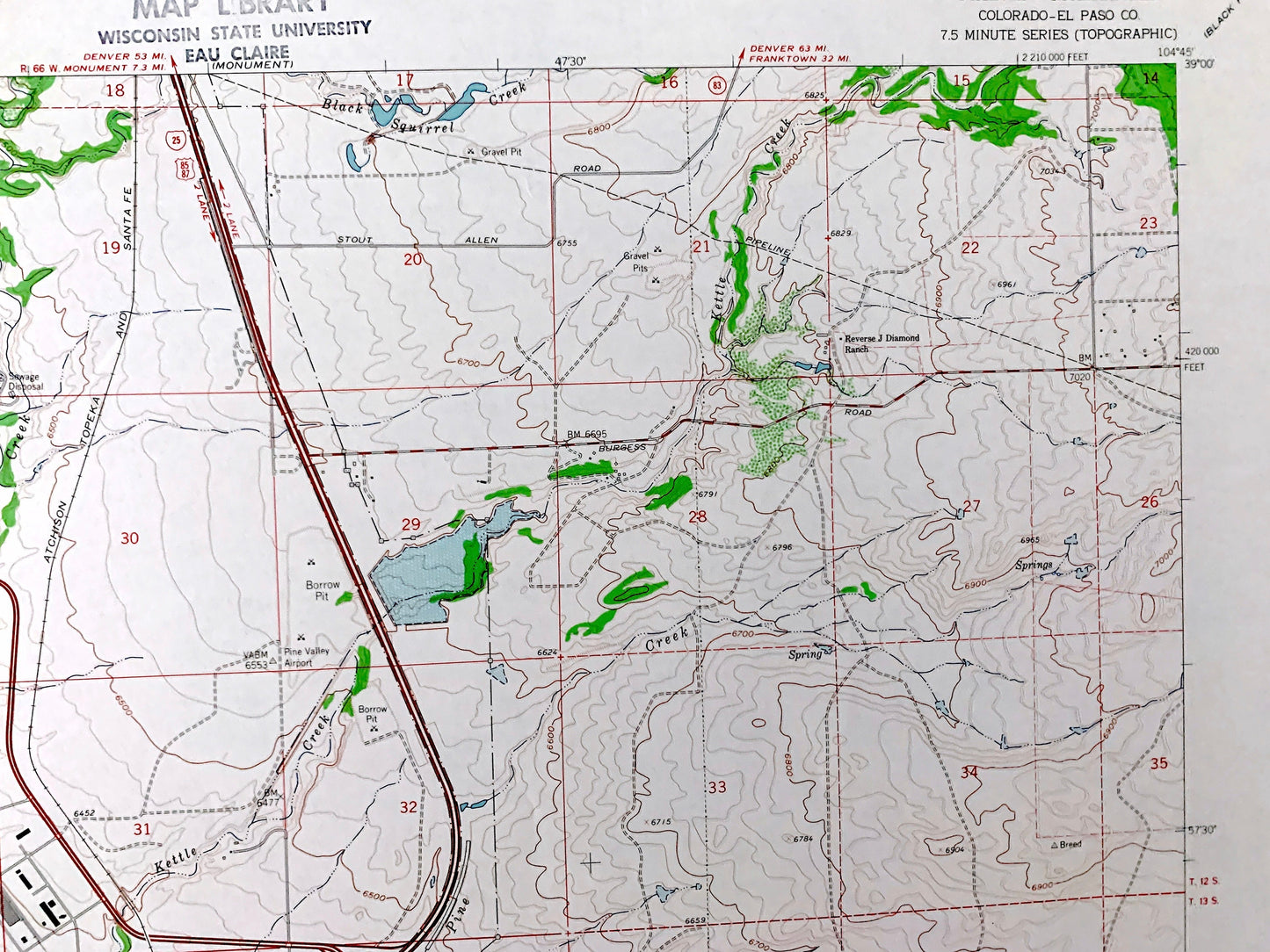
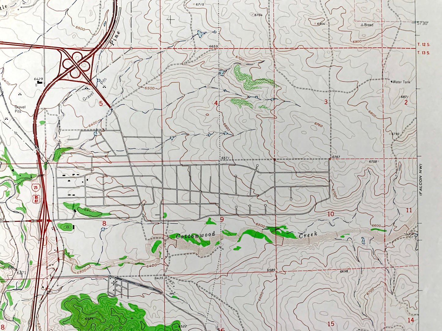
See what Colorado looked like over 60 years ago. Lots of intricate details and geological contours. Map even has little squares for every house that existed at the time. The USGS cartographers were very thorough back then!
Perfect for the historian, map-lover, the curious or just as a conversation starter. Wonderful and rare. Vintage maps such as these make great gifts.
Edition of 1961, printed 1963
Dimensions: 22" width x 27" height
----
Features
Cities & Towns: Edgerton, Woodmen, Breed, Papeton, Woodmen, Wilsons Ranch, Reverse J Diamond Ranch, Elkhorn Ranch, Pine Valley Ranch, Flying W Ranch, Colorado Springs, Mount St Francis.
Points of Interest: United States Air Force Academy, Pine Valley Airpark, Palmer Park, Modern Woodmen of America Sanatorium, Cragmoor Sanitarium, Nichols Field, Garden Ranch Airpark, Popes Bluffs, Austin Bluffs, Pulpit Rock, Templeton Gap, The Mesa, Monument Creek, Kettle Creek, Dry Creek, Pine Creek, Black Squirrel Creek, Douglas Creek, Shooks Run, and many more hills, streams, ponds, houses, schools, railroads, churches and roads.
Condition: Very Good Vintage condition, commensurate with age. This map is in great shape for being over 55 years old. Has light edge-wear and a stamp on the front, all will read as character when framed.
----
We will happily adjust shipping price for multiple purchases. Maps are rolled up and shipped in sturdy mailing tubes, never folded.
Couldn't load pickup availability
Share