My Store
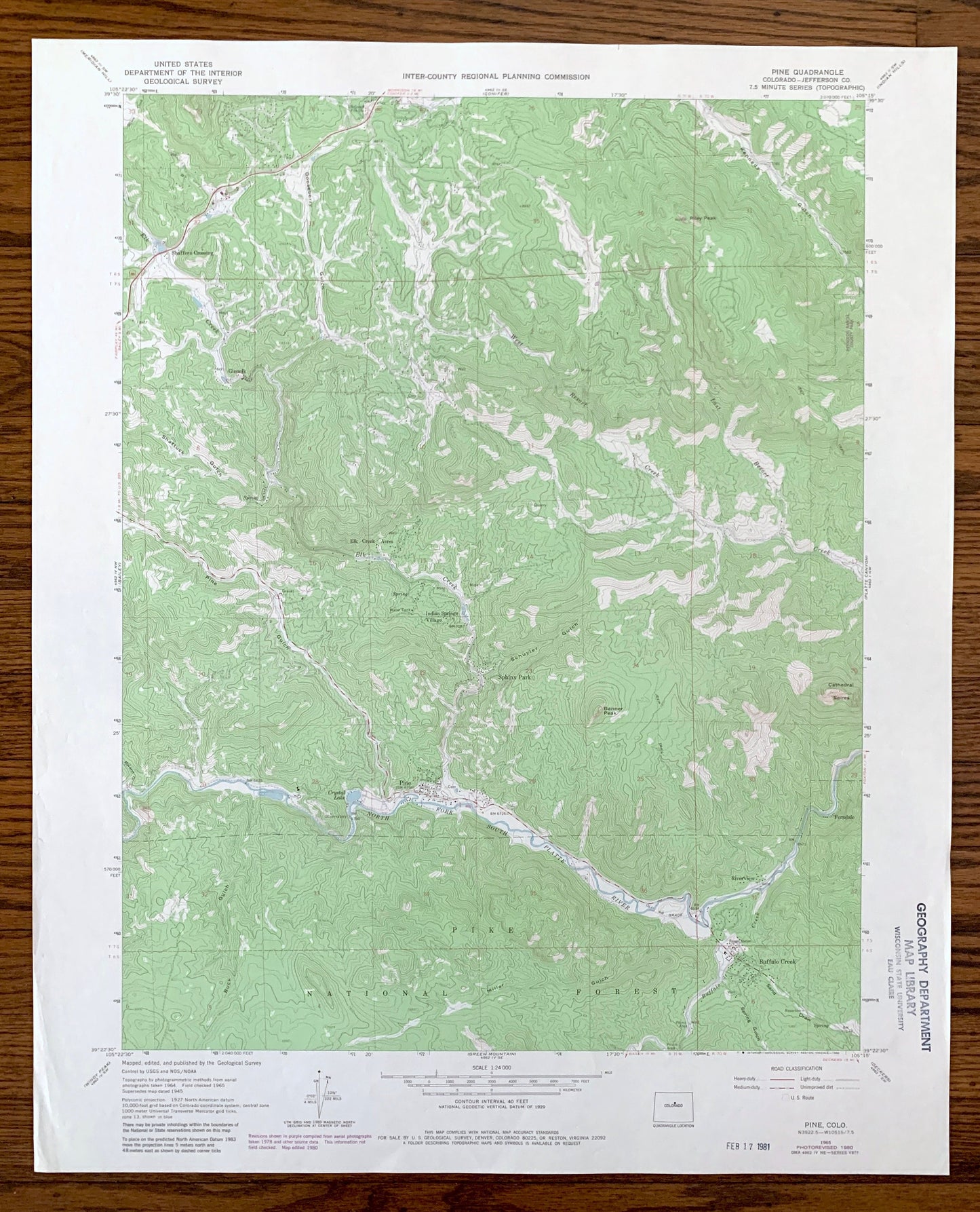
Antique Pine, Colorado 1965 US Geological Survey Topographic Map – Jefferson County, Glenelk, Ferndale, Riverview, Buffalo Creek, CO
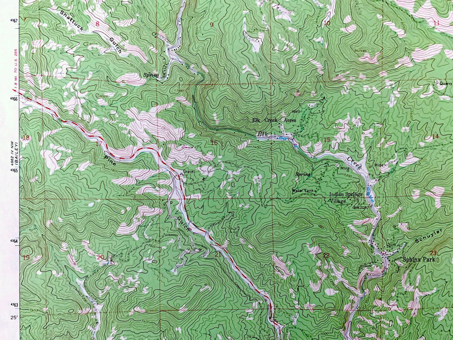
Antique Pine, Colorado 1965 US Geological Survey Topographic Map – Jefferson County, Glenelk, Ferndale, Riverview, Buffalo Creek, CO
Beautiful, antique map of Pine, Colorado and surrounding Jefferson County area. This is an authentic 1965 edition, 1980 print from the U.S. Geological Survey and NOT a computer reproduction.
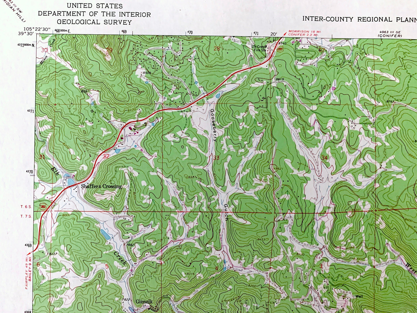
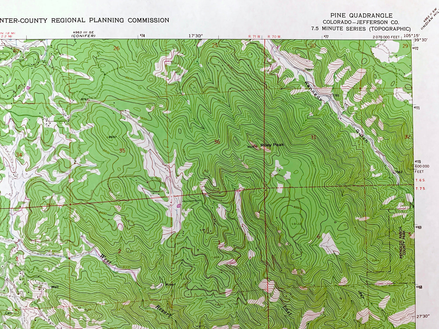
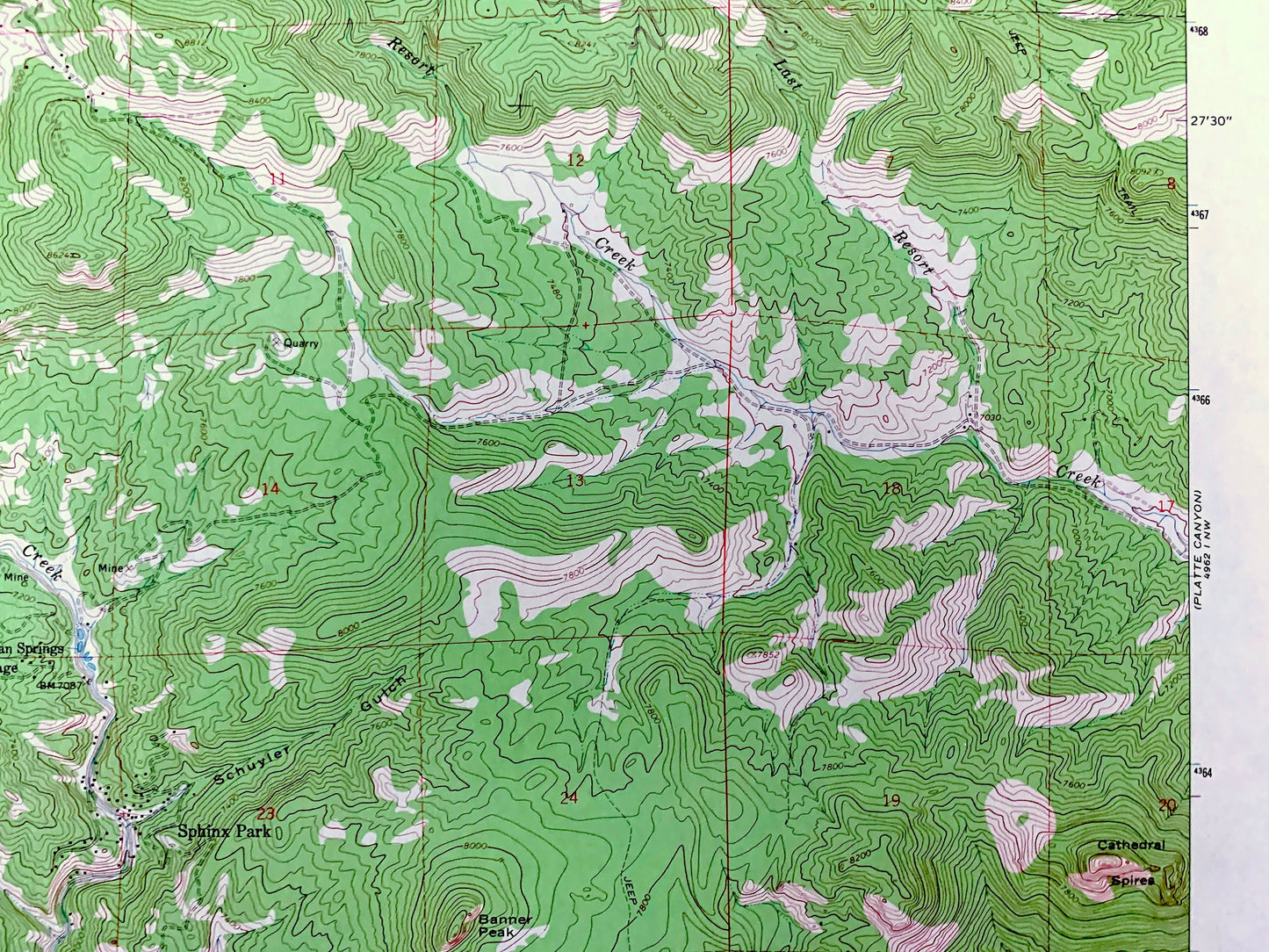
See what Colorado looked like over 55 years ago. Lots of intricate details and geological contours. Map even has little squares for every house that existed at the time. The USGS cartographers were very thorough back then!
Perfect for the historian, map-lover, the curious or just as a conversation starter. Wonderful and rare. Vintage maps such as these make great gifts.
Edition of 1965, printed 1980
Dimensions: 22" width x 27" height
----
Features
Cities & Towns: Glenelk, Ferndale, Riverview, Buffalo Creek, Elk Creek Acres, Indian Springs Village, Sphinx Park, Shaffers Crossing.
Points of Interest: Pike National Forest, Gooseberry Gulch, Riley Peak, Kennedy Gulch, Shattuck Gulch, Schuyler Gulch, Cathedral Spires, Banner Peak, North Fork South Platte River, Last Resort Creek, West Resort Creek, Elk Creek, and many more hills, streams, ponds, houses, schools, railroads, churches and roads.
Condition: Good Vintage condition, commensurate with age. This map is in great shape for being over 40 years old. Has light edge-wear and a stamp on the front but will read as character when framed.
----
We will happily adjust shipping price for multiple purchases. Maps are rolled up and shipped in sturdy mailing tubes, never folded.
Couldn't load pickup availability
Share