My Store
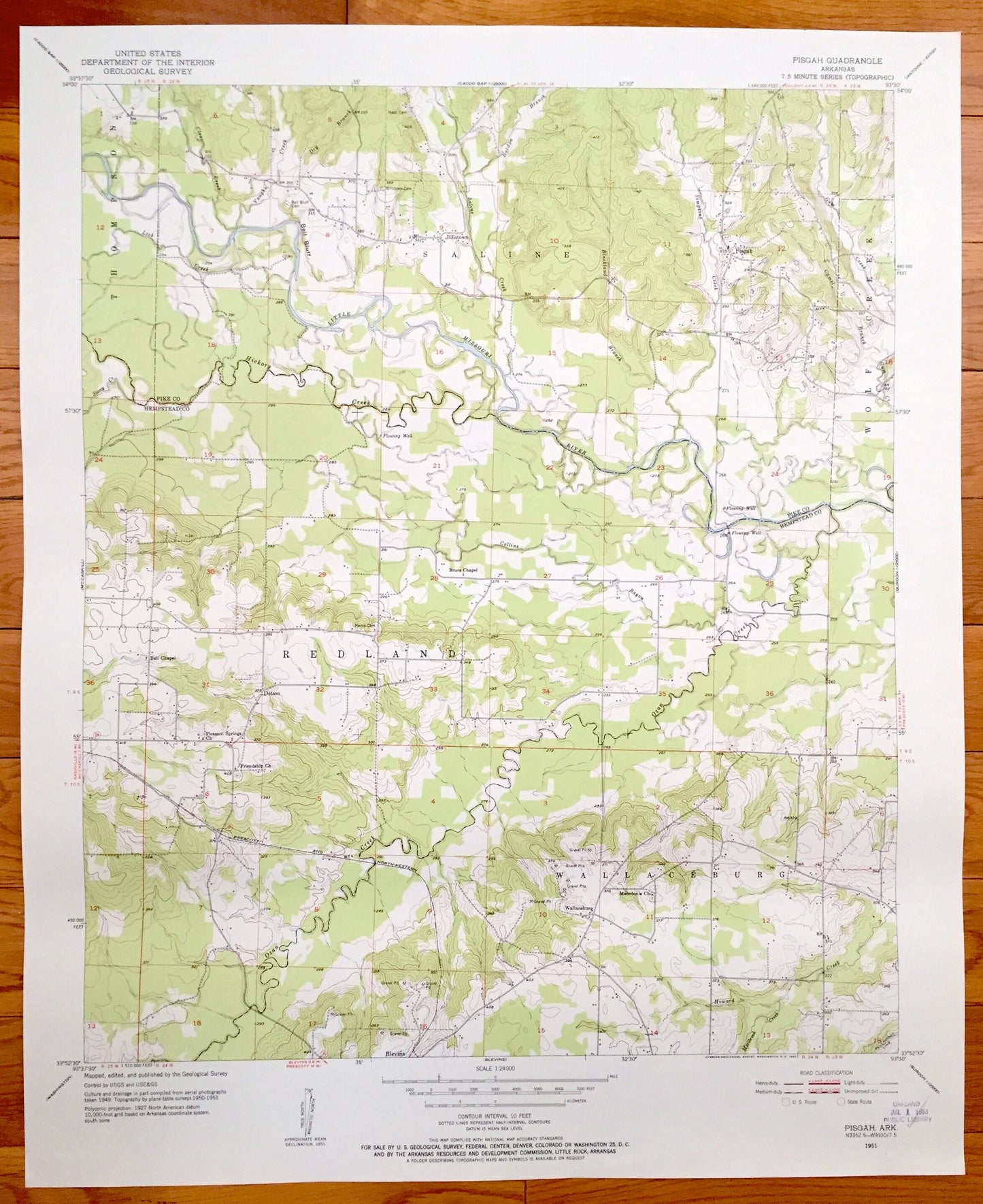
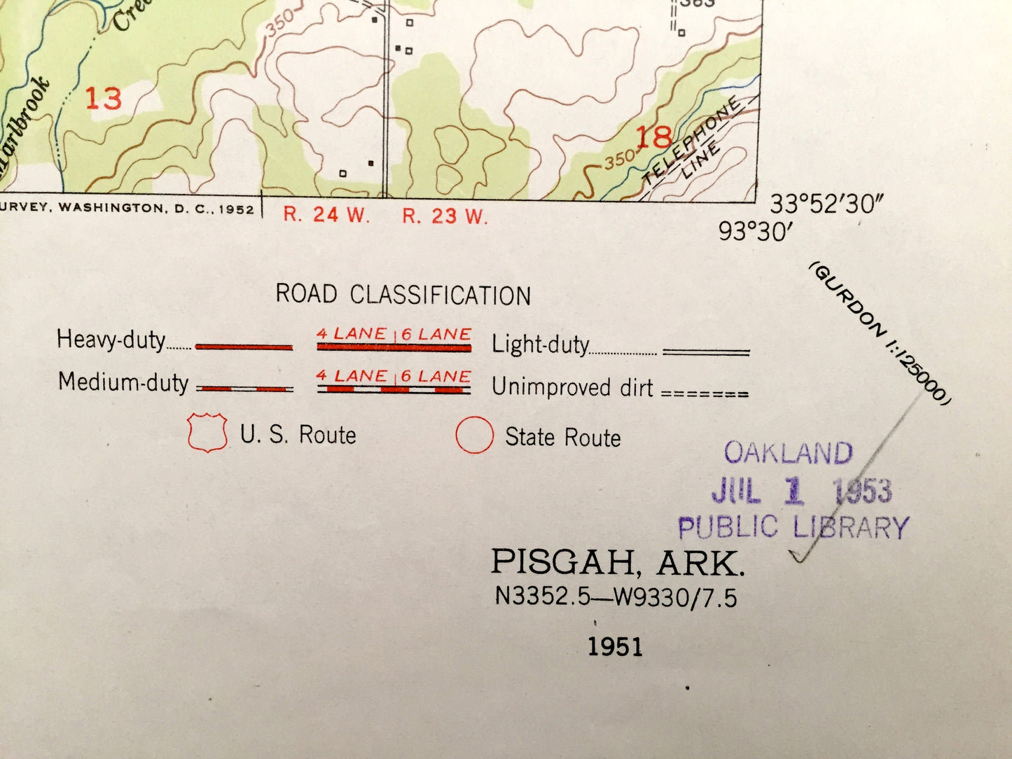
Antique Pisgah, Arkansas 1951 US Geological Survey Topographic Map – Saline, Wolf Creek, Redland, Wallaceburg, Pike, Hempstead County, AR
Antique Pisgah, Arkansas 1951 US Geological Survey Topographic Map – Saline, Wolf Creek, Redland, Wallaceburg, Pike, Hempstead County, AR
Beautiful, antique map of Pisgah, Arkansas and surrounding Pike County & Hempstead County area on the Little Missouri River. This is an authentic 1951 print from the U.S. Geological Survey and NOT a computer reproduction.
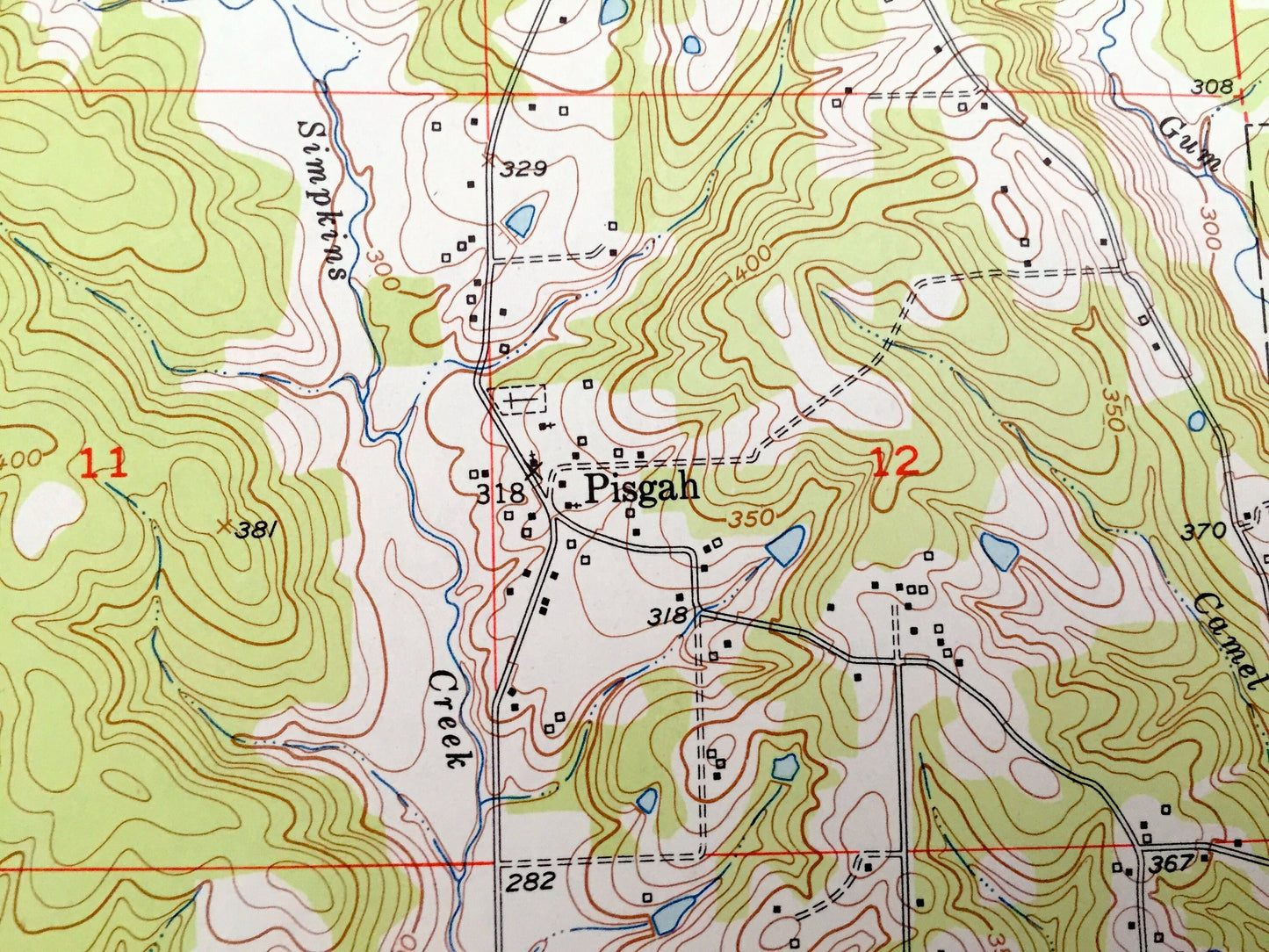
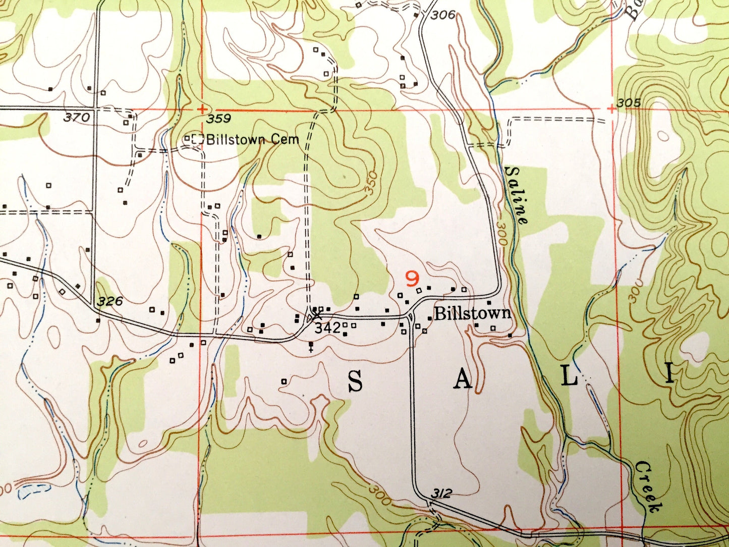
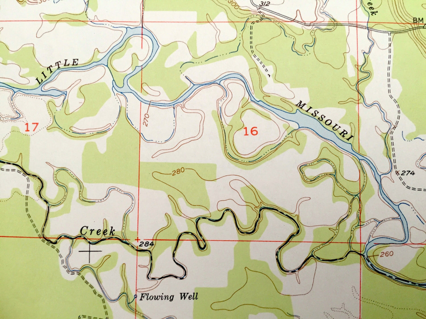
See what Pisgah, Saline, Redland and Wallaceburg looked like over 65 years ago. Lots of intricate details and geological contours. Map even has little squares for every house that existed at the time. The USGS cartographers were very thorough back then!
Perfect for the historian, map-lover, the curious or just as a conversation starter. Wonderful and rare. Vintage maps such as these make great gifts.
Edition of 1951, printed 1951
Dimensions: 22" width x 27" height
----
Features
Cities & Towns: Thompson, Saline, Wolf Creek, Redland, Wallaceburg, Billstown, Pisgah, Dotson, Blevins.
Points of Interest: Pike County, Hempstead County, Little Missouri River, Ozan Creek, Saline Creek, Vaughn Creek, Collins Bayou, and lots more, hills, creeks, gravel pits, schools, churches, houses, roads.
Condition: Very Good condition, commensurate with age. This map is in great shape for being over 65 years old.
----
We will happily adjust shipping price for multiple purchases. Maps are rolled up and shipped in sturdy mailing tubes, never folded.
Couldn't load pickup availability
Share