My Store
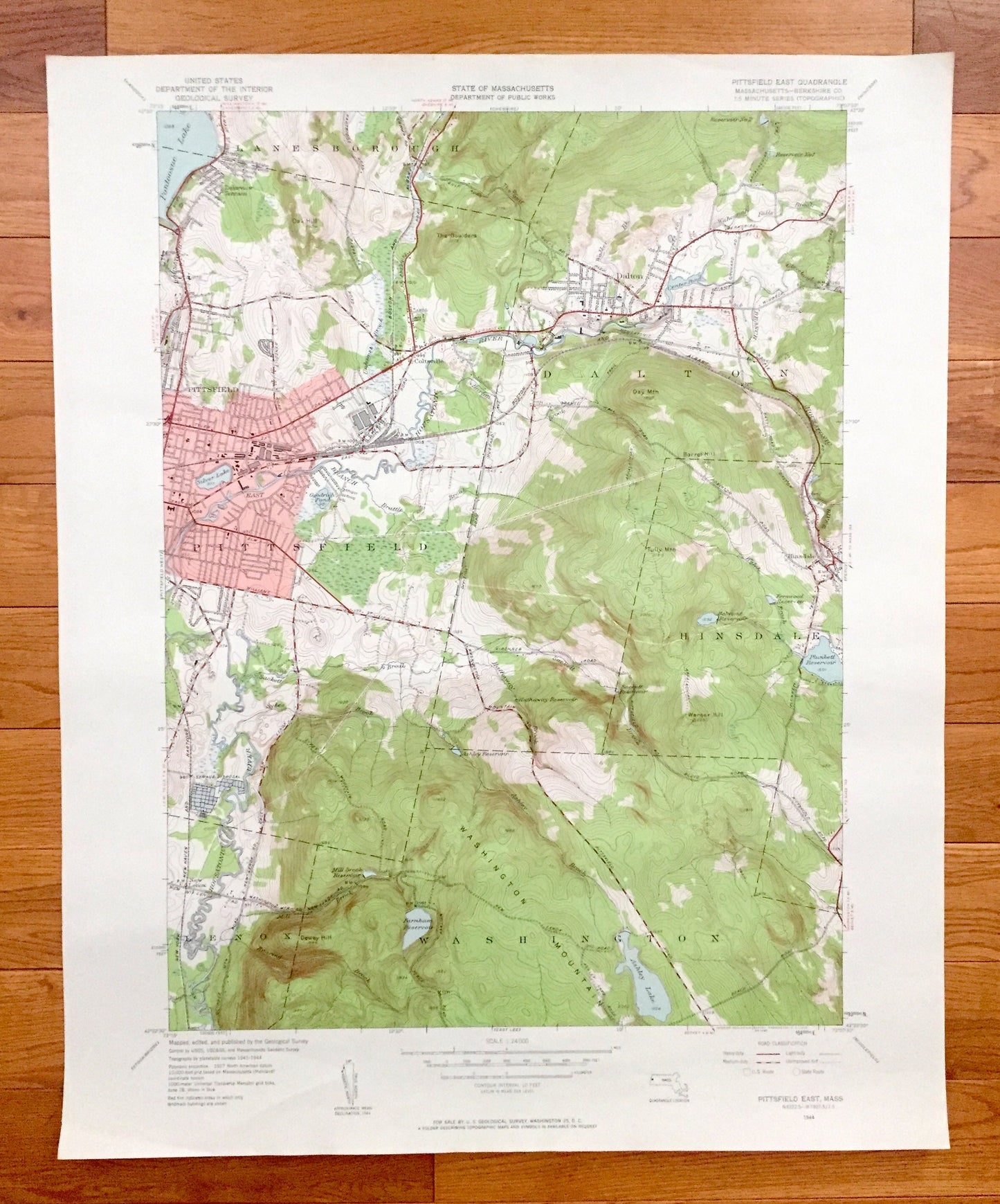
Antique Pittsfield East, Massachusetts 1944 US Geological Survey Topographic Map – Berkshire County, Lanesborough, Dalton, Hinsdale, Lenox
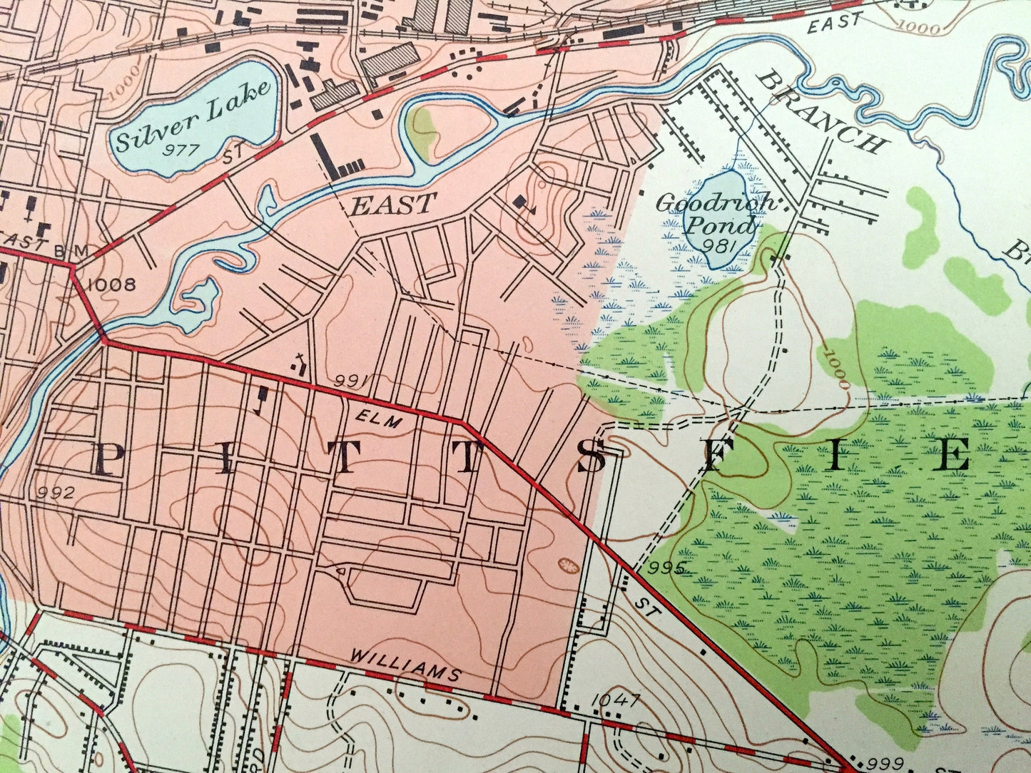
Antique Pittsfield East, Massachusetts 1944 US Geological Survey Topographic Map – Berkshire County, Lanesborough, Dalton, Hinsdale, Lenox
Beautiful, antique map of Pittsfield East, Massachusetts and surrounding Berkshire County area. This is an authentic 1944 edition, 1958 print from the U.S. Geological Survey and NOT a computer reproduction.
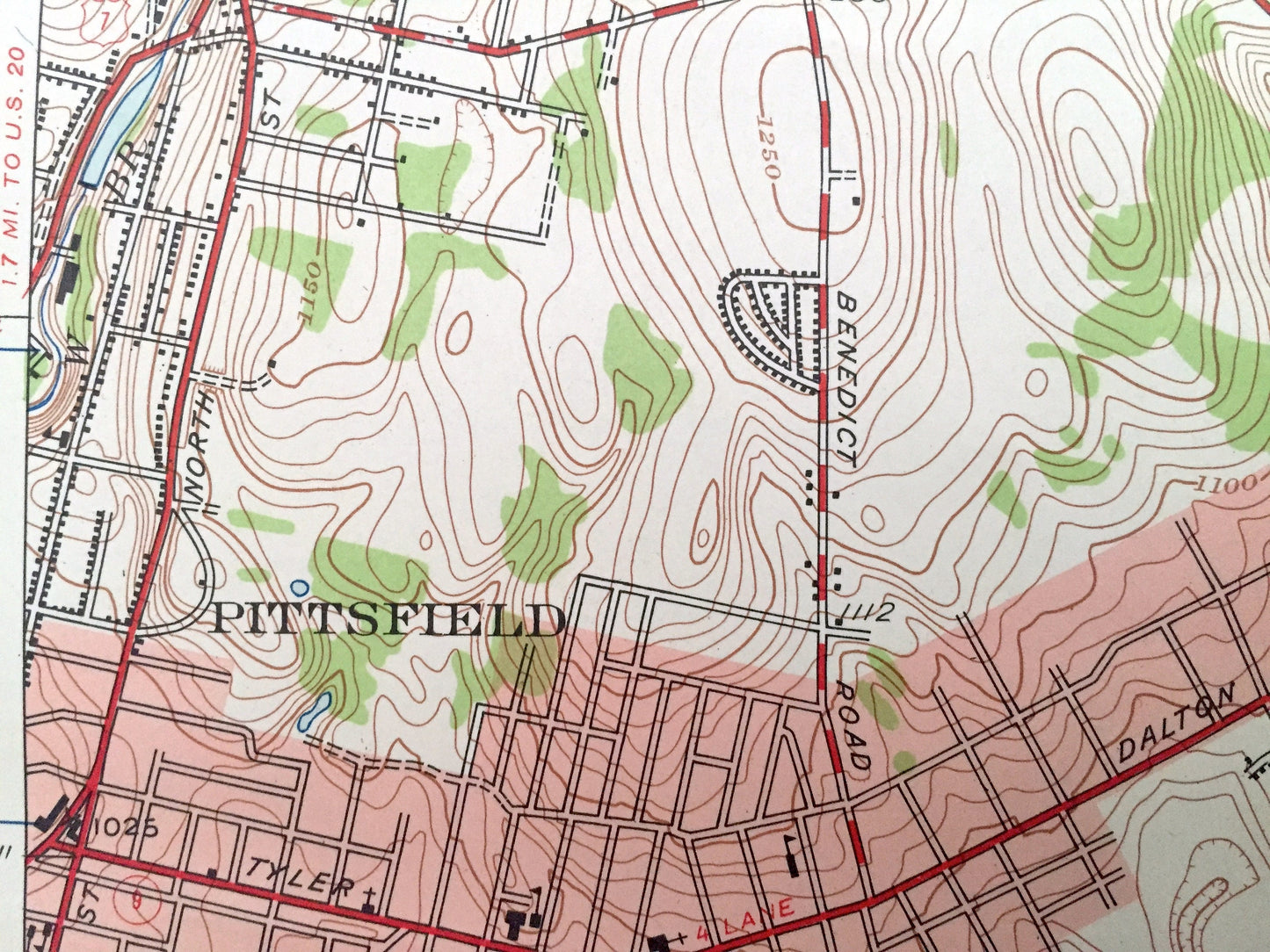
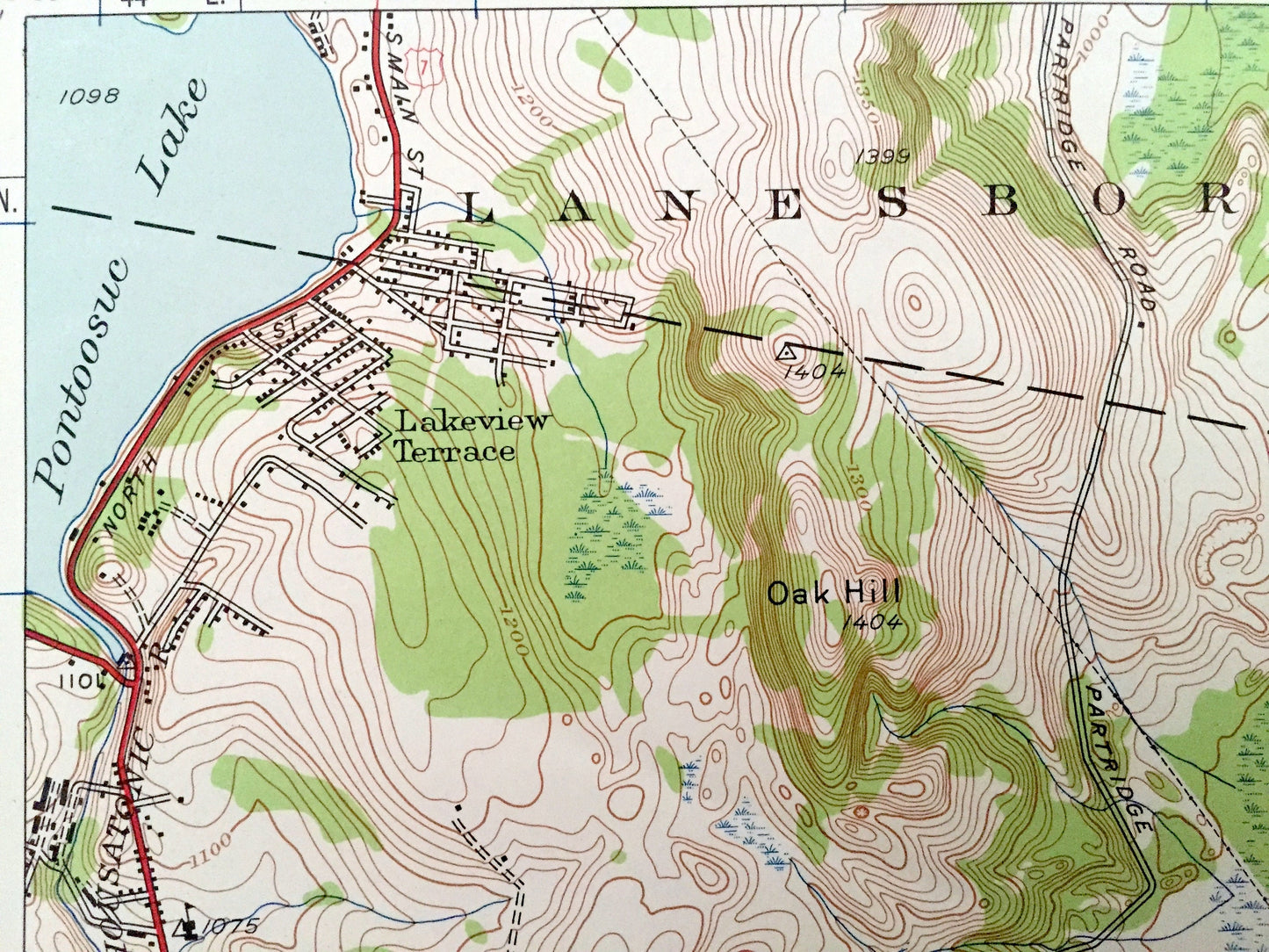
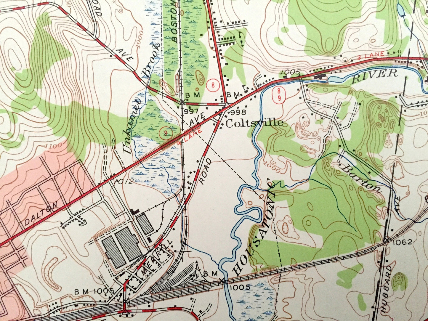
See what Massachusetts looked like over 75 years ago. Lots of intricate details and geological contours. Map even has little squares for every house that existed at the time. The USGS cartographers were very thorough back then!
Perfect for the historian, map-lover, the curious or just as a conversation starter. Wonderful and rare. Vintage maps such as these make great gifts.
Edition of 1944, printed 1958
Dimensions: 22" width x 27" height
----
Features
Cities & Towns: Pittsfield, Washington, Coltsville, Lakeview Terrace, Lanesborough, Dalton, Hinsdale, Lenox.
Points of Interest: Berkshire County, Washington Mountain, Tully Mountain, Day Mountain, The Boulders, Oak Hill, Warner Hill, Dewey Hill, Housatonic River, Pontoosuc Lake, Silver Lake, Ashley Lake, Plunkett Reservoir, Farmham Reservoir, Hathaway Reservoir, Mill Brook Reservoir and lots more hills, mountains, streams, ponds, lakes, rivers, schools, churches, houses, and roads.
Condition: Very Good condition, commensurate with age. This map is in incredible shape for being 60 years old. Has some light edge-wear and tears, all of which will read as vintage character when framed.
----
We will happily adjust shipping price for multiple purchases. Maps are rolled up and shipped in sturdy mailing tubes, never folded.
Couldn't load pickup availability
Share