My Store
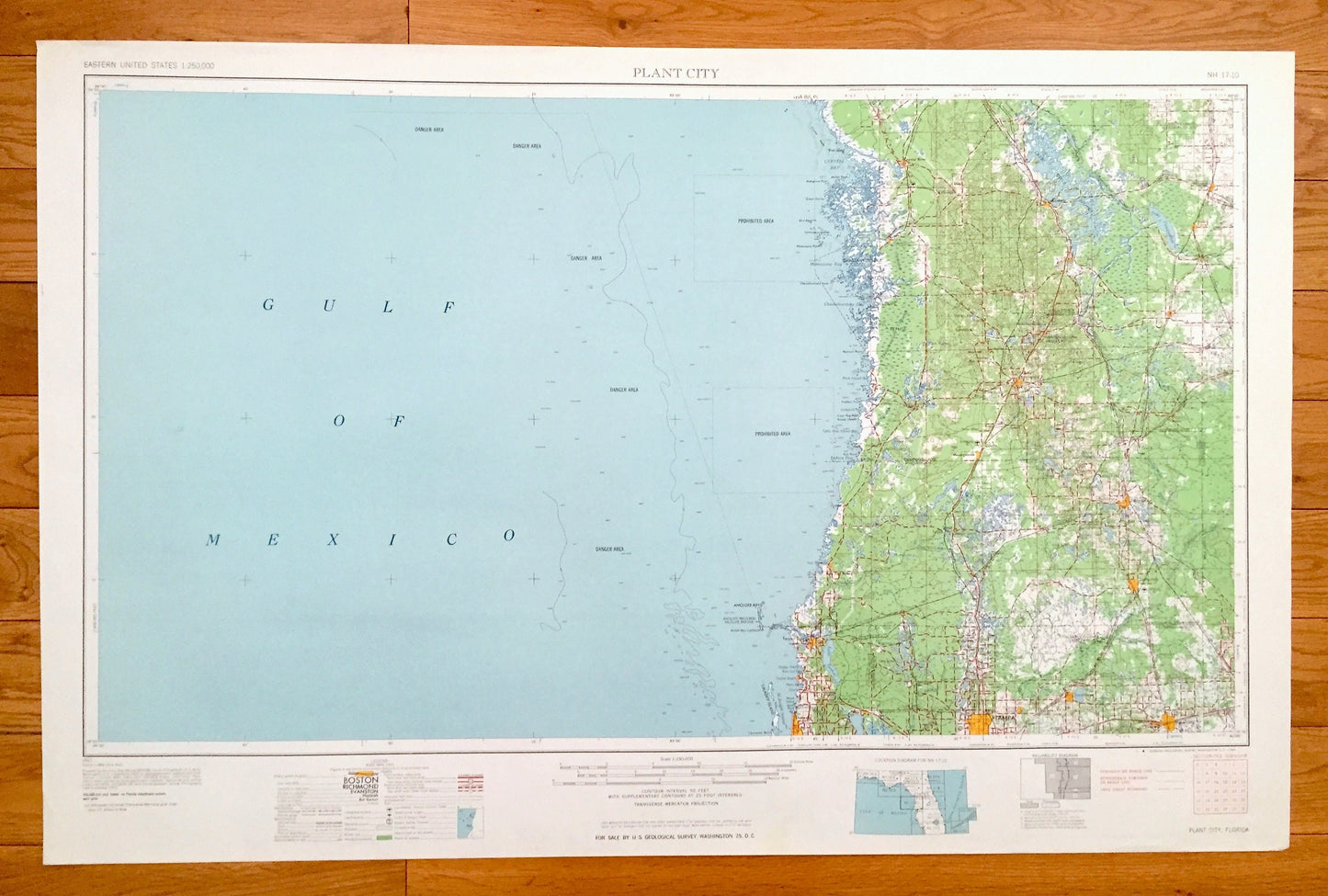
Antique Plant City, Florida 1964 US Geological Survey Topographic Map – Tampa, Dunedin, New Port Richey, Zephyrhillis, Dade City, Wildwood
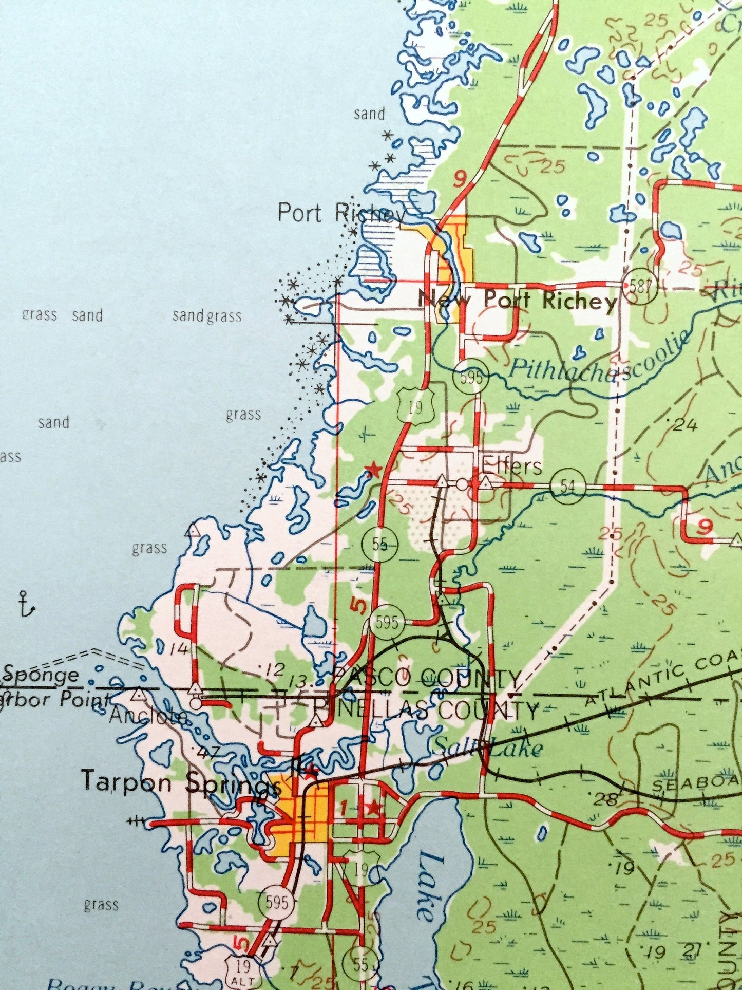
Antique Plant City, Florida 1964 US Geological Survey Topographic Map – Tampa, Dunedin, New Port Richey, Zephyrhillis, Dade City, Wildwood
Beautiful, antique map of Plant City, Florida and surrounding areas. This is an authentic 1964 edition, 1964 print from the U.S. Geological Survey and NOT a computer reproduction.
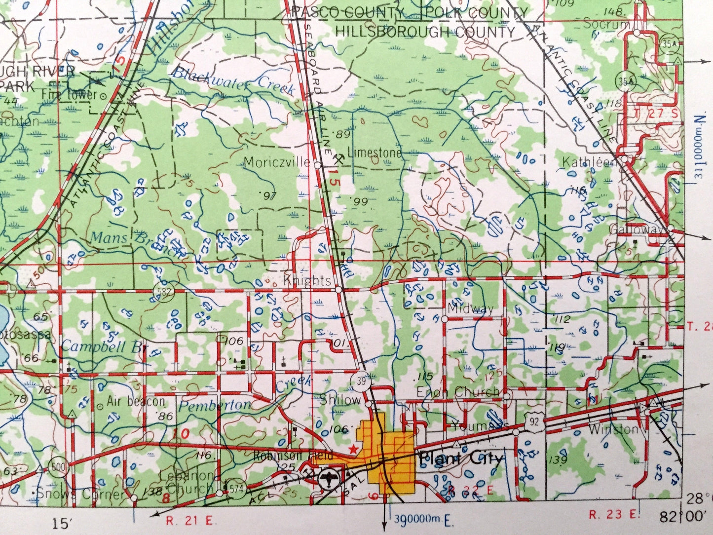
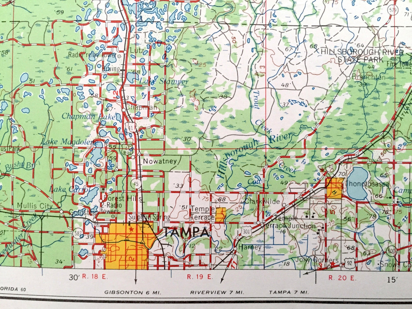
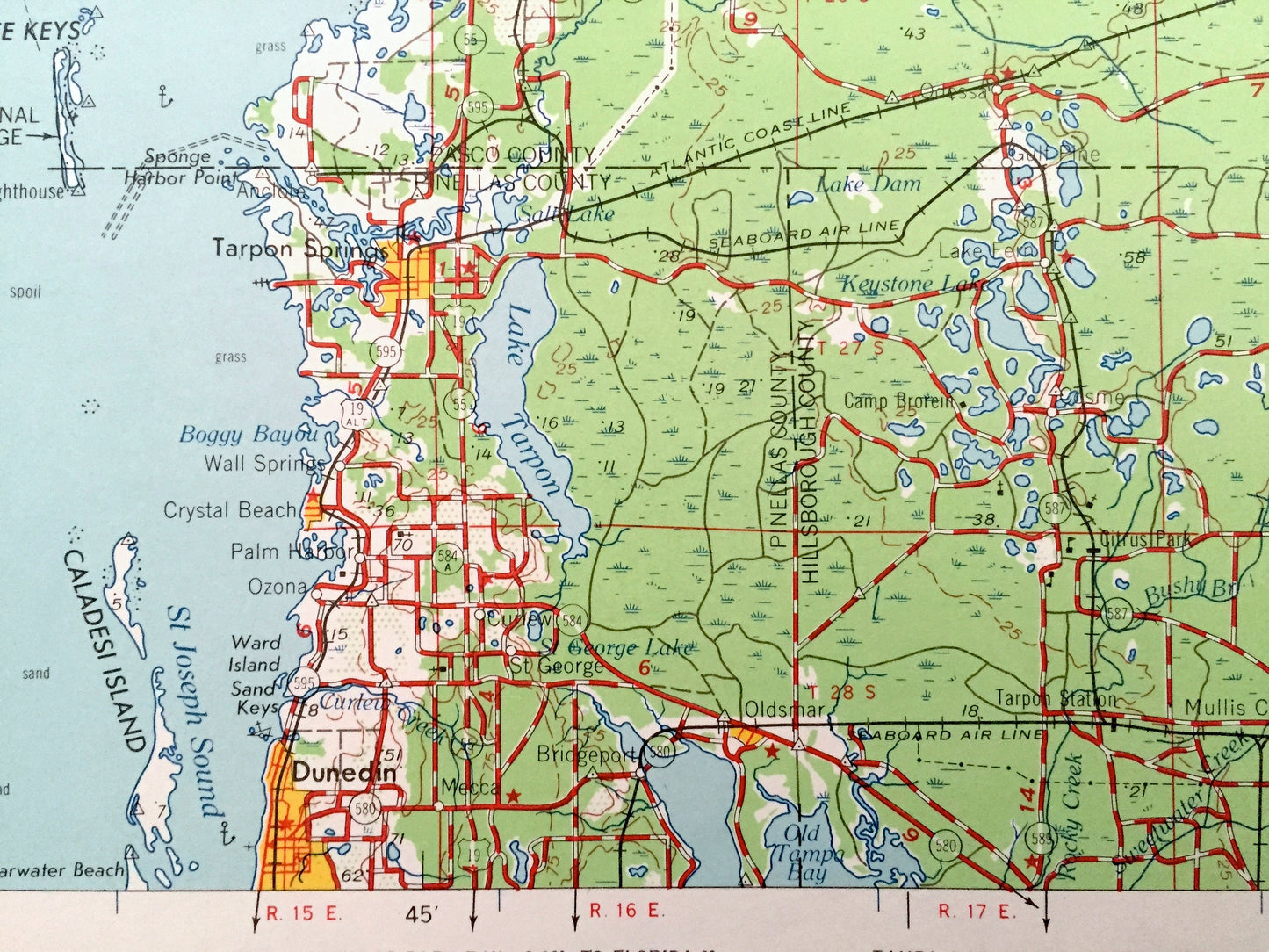
See what Florida looked like over 55 years ago. Lots of intricate details and geological contours. Map is incredibly large and in the grand 1:250,000 scale. The USGS cartographers were very thorough back then!
Perfect for the historian, map-lover, the curious or just as a conversation starter. Wonderful and rare. Vintage maps such as these make great gifts.
Edition of 1964, printed 1964
Dimensions: 32" width x 22 1/2" height
----
Features
Cities & Towns: Plant City, Tarpon Springs, Masaryktown, Crystal Beach, Port Richey, Bushnell, Dunedon, Inverness, Hudson, Temple Terrace, Coleman, Tampa, Dundin, New Port Richey, Zephyrhillis, Dade City, Brooksville, Crystal River.
Points of Interest: Gulf Of Mexico, Anclote Keys, Caladesi Island, Anclote National Wildlife Refuge, Chassahowitzka National Wildlife Refuge, Crystal Bay, Lake Tarpon and lots more hills, mountains, lakes, islands, bays, highways, railroads.
Condition: Very Good condition, commensurate with age. This map is in incredible shape for being over 55 years old. Has light edge-wear, all of which will read as vintage character when framed.
----
We will happily adjust shipping price for multiple purchases. Maps are rolled up and shipped in sturdy mailing tubes, never folded.
Couldn't load pickup availability
Share