My Store
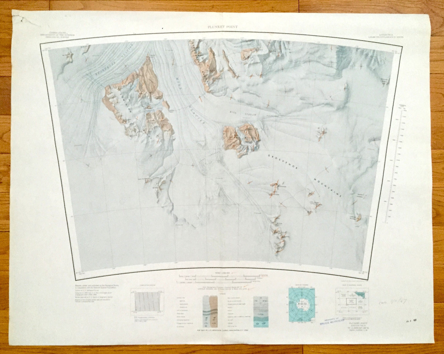
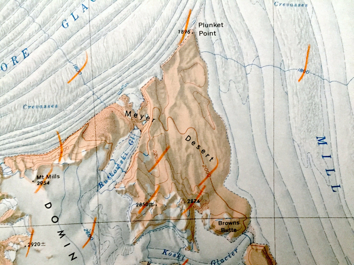
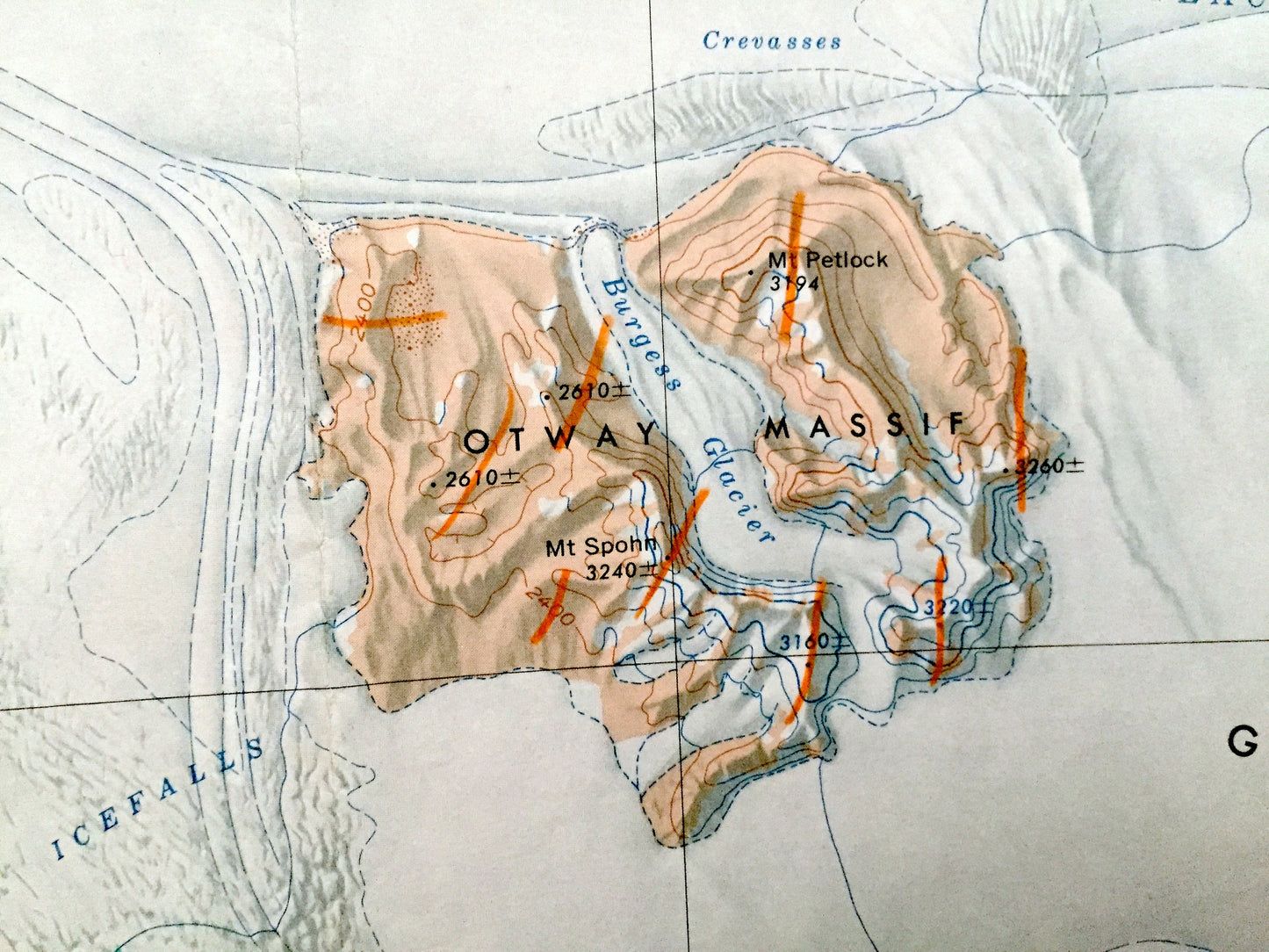
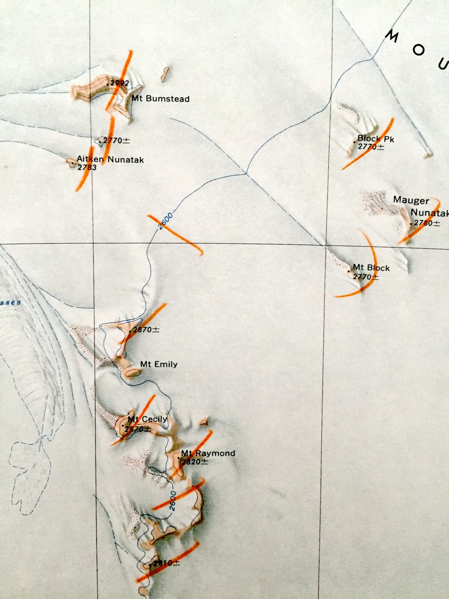
Antique Plunket Point, Antarctica 1965 US Geological Survey Topographic Map – Grosvenor Mountains, Dominion Range, Shackleton Ice Falls
Antique Plunket Point, Antarctica 1965 US Geological Survey Topographic Map – Grosvenor Mountains, Dominion Range, Shackleton Ice Falls
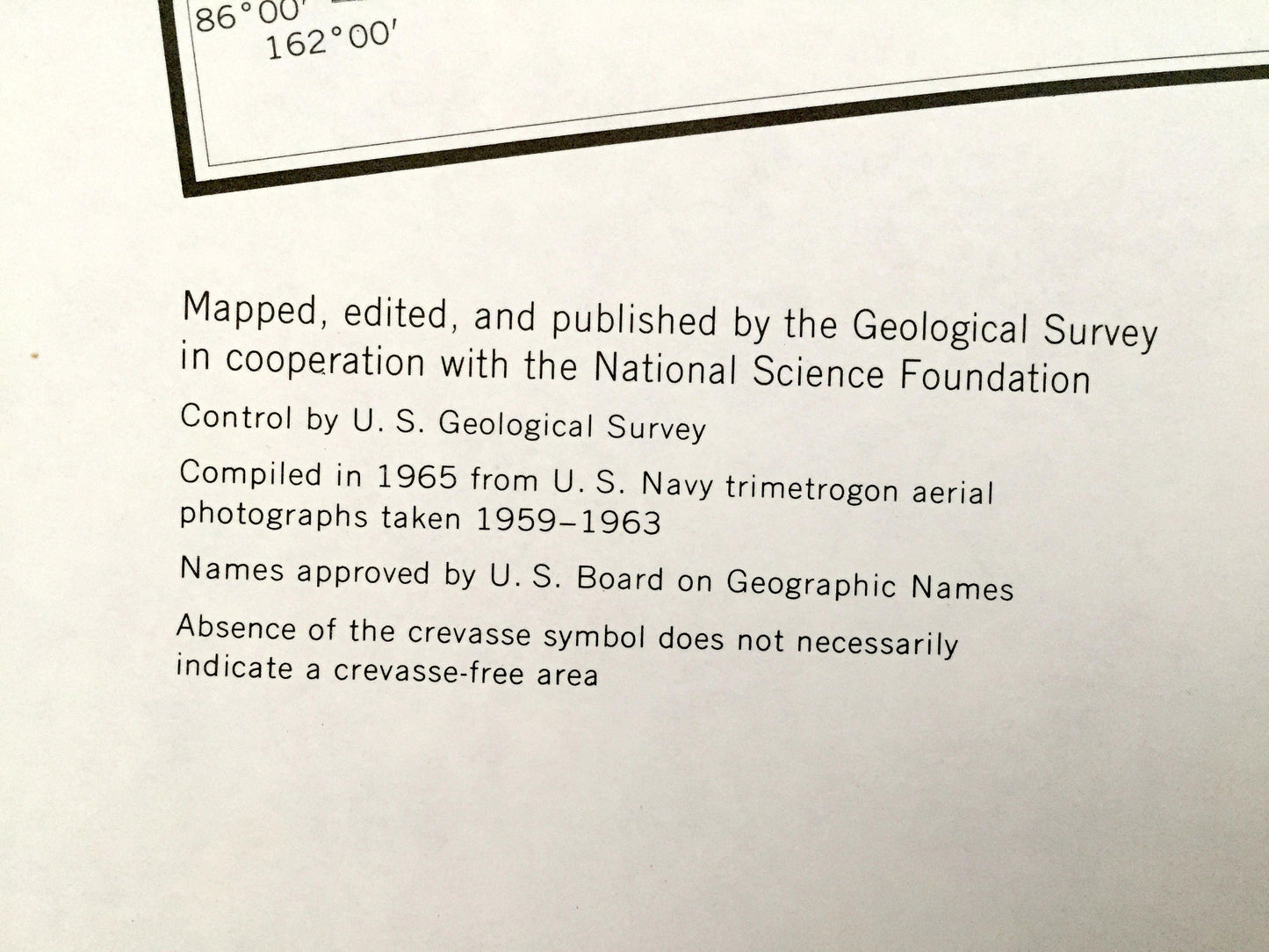
Beautiful, antique map of the Plunket Point and the Grosvenor Mountains of Antarctica. This is an authentic 1965 print from the U.S. Geological Survey Reconnaissance Series and not a computer reprint.
See what Antarctica looked like almost 60 years ago. Lots of intricate details and geological contours. The USGS cartographers were very thorough back then!
Perfect for the historian, map-lover, the curious or just as a conversation starter. Wonderful and rare. Vintage maps such as these make great gifts.
Edition of 1965, printed 1965
Dimensions: 33" width x 26" height
----
Features
Points of Interest: Plunket Point, Grosvenor Mountains, Dominion Range, Supporters Range, Beardmore Glacier, Mill Glacier, Mill Stream Glacier, Snakeskin Glacier, Otway Massif, Lhasa Nunatak, Faulkner Glacier, Meyer Desert, Jensen Glacier, Safety Spur, Mt. Nimrod, Mt. White, Mt. Spohn, Browns Butte, Mt. Tennant, Mt. Saunders, Shackleton Ice Falls, Mt. Pratt, Larkman Nunatak and many more mountains, glaciers, inlets, promontories, crevasses, névés, massifs and bays.
Condition: Good condition, commensurate with age. This map is in incredible shape for being almost 60 years old. Has light edge-wear and pencil-markings (possibly used in the field), all of which will read as vintage character when framed.
----
We will happily adjust shipping price for multiple purchases. Maps are rolled up and shipped in sturdy mailing tubes, never folded.
Couldn't load pickup availability
Share