My Store
Antique Plymouth, Massachusetts 1937 US Geological Survey Topographic Map – Manomet, Priscilla Beach, White Horse, Cedar Brushes Cape Cod MA
Antique Plymouth, Massachusetts 1937 US Geological Survey Topographic Map – Manomet, Priscilla Beach, White Horse, Cedar Brushes Cape Cod MA
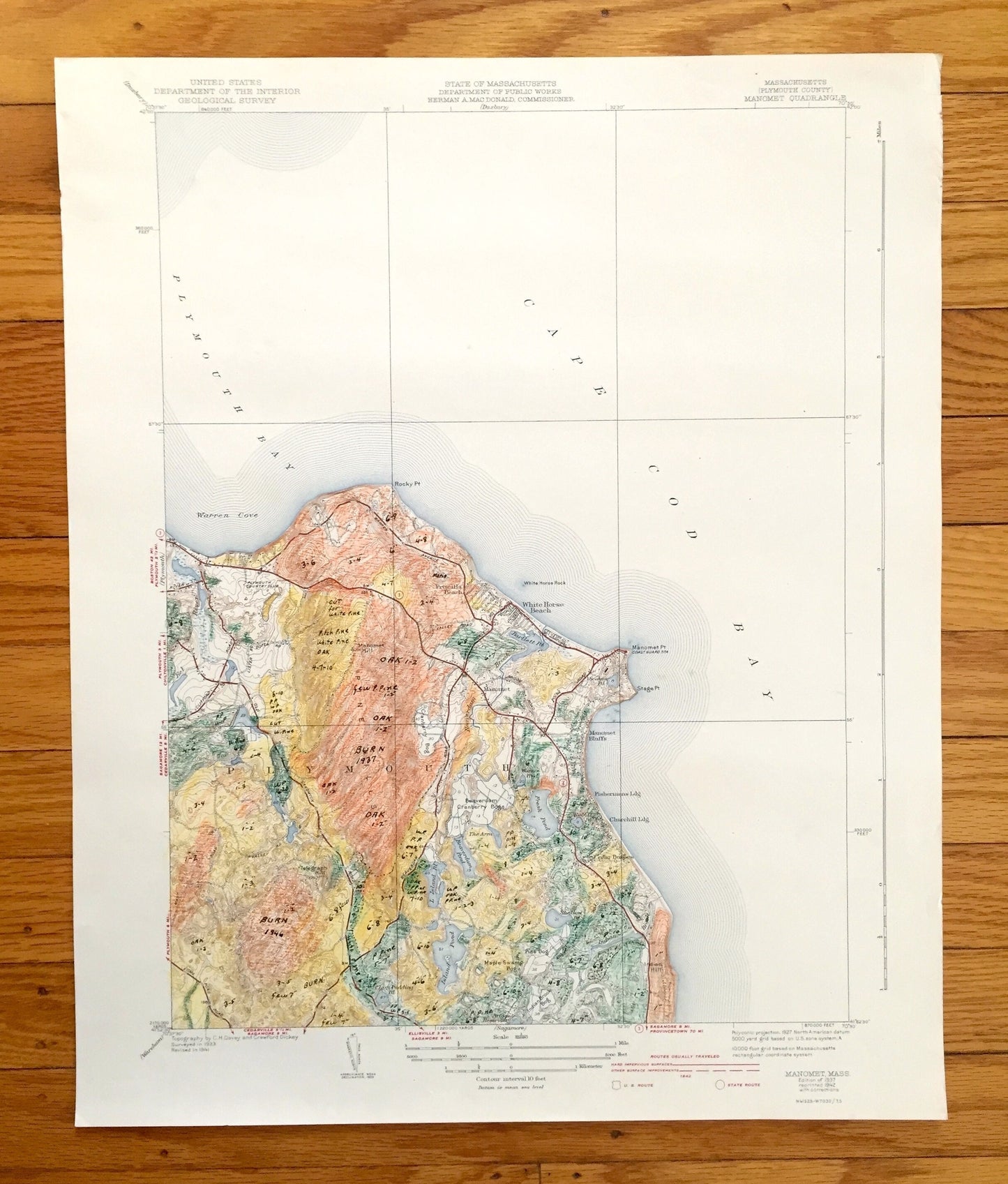
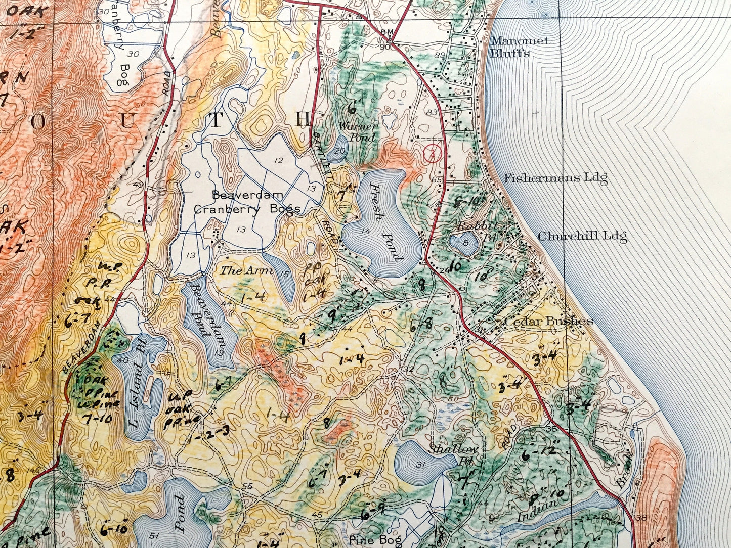
Beautiful, antique map of Plymouth, Massachusetts and surrounding Plymouth County area on Cape Cod Bay. This is an authentic 1937 edition, 1942 print from the U.S. Geological Survey and NOT a computer reproduction.
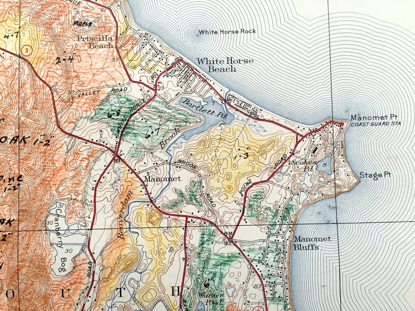
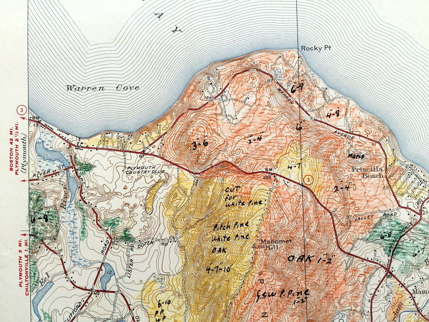
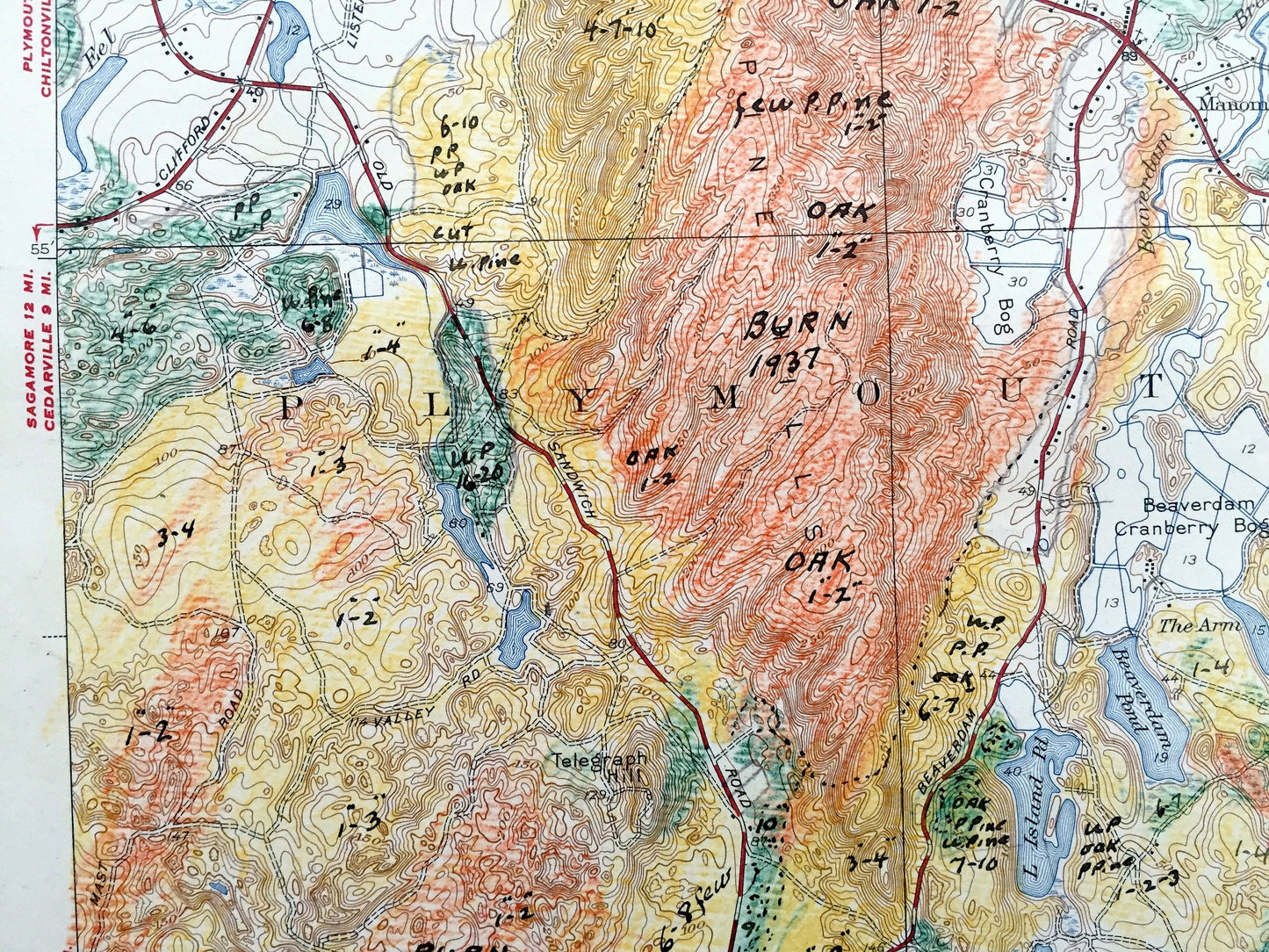
See what Massachusetts looked like over 85 years ago. Lots of intricate details and geological contours. Map even has little squares for every house that existed at the time. The USGS cartographers were very thorough back then! On the back is a description of topographic symbols and map guide. This map was most likely used in the field and has many notations and coloring throughout the map, making it a very unique specimen.
Perfect for the historian, map-lover, the curious or just as a conversation starter. Wonderful and rare. Vintage maps such as these make great gifts.
Edition of 1937, printed 1942
Dimensions: 16 1/2" width x 20" height
----
Features
Cities & Towns: Manomet, Plymouth, Priscilla Beach, Cedar Brushes.
Points of Interest: Cape Cod Bay, Plymouth Bay, Warren Cove, White Horse Beach, Manomet Point (Coast Guard Station) Manomet Bluffs, Beaverdam Cranberry Bogs, Pine Hills, Island Pond, Rocky Points, White Horse Rock and many more beaches, roads, houses, reservoirs, ponds, hills, streams, and bogs.
Condition: Good or "Very Vintage" condition, commensurate with age. This map is in great shape for being 80 years old. Has some edge-wear, foxing, and copious writing and notations, as well as hand-coloring, but this will all add to vintage character when framed.
----
We will happily adjust shipping price for multiple purchases. Maps are rolled up and shipped in sturdy mailing tubes, never folded.
Couldn't load pickup availability
Share