My Store
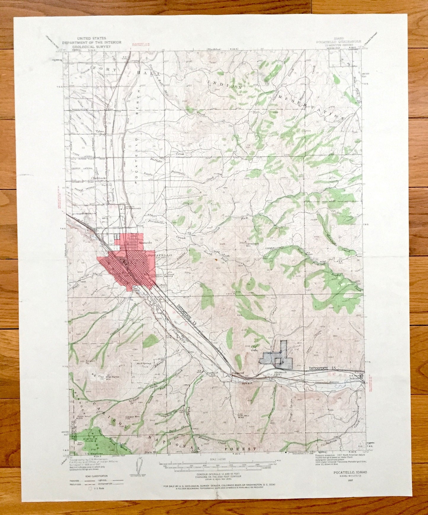
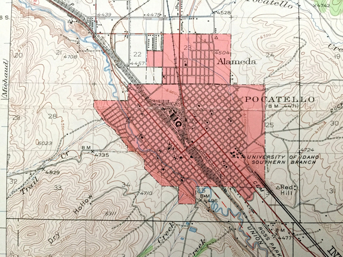
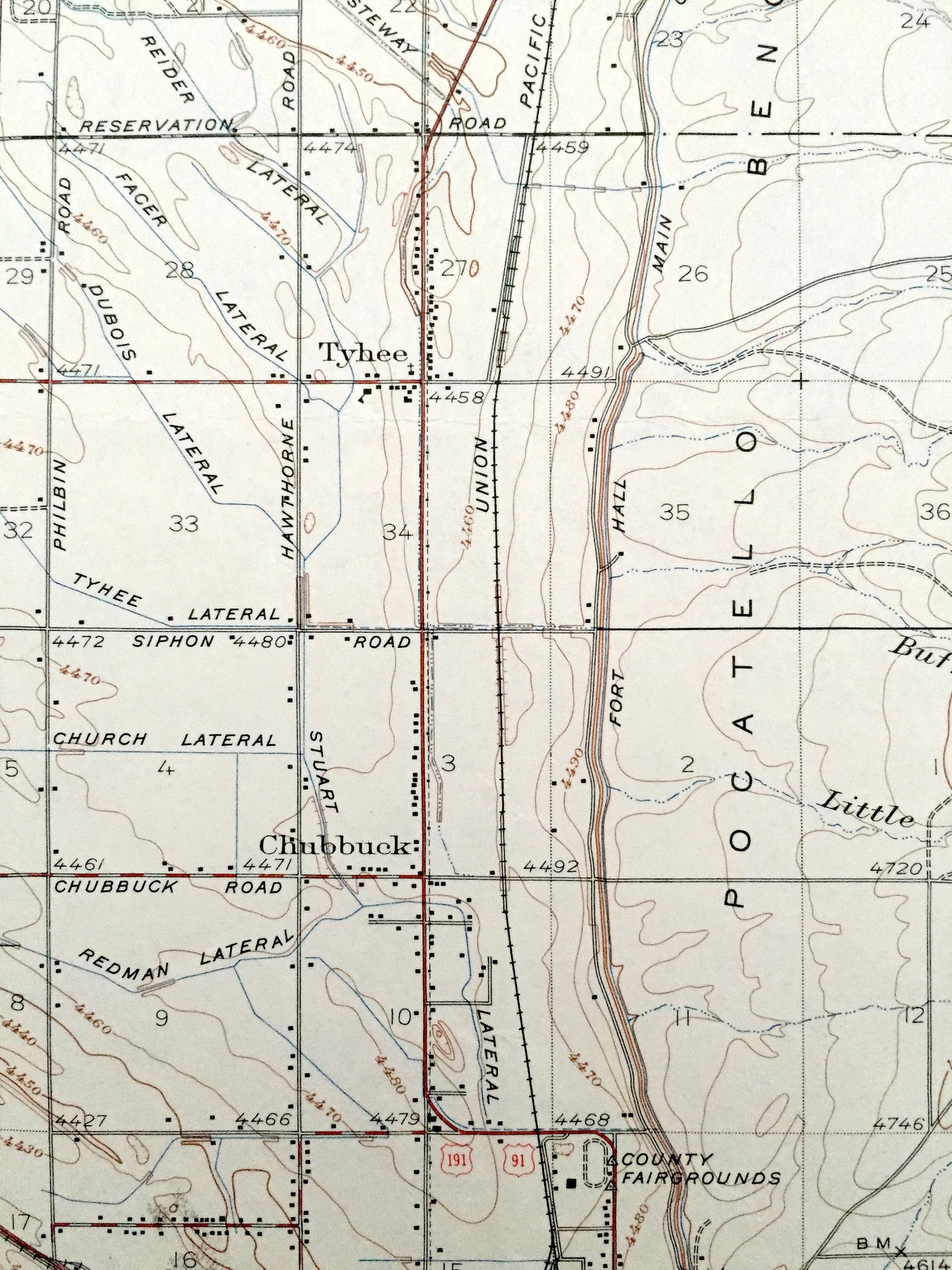
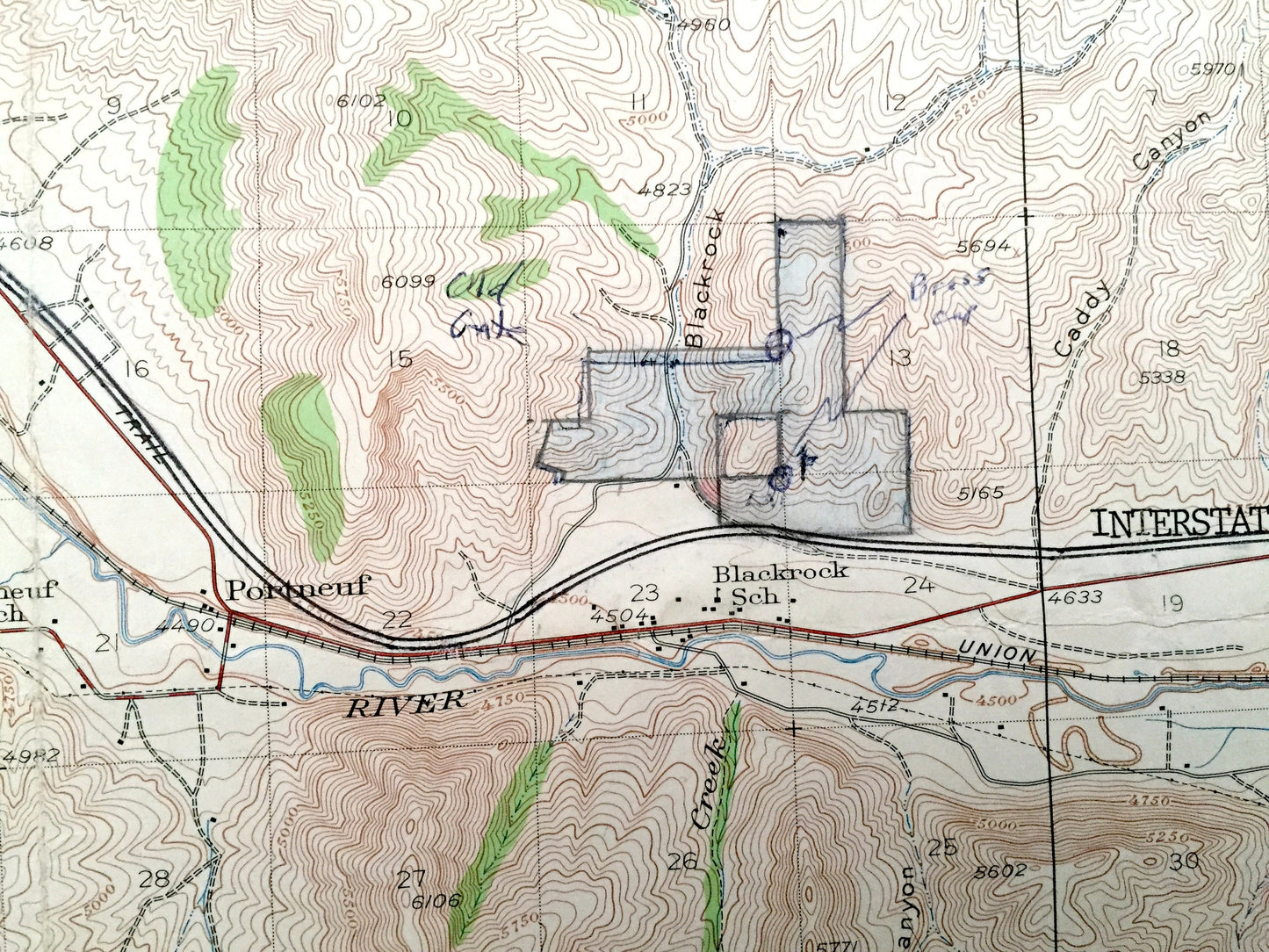
Antique Pocatello, Idaho 1937 US Geological Survey Topographic Map – Alameda, Fort Hall Indian Reservation, Caribou National Forest, Bannock
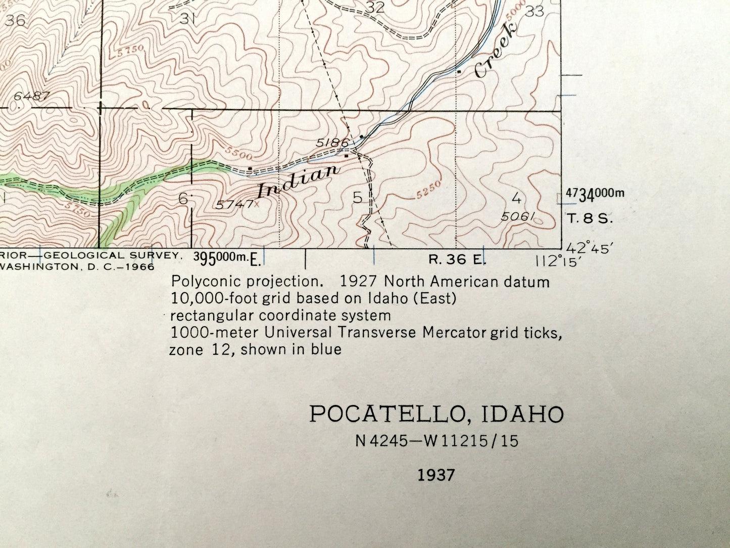
Antique Pocatello, Idaho 1937 US Geological Survey Topographic Map – Alameda, Fort Hall Indian Reservation, Caribou National Forest, Bannock
Beautiful, antique map of Pocatello, Idaho and surrounding Bannock County area. This is an authentic 1937 edition, 1960 print from the U.S. Geological Survey and NOT a computer reproduction.
See what Idaho looked like more than 85 years ago. Lots of intricate details and geological contours. Map even has little squares for every house that existed at the time. The USGS cartographers were very thorough back then!
Perfect for the historian, map-lover, the curious or just as a conversation starter. Wonderful and rare. Vintage maps such as these make great gifts.
Edition of 1937, printed 1960
Dimensions: 16 1/2" width x 20" height
----
Features
Cities & Towns: Pocatello, Alameda, Tyhee, Chubbuck, Portneuf, Inkom.
Points of Interest: Bannock County, Power County, Fort Hall Indian Reservation, Caribou National Forest, Pocatello Bench, Portneuf River, Mink Creek, Big Flat, University of Idaho Southern Branch, and many more hills, mountains, creeks, towns, houses, churches, schools, roads and train tracks.
Condition: Very Good Vintage condition, commensurate with age. This map is in incredible shape for being over 60 years old. Was probably used in the field. Has pencil markings but this will read as vintage character when framed.
----
We will happily adjust shipping price for multiple purchases. Maps are rolled up and shipped in sturdy mailing tubes, never folded.
Couldn't load pickup availability
Share