My Store
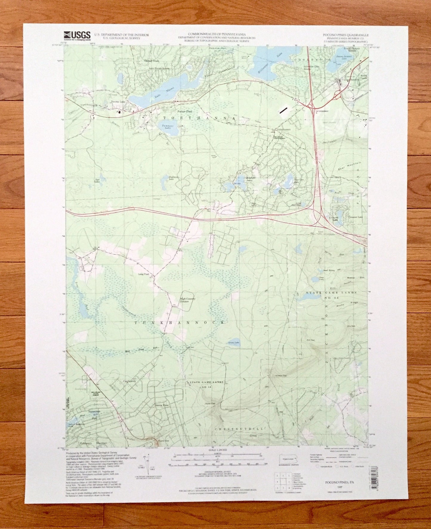
Antique Pocono Pines, Pennsylvania 1997 US Geological Survey Topographic Map – Monroe County, Tobyhanna, Bear Mountain, Lake Naomi, PA
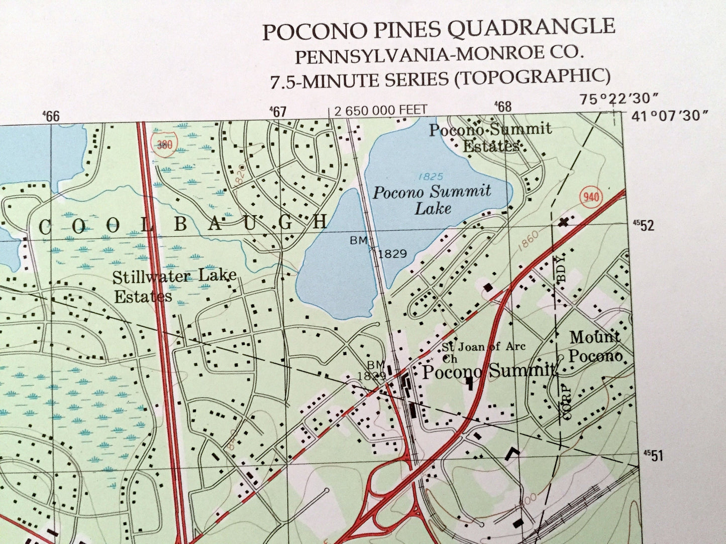
Antique Pocono Pines, Pennsylvania 1997 US Geological Survey Topographic Map – Monroe County, Tobyhanna, Bear Mountain, Lake Naomi, PA
Beautiful, antique map of Pocono Pines, Pennsylvania and surrounding Monroe County area. This is an authentic 1997 edition, 1998 print from the U.S. Geological Survey and NOT a computer reproduction.
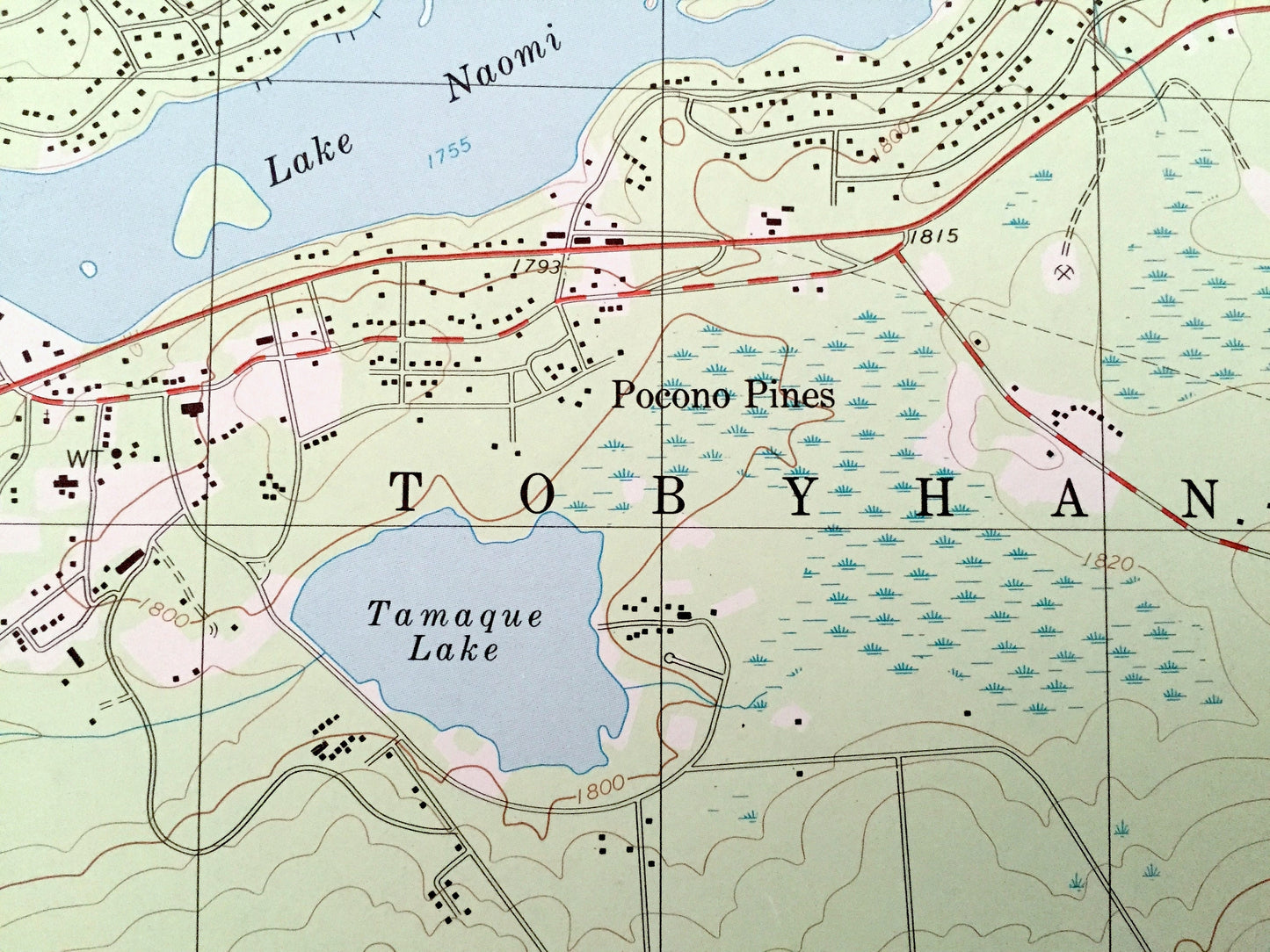
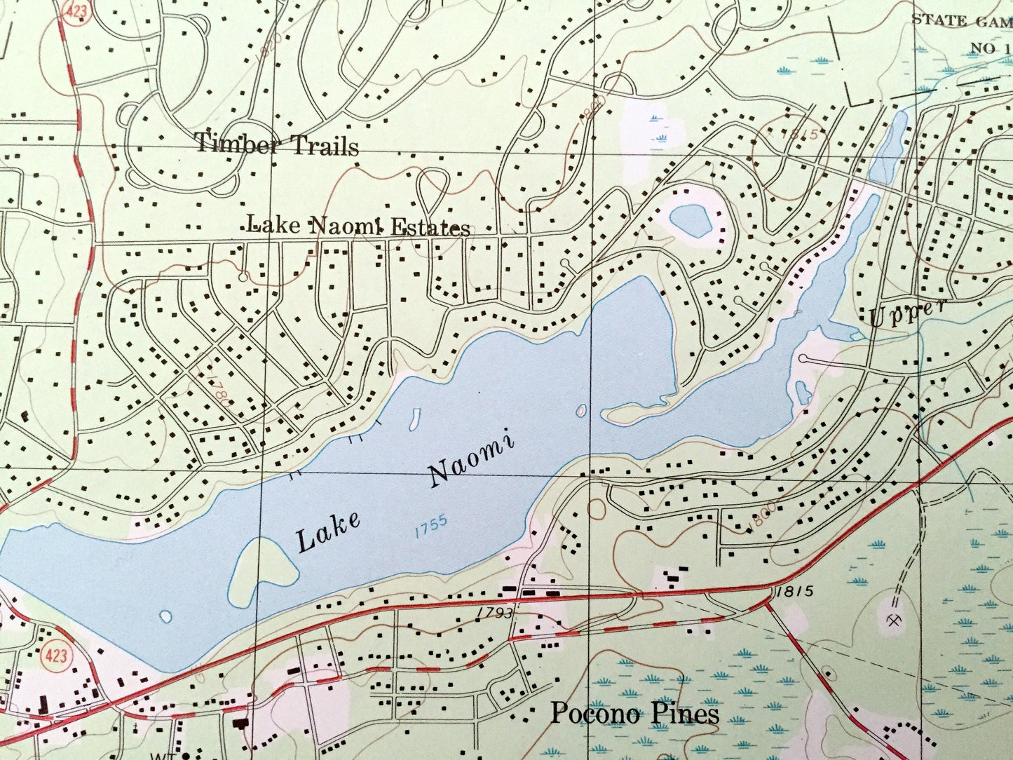
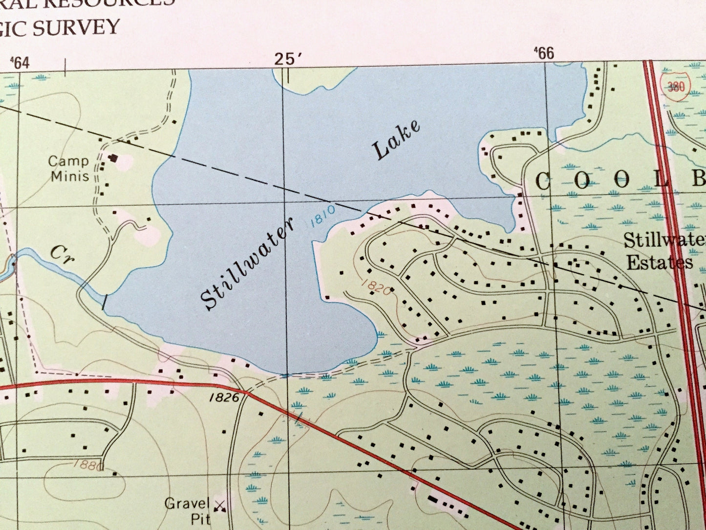
See what the Poconos looked like over 25 years ago. Lots of intricate details and geological contours. Map even has little squares for every house that existed at the time. The USGS cartographers were very thorough back then!
Perfect for the historian, map-lover, the curious or just as a conversation starter. Wonderful and rare. Vintage maps such as these make great gifts.
Edition of 1997, printed 1998
Dimensions: 22" width x 27" height
----
Features
Cities & Towns: Pocono Pines, Tobyhanna, Coolbaugh, Pocono, Tunkhannock, Chestnuthill, Jackson, Timber Trails, Pocono Lake, Little Summit, Pocono Summit, Mount Pocono, Crescent Lake, Long Pond, High Country Estates, Candlewick, Sierra View, Stonecrest.
Points of Interest: Monroe County, The Poconos, Lake Naomi, Stillwater Lake, Pocono Summit Lake, Tamaque Lake, Emerald Lakes, Pine Tree Lake, Deer Pond, Crescent Lake, Grass Lake, Bear Mountain, Halfmoon Lake, Long Pond, Tunkhannock Creek, Spring Run, Wolf Swamp Run, State Game Lands, Hyspy Gap, Delaware State Forest and many more hills, streams, ponds, houses, schools, churches, Camps and roads.
Condition: Very Good Vintage condition, commensurate with age. This map is in great shape for being about 25 years old.
----
We will happily adjust shipping price for multiple purchases. Maps are rolled up and shipped in sturdy mailing tubes, never folded.
Couldn't load pickup availability
Share