My Store
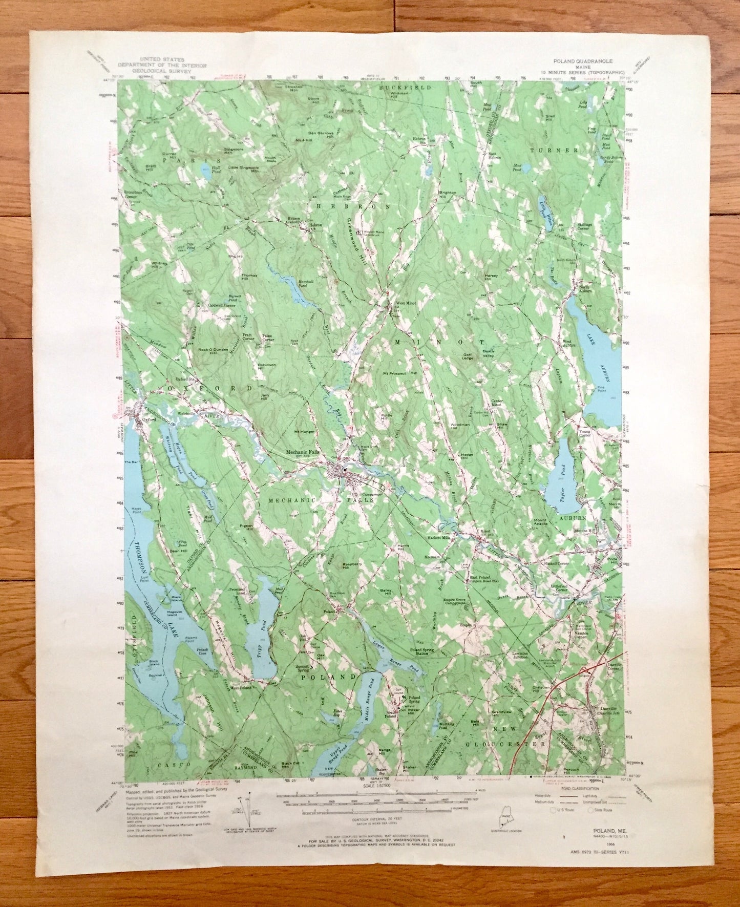
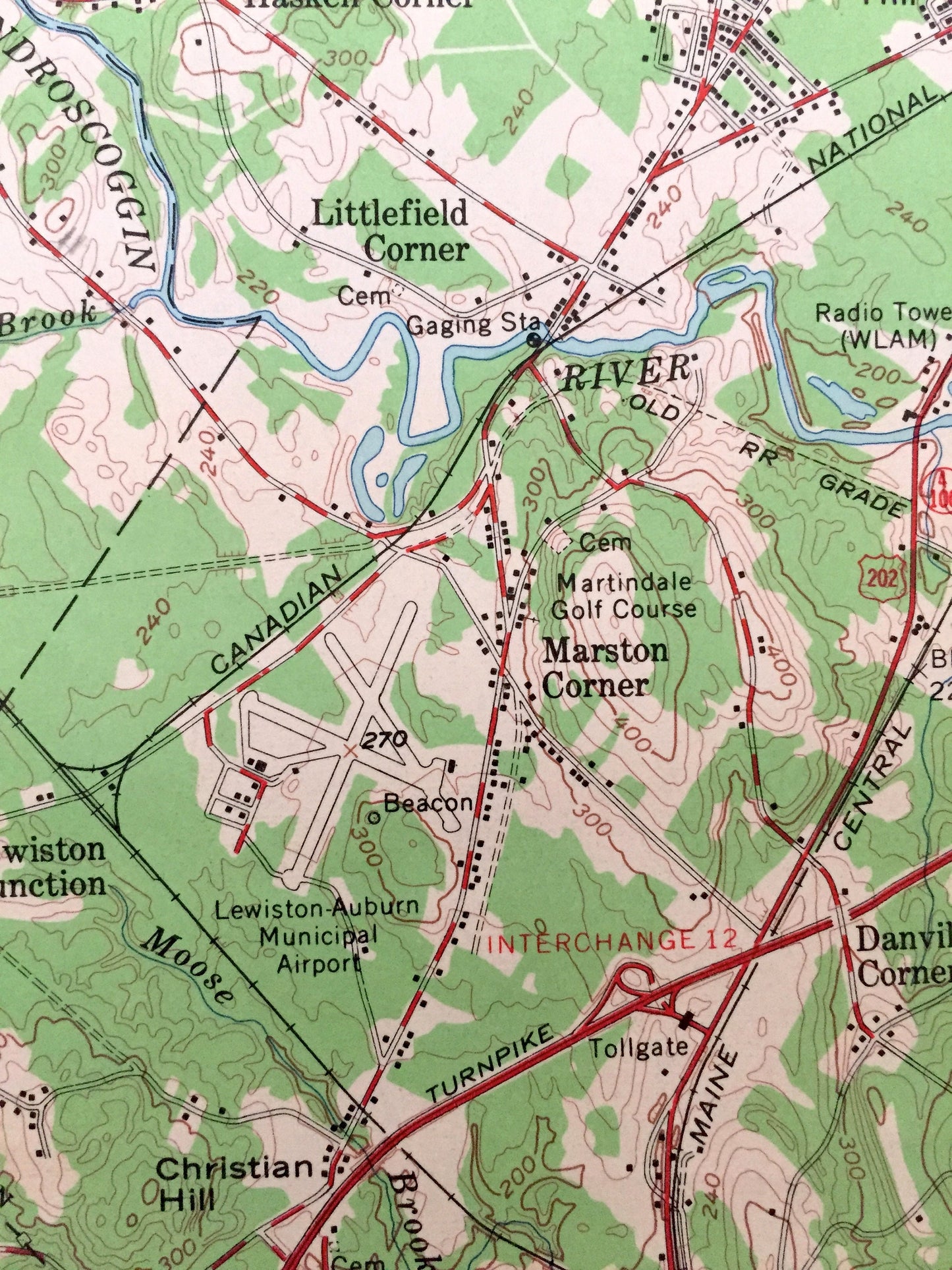
Antique Poland, Maine 1956 US Geological Survey Topographic Map – Mechanic Falls, Oxford County, Spring, Thompson Lake,, Androscoggin, ME
Antique Poland, Maine 1956 US Geological Survey Topographic Map – Mechanic Falls, Oxford County, Spring, Thompson Lake,, Androscoggin, ME
Beautiful, antique map of Poland, Oxford, Mechanic Falls, Minot, Hebron, Maine area of Androscoggin County and Oxford County. This is an authentic 1956 edition, 1968 print from the U.S. Geological Survey and NOT a computer reproduction.
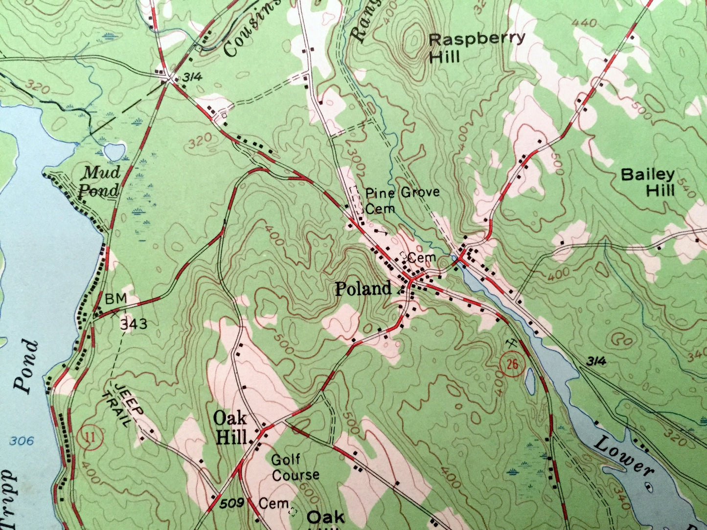
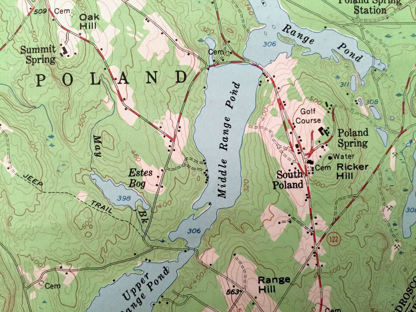
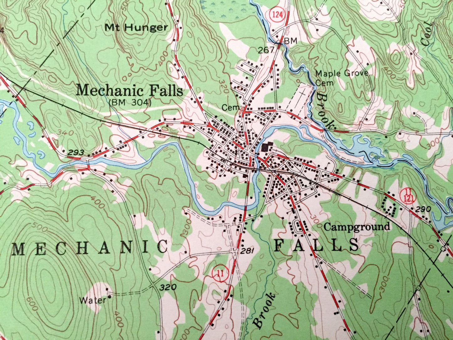
See what Maine looked like over 65 years ago. Lots of intricate details and geological contours. Map even has little squares for every house that existed at the time. The USGS cartographers were very thorough back then!
Perfect for the historian, map-lover, the curious or just as a conversation starter. Wonderful and rare. Vintage maps such as these make great gifts.
Edition of 1956, printed 1968
Dimensions: 17" width x 21" height
----
Features
Cities & Towns: Paris, Hebron, Buckfield, Turner, Oxford, Minot, Auburn, Mechanic Falls, Otisfield, Casco, Raymond, Poland, New Gloucester, West Minot, Skillings, North Auburn, Welchville, Advent Campground, Hacket Mills, Center Minot, Youngs Corner, Stevens Mills, West Poland, Poland Spring, Taylor Crossroads, East Poland, Haskell Corner, Littlefield, Empire, Marston Corner, Elmwood Farm, Hotel Road, Danville, Thompson Corner.
Points of Interest: Androscoggin River, Little Androscoggin River, Thompson Lake, Tripp Pond, Upper Range Pond, Middle Range Pond, Lake Auburn, Taylor Pond, Singepole Mountain, Ben Barrows Hill, Stone Hill, Maple Hill, Thomas Hill, Hersey Hill, Goff Ledge, Robinson Hill, Pottle Hill, Woodman Hill, Apatite Hill, Pigeon Hill, Raspberry Hill, Megquire Hill, Johnson Hill, Ricker Hill, Bald Hill, Grandview Hill, Poland Springs, Shaker Hill, Greenleaf Hill, Davis Brook, Marshall Pond, Grand Trunk Railroad, Boston & Maine Central Railroad, and lots more hills, streams, ponds, marshes, houses, islands, coves, roads, railroads.
Condition: Good Vintage condition, commensurate with age. This map is in great shape for being over 50 years old. Has some wear but this will add to vintage character when framed.
----
We will happily adjust shipping price for multiple purchases. Maps are rolled up and shipped in sturdy mailing tubes, never folded.
Couldn't load pickup availability
Share