My Store
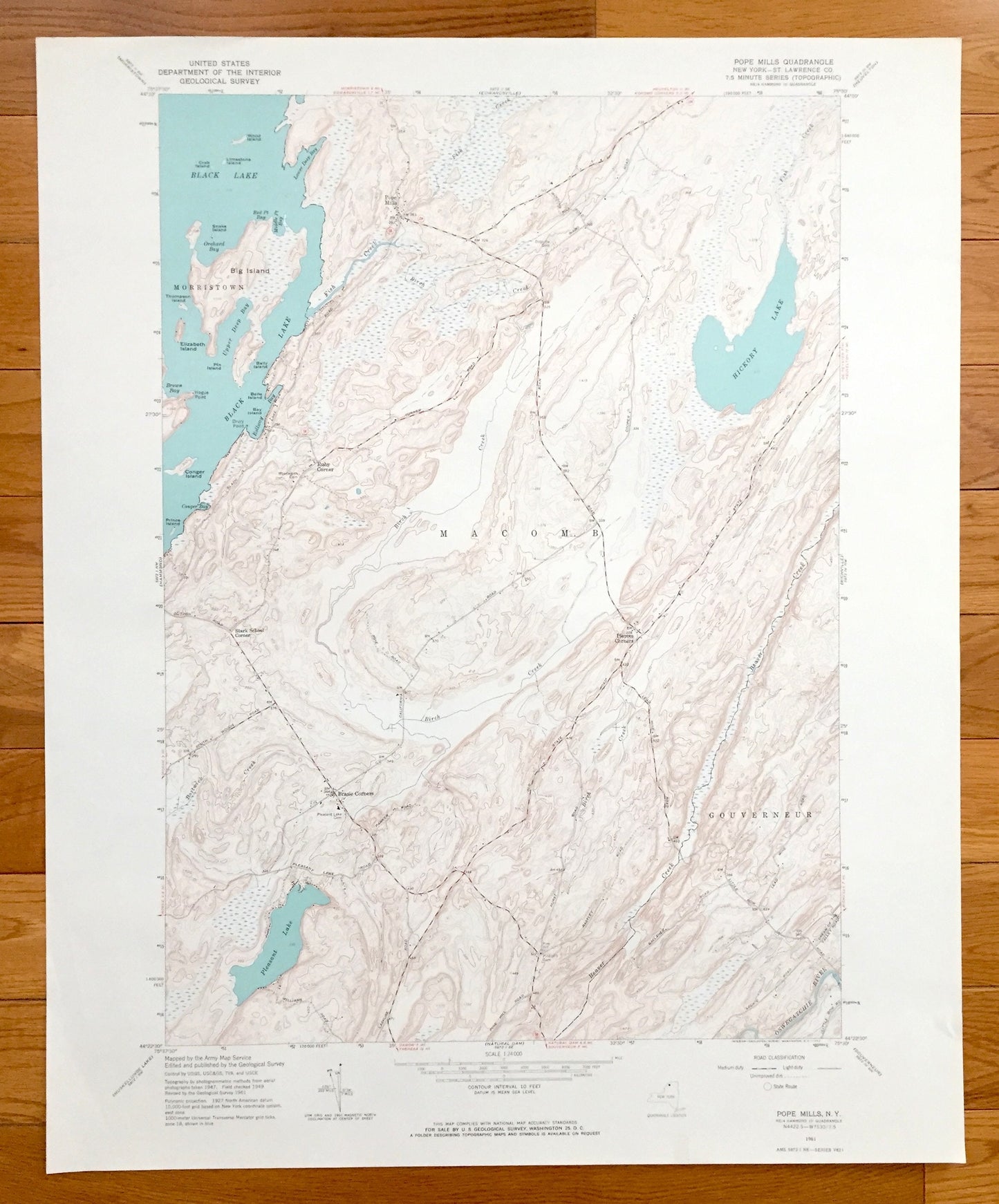
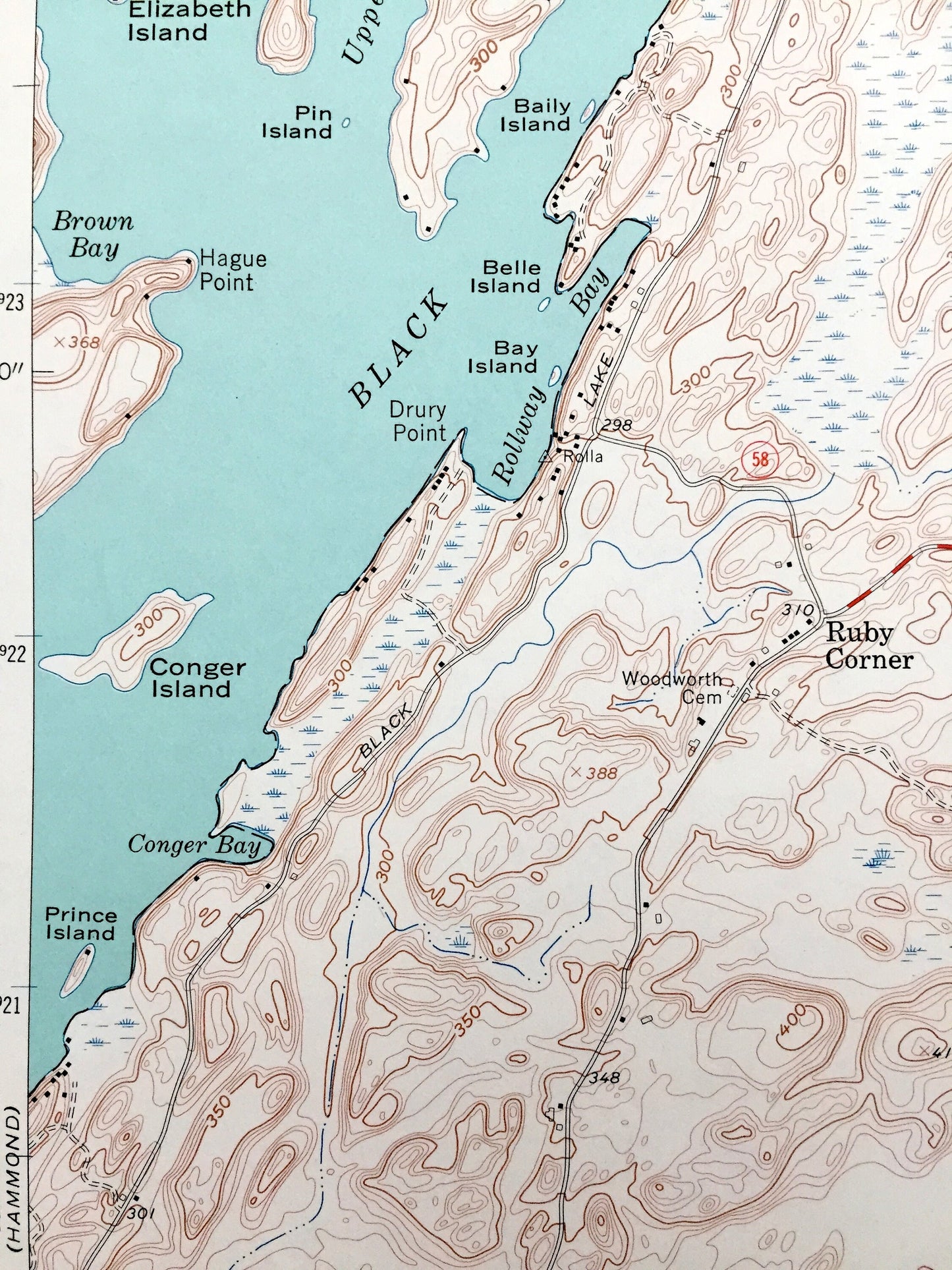
Antique Pope Mills, New York 1961 US Geological Survey Topographic Map – St Lawrence County, Morristown, Macomb, Pierces Corners, Black Lake
Antique Pope Mills, New York 1961 US Geological Survey Topographic Map – St Lawrence County, Morristown, Macomb, Pierces Corners, Black Lake
Beautiful, antique map of Pope Mills, New York and surrounding St. Lawrence County area. This is an authentic edition of 1961 print from the U.S. Geological Survey and NOT a computer reproduction.
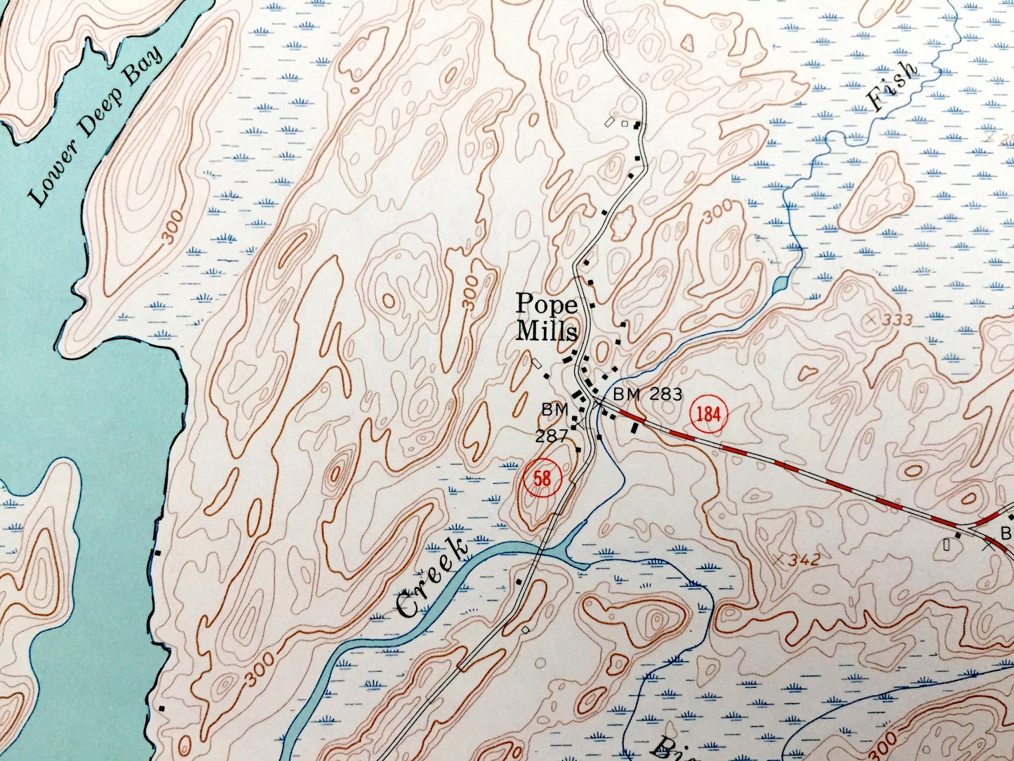
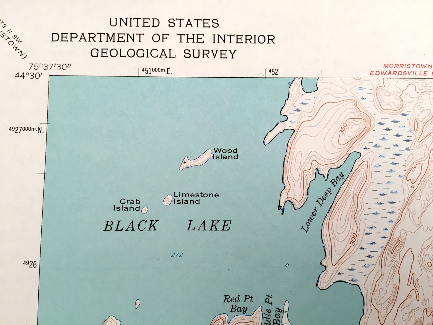
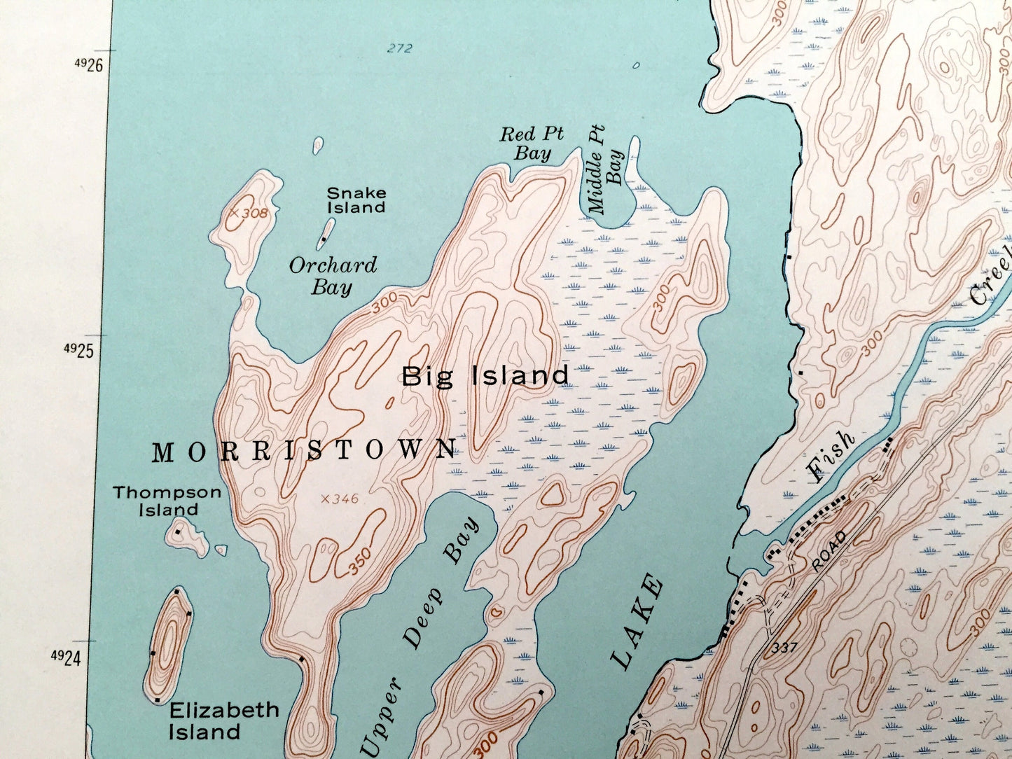
See what New York looked like almost 60 years ago. Lots of intricate details and geological contours. Map even has little squares for every house that existed at the time. The USGS cartographers were very thorough back then!
Perfect for the historian, map-lover, the curious or just as a conversation starter. Wonderful and rare. Vintage maps such as these make great gifts.
Edition of 1961, printed 1961
Dimensions: 22" width x 27" height
----
Features
Cities & Towns: Pope Mills, Morristown, Ruby Corner, Macomb, Pierces Corners, Gouverneur, Brasie Corners.
Points of Interest: Black Lake, Big Island, Hickory Lake, Pleasant Lake, Conger Island, Fish Creek, Orchard Bay, Rollway Bay, Birch Creek, and many more roads, houses, reservoirs, ponds, and hills.
Condition: Very Good condition, commensurate with age. This map is in incredible shape for being almost 60 years old.
----
We will happily adjust shipping price for multiple purchases. Maps are rolled up and shipped in sturdy mailing tubes, never folded.
Couldn't load pickup availability
Share