My Store
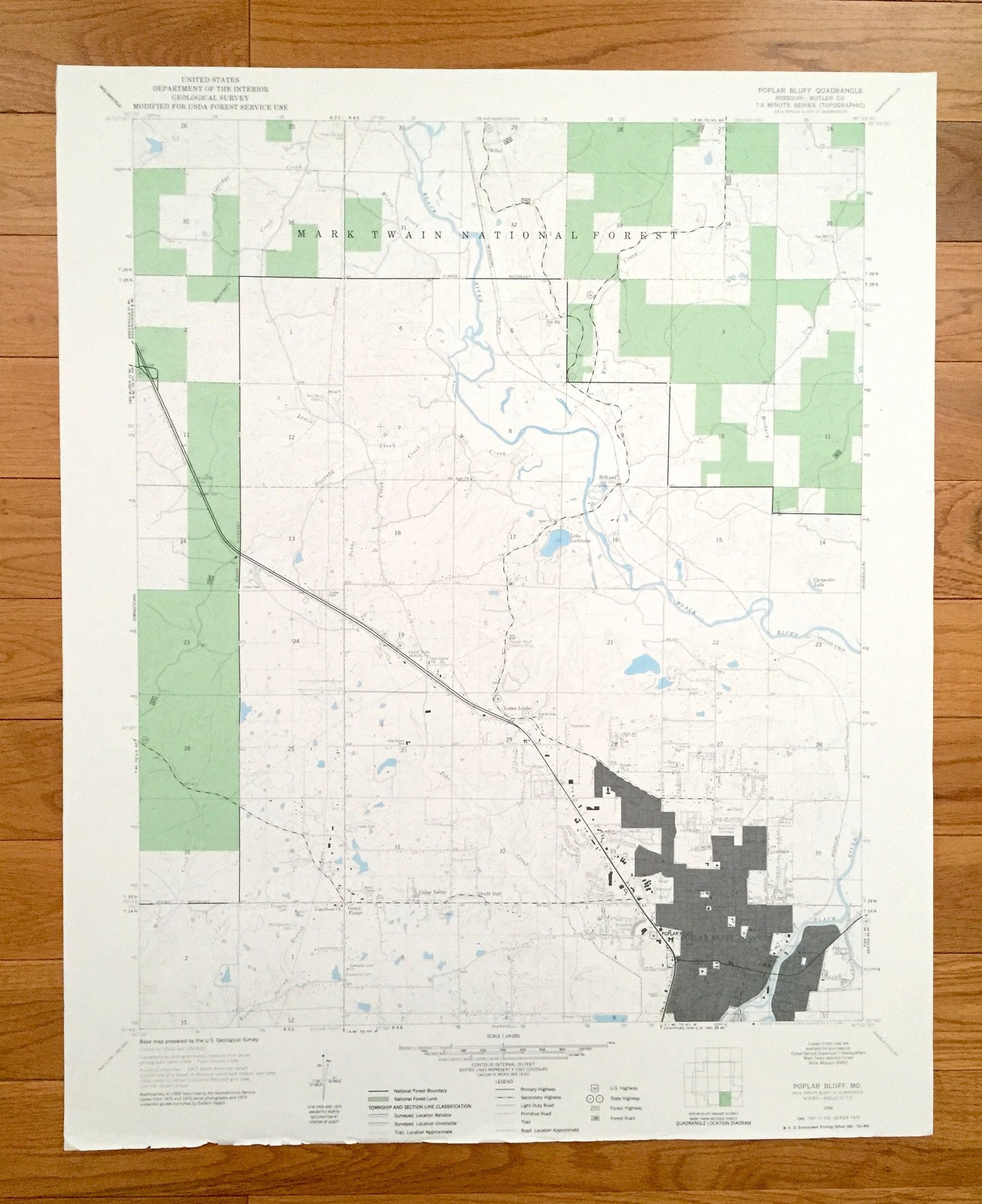
Antique Poplar Bluff, Missouri 1966 US Geological Survey Topographic Map – Butler County, Wilby, Hilliard, Loma Linda, Green Forest, MO
Antique Poplar Bluff, Missouri 1966 US Geological Survey Topographic Map – Butler County, Wilby, Hilliard, Loma Linda, Green Forest, MO
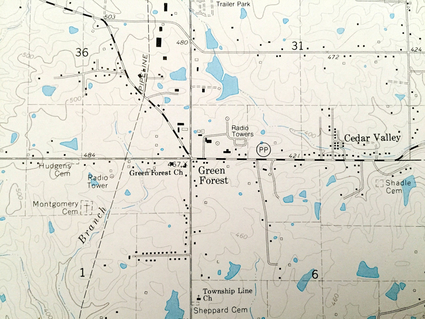
Beautiful, antique map of Poplar Bluff, Missouri and surrounding Butler County areas. This is an authentic 1966 edition, 1967 print from the U.S. Geological Survey and NOT a computer reproduction.
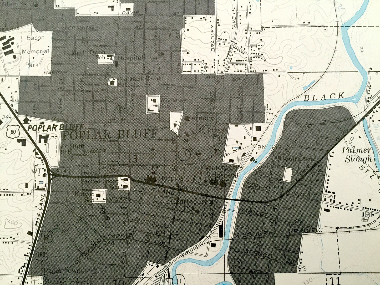
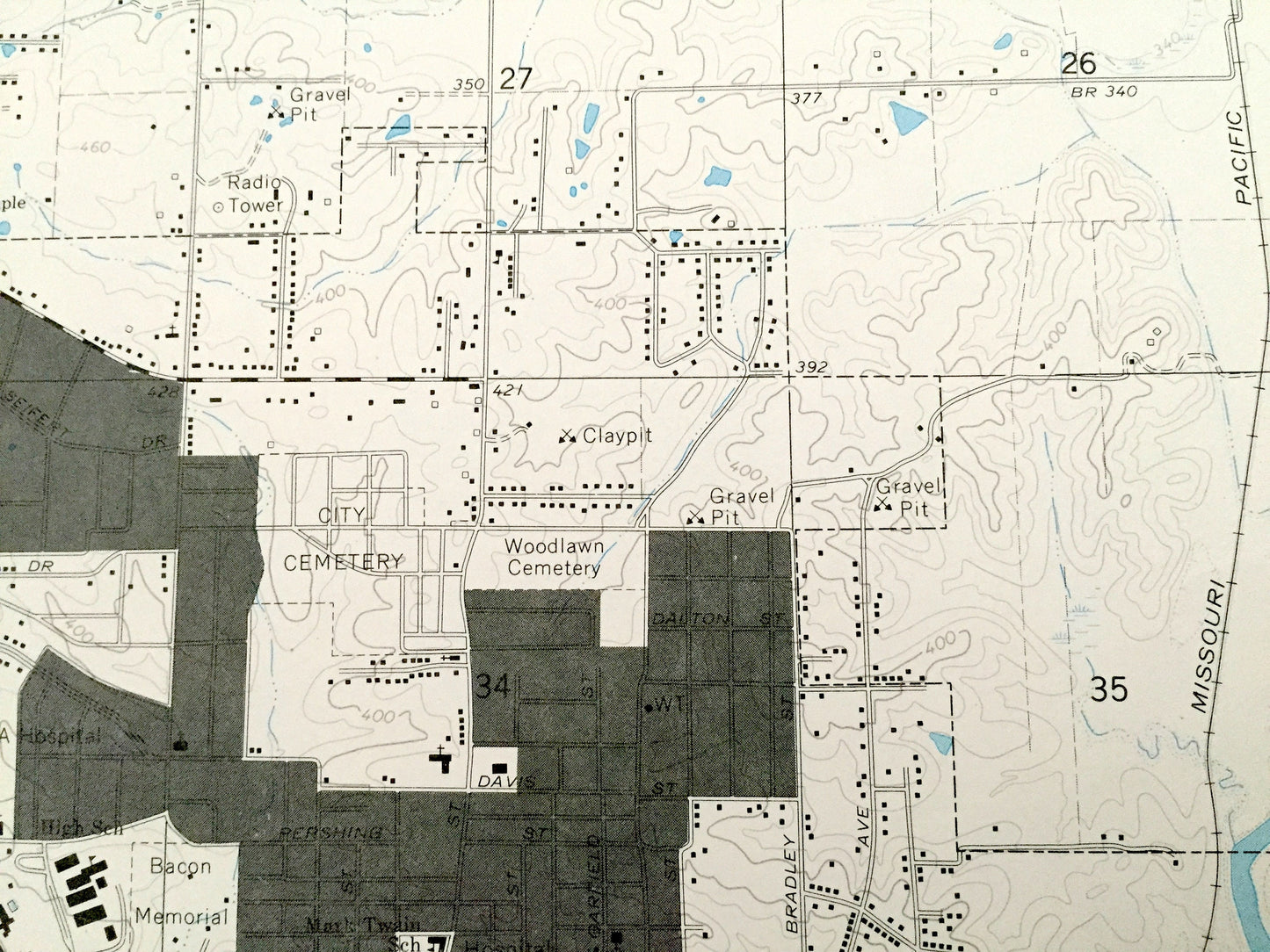
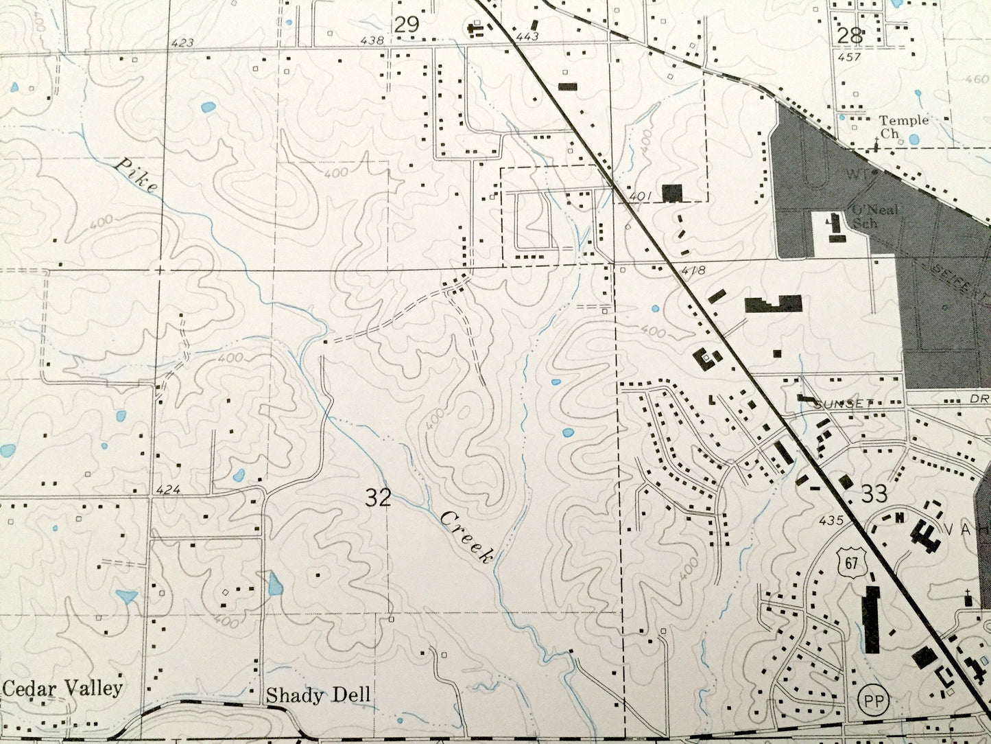
See what Missouri looked like over 50 years ago. Lots of intricate details and geological contours. Map even has little squares for every house that existed at the time. The USGS cartographers were very thorough back then!
Perfect for the historian, map-lover, the curious or just as a conversation starter. Wonderful and rare. Maps such as these make great gifts.
Edition of 1966, printed 1967
Dimensions: 22" width x 27" height
----
Features
Cities & Towns: Cedar Valley, Shady Dell, Green Forest, Loma Linda, Hilliard, Wilby.
Points of Interest: Mark Twain National Forest, Poplar Bluff Country Club, Waterworks Hospital, Bacon Memorial Park, Black River, Carpenter Lake, Palmer Slough, Lake Lockloma, Aldridge Creek, Hartman Creek, Lewis Creek, Hoedapp Creek, Dobbs Creek, Kenner Spring Branch, Mill Creek, Buck Creek, and many more hills, streams, ponds, houses, schools, railroads, churches and roads.
Condition: Very Good Vintage condition, commensurate with age. This map is in incredible shape for being over 50 years old. Has light edge-wear but this will read as character when framed.
----
We will happily adjust shipping price for multiple purchases. Maps are rolled up and shipped in sturdy mailing tubes, never folded.
Couldn't load pickup availability
Share