My Store
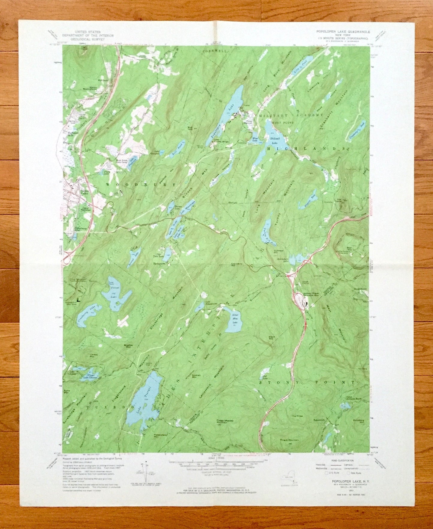
Antique Popolopen Lake, New York 1957 US Geological Survey Topographic Map – Orange, Rockland County, West Point, Highlands Woodbury Camp NY
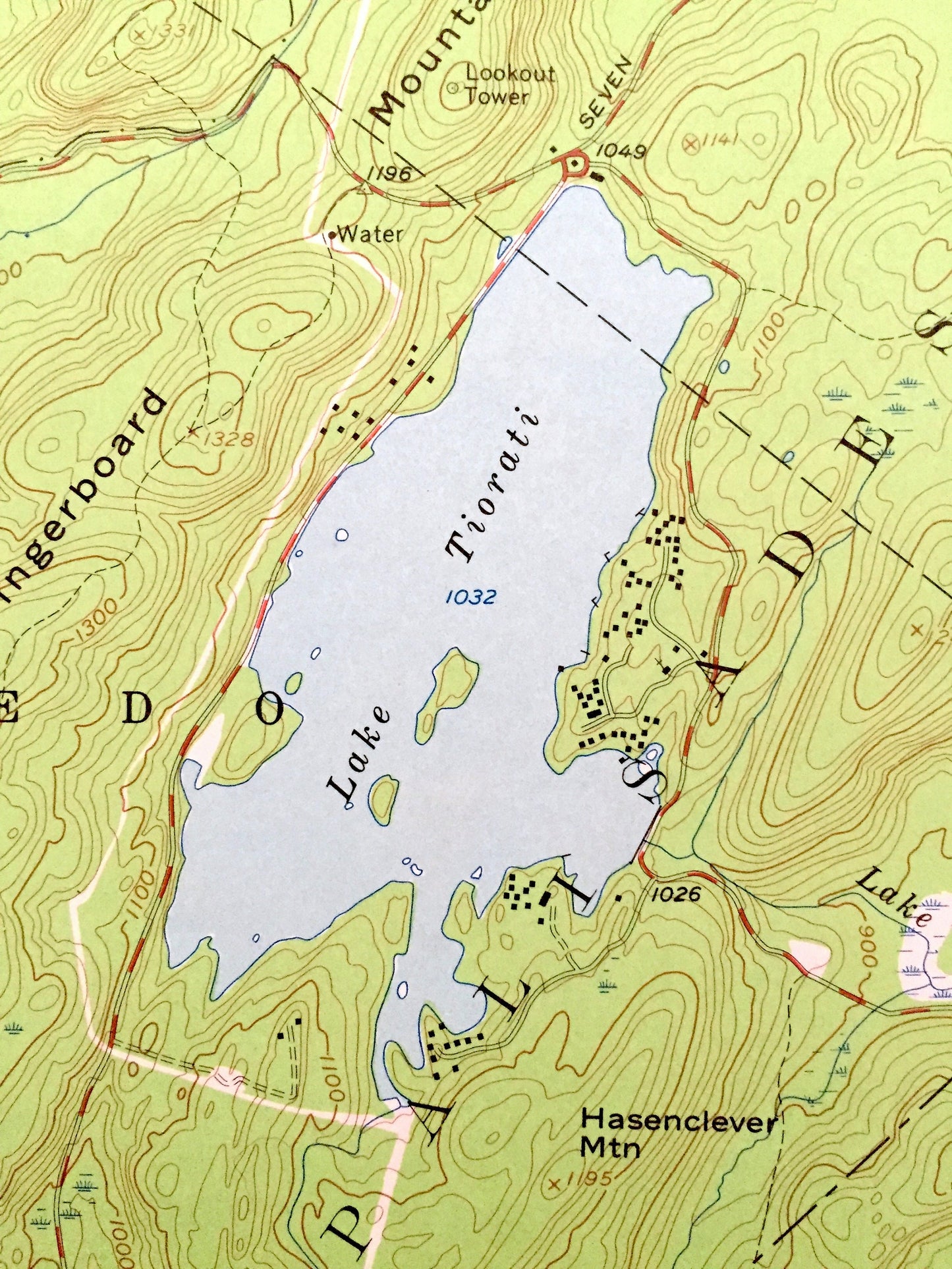
Antique Popolopen Lake, New York 1957 US Geological Survey Topographic Map – Orange, Rockland County, West Point, Highlands Woodbury Camp NY
Beautiful, antique map of Popolopen Lake, New York and surrounding Orange & Rockland County area. This is an authentic 1957 edition, 1964 print from the U.S. Geological Survey and NOT a computer reproduction.
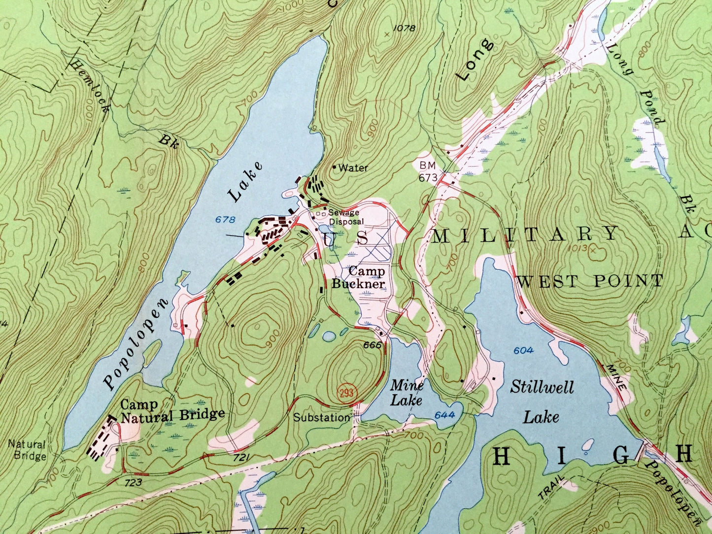
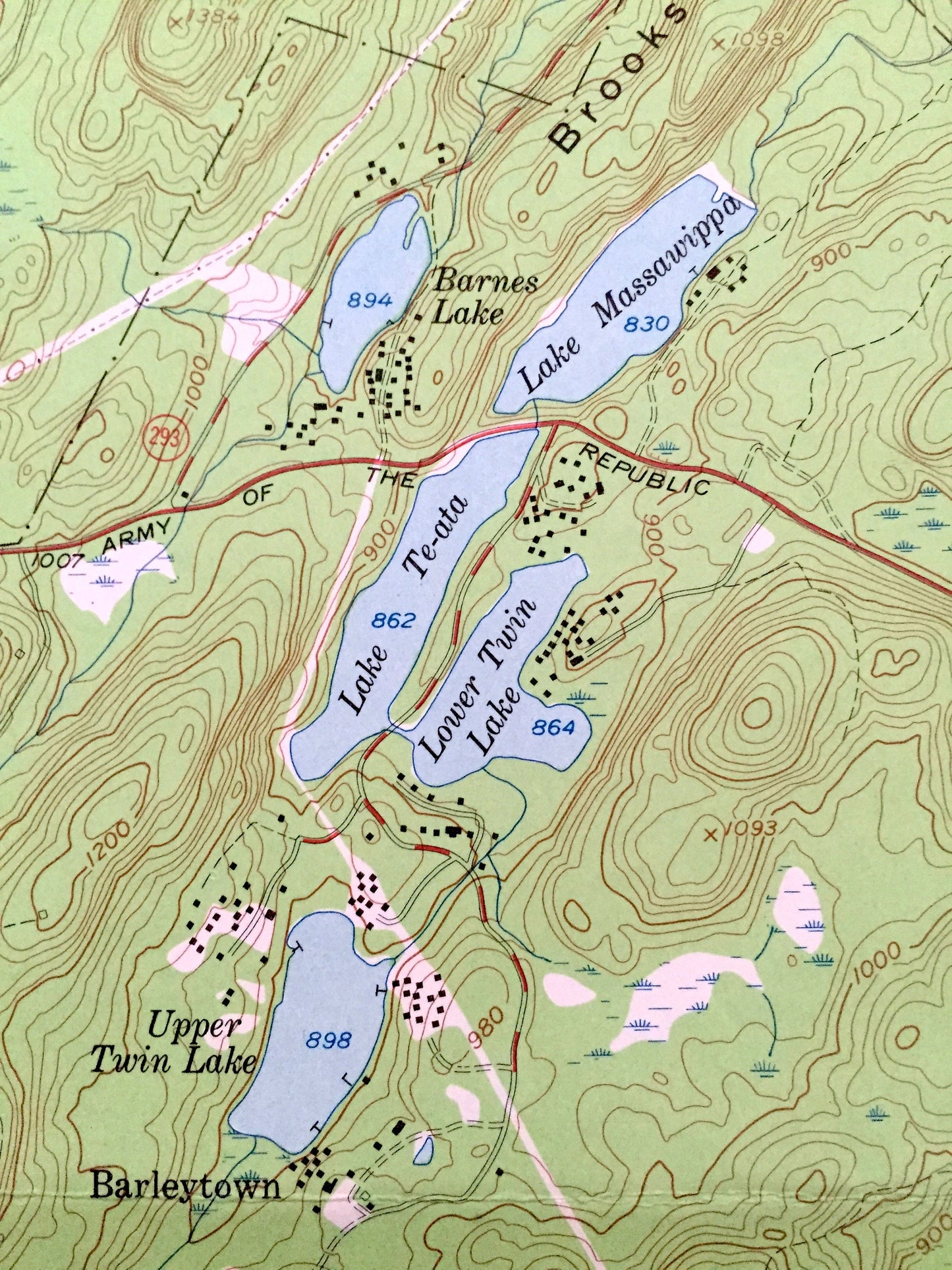
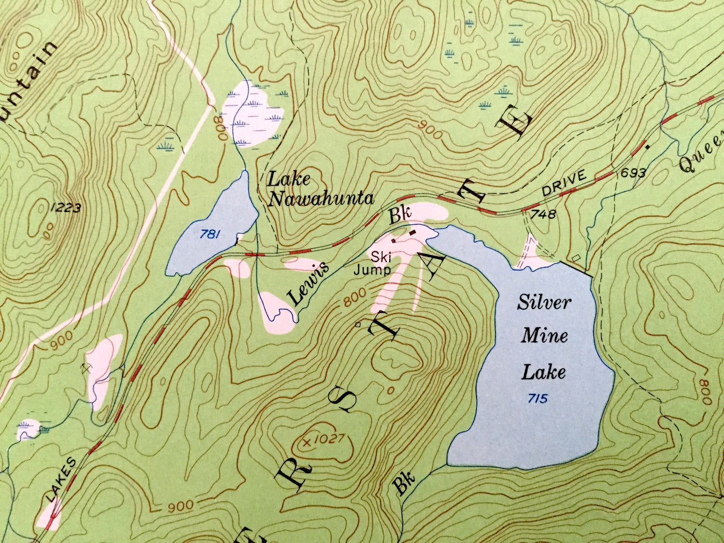
See what New York looked like over 60 years ago. Lots of intricate details and geological contours. Map even has little squares for every house that existed at the time. The USGS cartographers were very thorough back then!
Perfect for the historian, map-lover, the curious or just as a conversation starter. Wonderful and rare. Vintage maps such as these make great gifts.
Edition of 1957, printed 1964
Dimensions: 22" width x 27" height
----
Features
Cities & Towns: Woodbury, Highlands, Cornwall, Tuxedo, Stony Point, Highland Mills, Central Valley, Barleytown, Bulsontown.
Points of Interest: Rockland County, Orange County, Lake Popolopen, Palisades Interstate Park, Stillwell Lake, Long Pond, Lake Te-ata, Lower Twin Lake, Cranberry Lake, Forest Lake, Silver Mine Lake, Lake Tiorati, Lake Cohasset, Camp Wildwood, West Point Girls Camp, Camp Natural Bridge, Camp Buckner, West Point Military Academy, Flaggy Meadow Mountain, and many more hills, streams, ponds, houses, schools, churches and roads.
Condition: Good Vintage condition, commensurate with age. This map is in great shape for being almost 60 years old. Has light edge-wear and folds as issued, but these will flatten easily and all will add to vintage character when framed.
----
We will happily adjust shipping price for multiple purchases. Maps are rolled up and shipped in sturdy mailing tubes, never folded.
Couldn't load pickup availability
Share