My Store
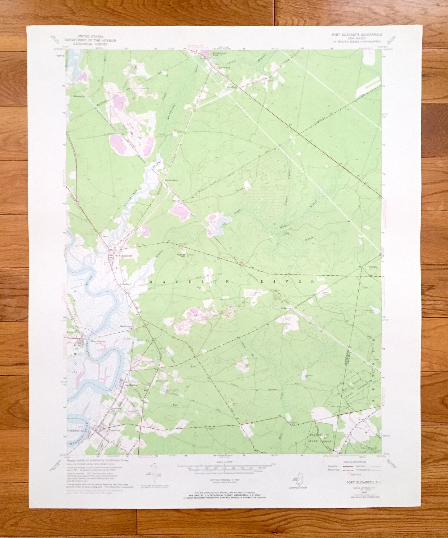
Antique Port Elizabeth, New Jersey 1956 US Geological Survey Topographic Map – Cumberland, Cape May County, Commercial, Maurice River, NJ
Antique Port Elizabeth, New Jersey 1956 US Geological Survey Topographic Map – Cumberland, Cape May County, Commercial, Maurice River, NJ
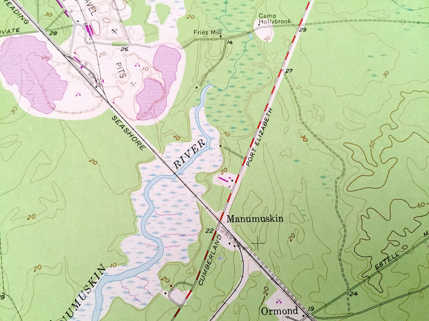
Beautiful, antique map of Port Elizabeth, New Jersey and surrounding Cumberland County and Cape May County areas. This is an authentic 1956 edition, 1972 print from the U.S. Geological Survey and NOT a computer reproduction.
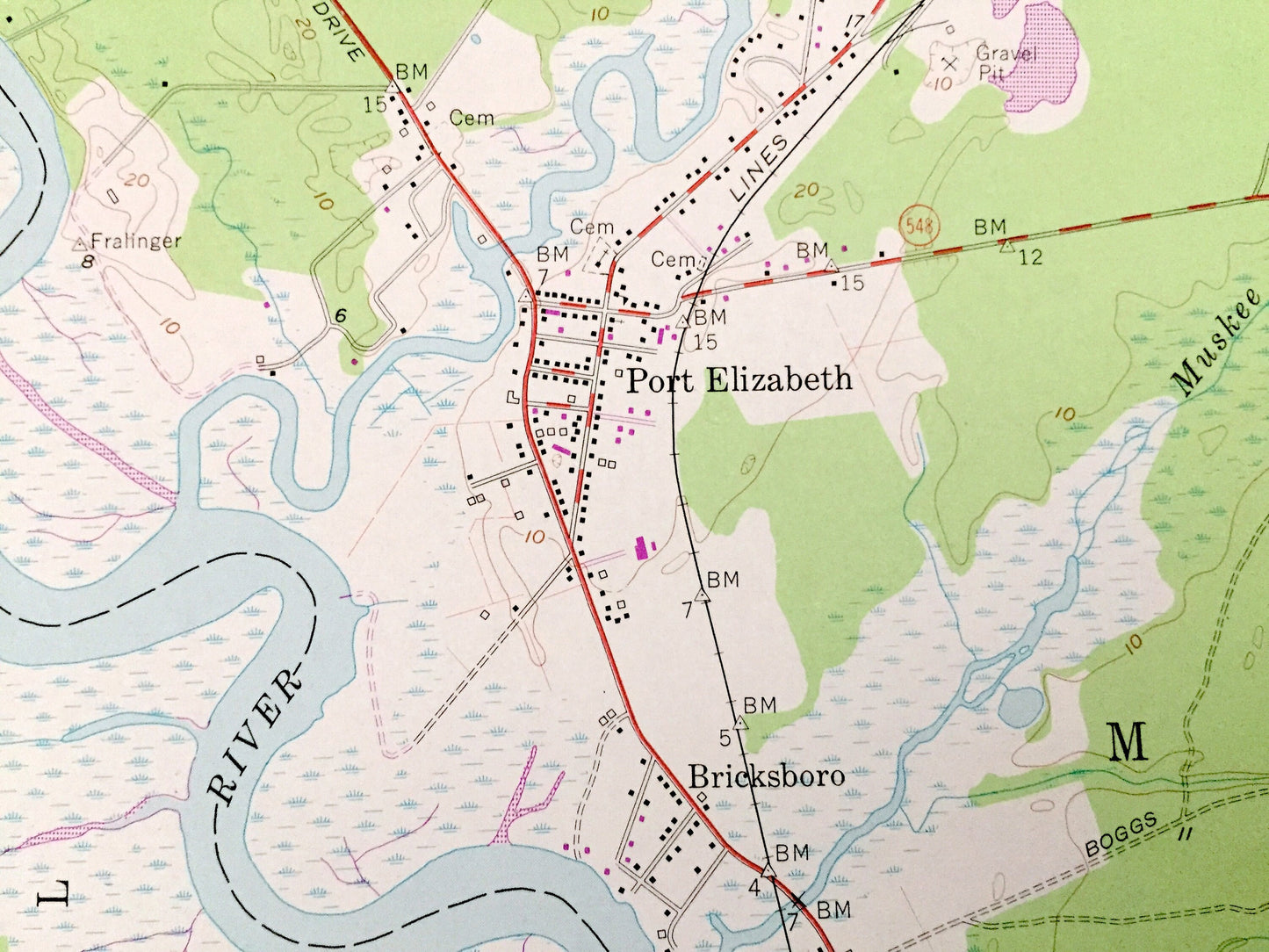
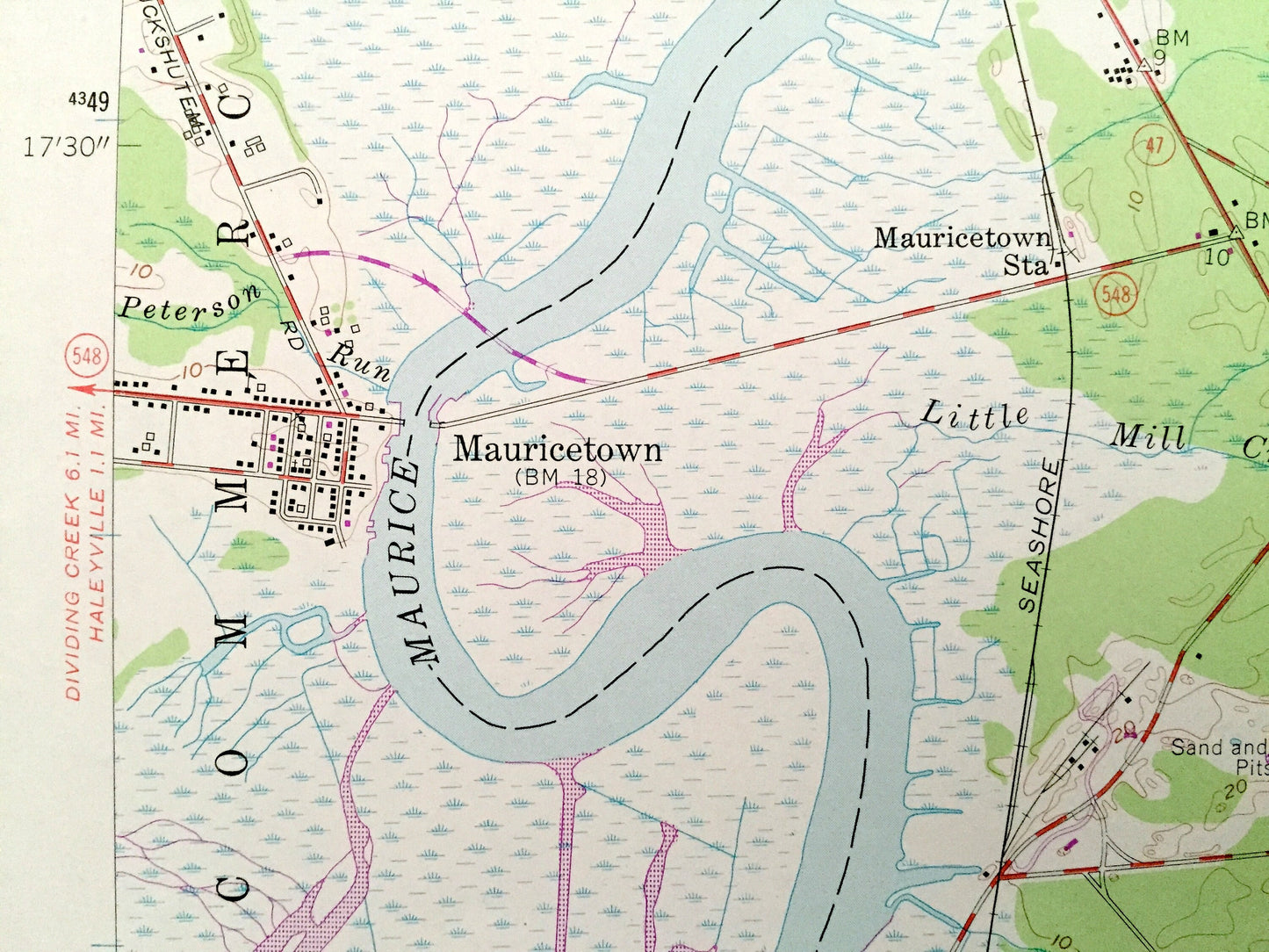
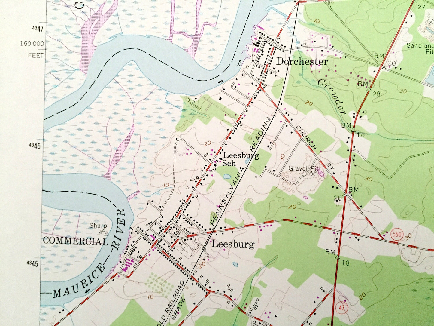
See what New Jersey looked like more than 60 years ago. Lots of intricate details and geological contours. Map even has little squares for every house that existed at the time. The USGS cartographers were very thorough back then!
Perfect for the historian, map-lover, the curious or just as a conversation starter. Wonderful and rare. Vintage maps such as these make great gifts.
Edition of 1956, printed 1972
Dimensions: 22" width x 27" height
----
Features
Cities & Towns: Manantico, Manumuskin, Ormond, Bricksboro, Mauricetown, Dorchester, Leesburg, Halberton, Upper Township, Hesstown, Cumberland.
Points of Interest: Fries Mill, Camp Hollybrook, Muskee Hill, Belleplain State Forest, Cape May County, Manumuskin River, Jones Mill, Maurice River, Little Mill Creek, Crowder Run, Peterson Run, West Creek, Slab Branch, Middle Branch, Nixons Branch, Lawrence Branch, Gravel Pits, and many more roads, ponds, houses, beaches, islands, rivers, inlets, marshes, lighthouses and creeks.
Condition: Very Good Vintage condition, commensurate with age. This map is in great shape for being over 45 years old. Has light edge-wear, all of which add to character when framed.
----
We will happily adjust shipping price for multiple purchases. Maps are rolled up and shipped in sturdy mailing tubes, never folded.
Couldn't load pickup availability
Share