My Store
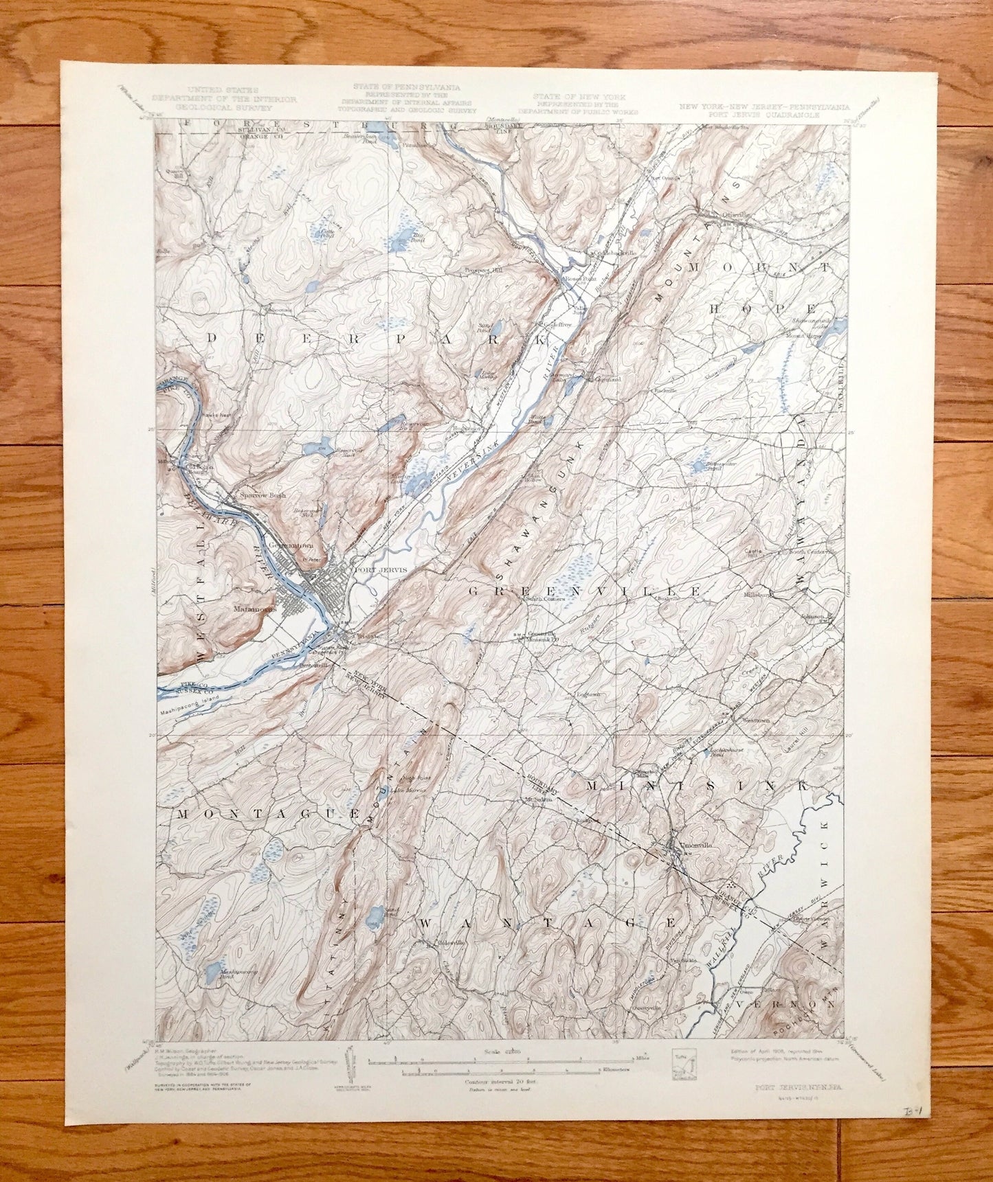
Antique Port Jervis, New York 1908 US Geological Survey Topographic Map – Matamoras, Orange, Sussex, Pike County, Neversink New Jersey NY NJ
Antique Port Jervis, New York 1908 US Geological Survey Topographic Map – Matamoras, Orange, Sussex, Pike County, Neversink New Jersey NY NJ
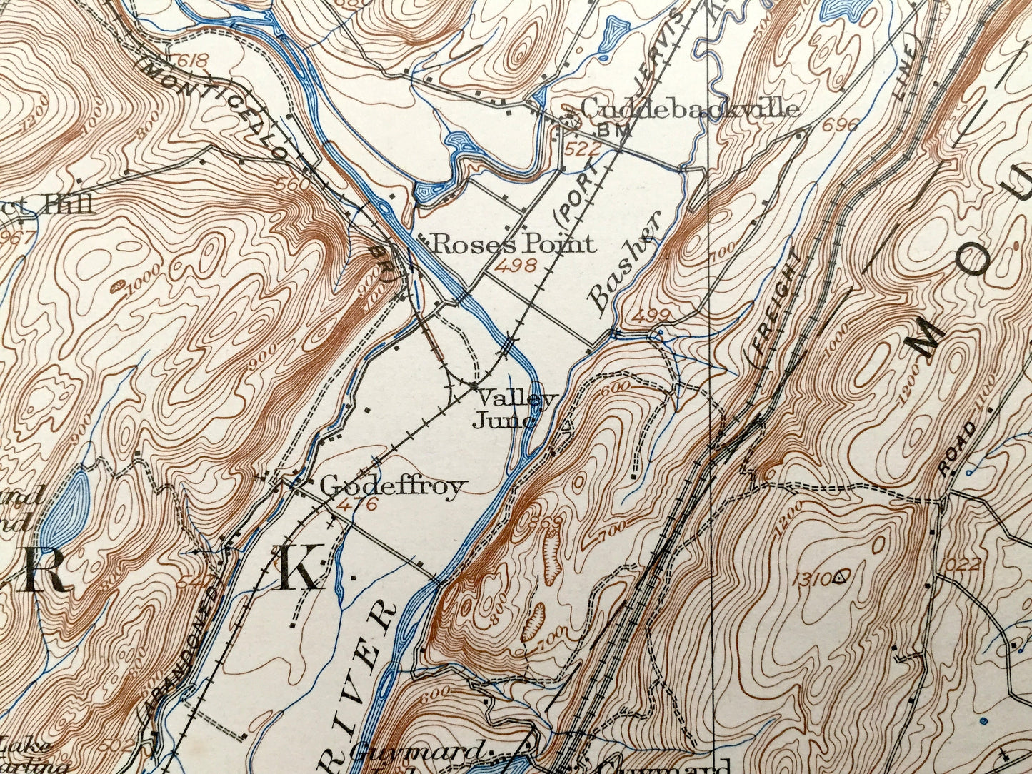
Beautiful, antique map of Port Jervis, New York and surrounding areas of New York, New Jersey and Pennsylvania. This is an authentic 1908 edition, 1944 print from the U.S. Geological Survey and NOT a computer reproduction.
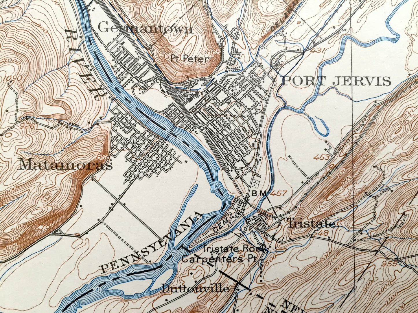
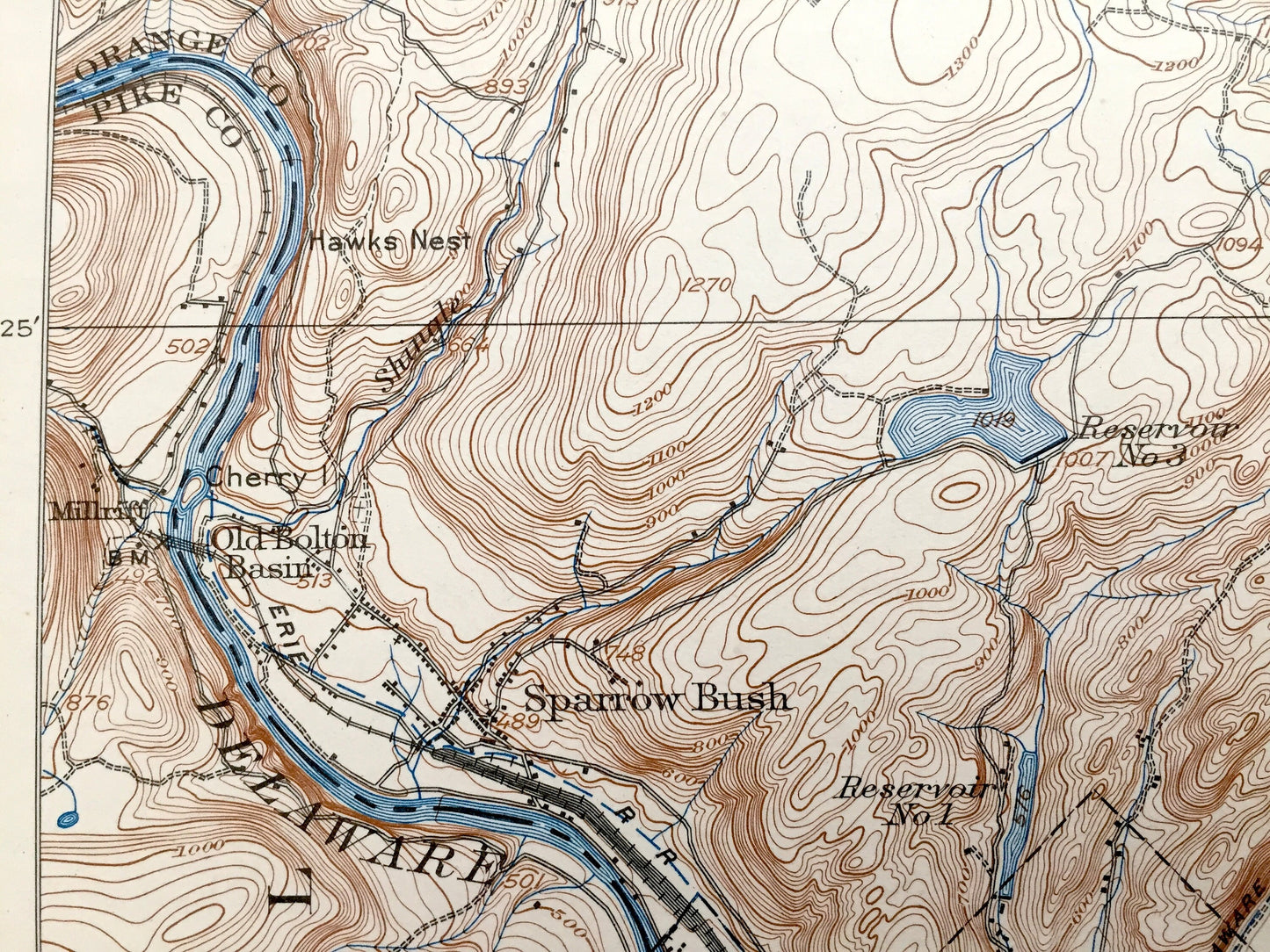
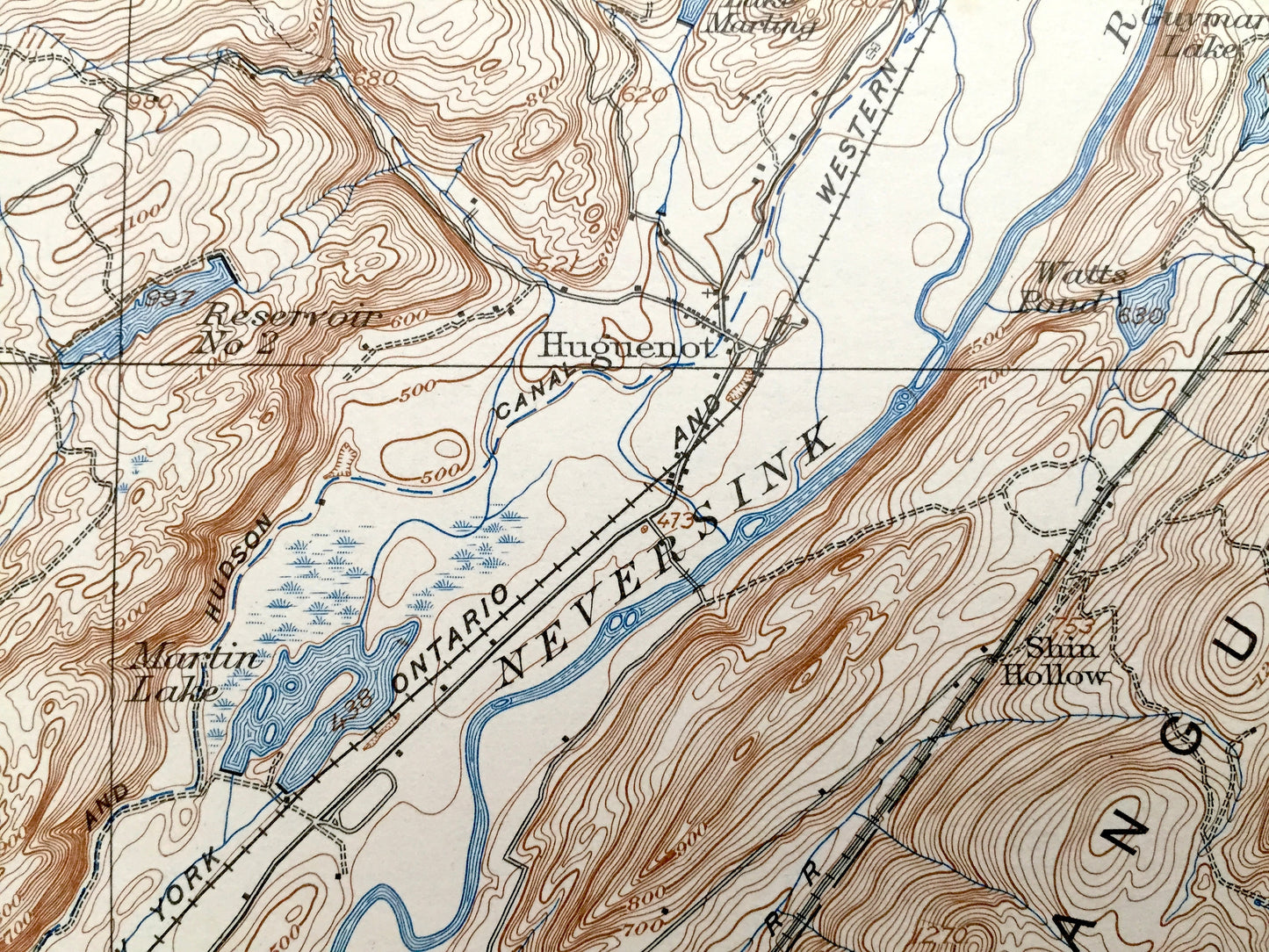
See what the Tri-State area looked like more than 110 years ago. Lots of intricate details and geological contours. Map even has little squares for every house that existed at the time. The USGS cartographers were very thorough back then! On the back is a description of topographic symbols and map guide.
Perfect for the historian, map-lover, the curious or just as a conversation starter. Wonderful and rare. Vintage maps such as these make great gifts.
Edition of 1908, printed 1944
Dimensions: 16 1/2" width x 20" height
----
Features
Cities & Towns: NEW YORK: Port Jervis, Forestburg, Deer Park, Mount Hope, Greenville, Wawayanda, Minisink, Warwick, Quarry Hill, Paradise, Cahoonzie, Rio, Cuddebackville, Roses Point, Godeffroy, Guymard, Huguenot, Prospect Hill, Otisville, Port Orange, Finchville, Sparrow Bush, Germantown, Tristate, Logtown, Millsburg, Johnson, Westtown, Unionville.
NEW JERSEY: Montague, Wantage, Vernon, Duttonville, Colesville, Mt Salem, Rockport, Van Sickle, Milton, Owen.
PENNSYLVANIA: Westfall, Matamoras, Millrift.
Points of Interest: Sullivan County, Orange County, Pike County, Sussex County, Delaware River, Neversink River, Shawangunk Mountains, Tri-State Rock, Kittatinny Mountain, Sand Pond, Mashipacong Pond, Shawagunk Lake, Wallkill River, High Point, New York Ontario & Western Railroad and many more hills, mountains, streams, ponds, houses, schools and roads.
Condition: Very Good Vintage condition, commensurate with age. This map is in great shape for being more than 75 years old. Has light edge-wear and pencil mark in margin corner, but this will all add to vintage character when framed.
----
We will happily adjust shipping price for multiple purchases. Maps are rolled up and shipped in sturdy mailing tubes, never folded.
Couldn't load pickup availability
Share