My Store
Antique Portland, Maine 1916 US Geological Survey Topographic Map – Scarborough, Westbrook, Falmouth, Old Orchard, Saco, Cape Elizabeth, ME
Antique Portland, Maine 1916 US Geological Survey Topographic Map – Scarborough, Westbrook, Falmouth, Old Orchard, Saco, Cape Elizabeth, ME
Beautiful, antique map of Portland, Maine and surrounding Cumberland County area. This is an authentic 1916 edition, 1923 print from the U.S. Geological Survey and NOT a computer reproduction.
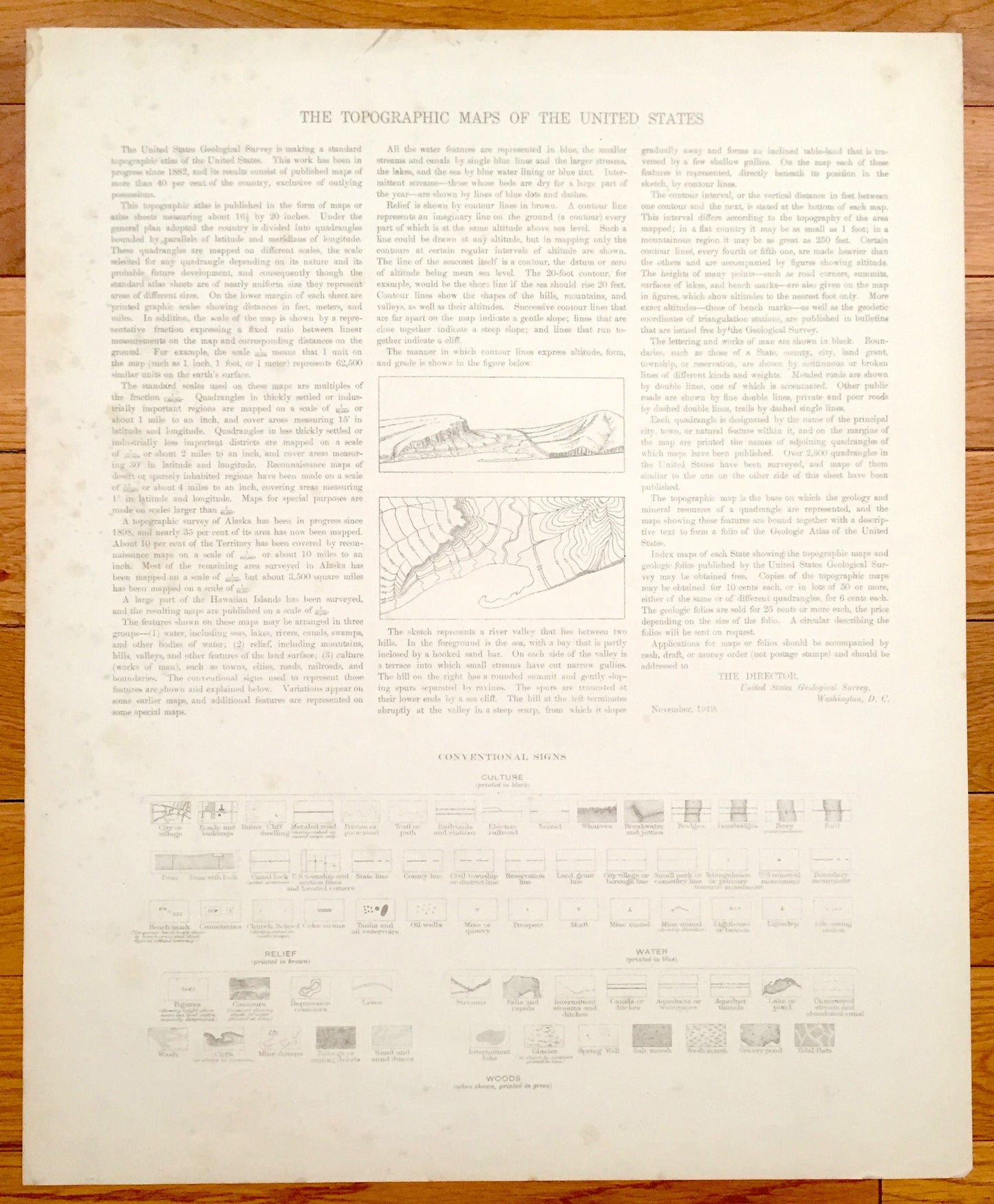
See what Portland, Scarborough, Westbrook and Falmouth looked like over 100 year ago. Lots of intricate details and geological contours. Map even has little squares for every house that existed at the time. The USGS cartographers were very thorough back then! On the back is a description of topographic symbols and map guide.
Perfect for the historian, map-lover, the curious or just as a conversation starter. Wonderful and rare. Maps such as these make great gifts.
Edition of 1916, printed 1923
Dimensions: 16 1/2" width x 20" height
----
Features
Cities & Towns: Windham, Falmouth, Portland, Westbrook, Scarborough, Saco, Old Orchard, South Portland, Prides Corner, Pleasant Hill, North Deering, Deering Junction, Lunts Corner, East Deering, Deering, Sagamore Village, Nasons Corner, Rosemont, Highlands, Woodfords, Woodfords Corner, Oakdale, West End, Stroudwater, Cumberland Mills, South Portland Gardens, Crocketts Corner, Pleasantdale, Knightville, Ligonia, Thornton Heights, Riverton.
Points of Interest: Cumberland County, Back Cove, Fore River, Presumpscot River, Stroudwater River, Long Creek, Portland International Jetport, Riverside Golf Course, Piscataqua River, Rocky Hill, Lorenzen Hill, Highland Lake, Portland Harbor, Running Hill, Maine Central Railroad Graves Hill, Canadian National Railroad and lots more hills, creeks, towns, schools, churches, cemeteries, roads and train tracks.
Condition: Good Vintage condition, commensurate with age. This map is in great shape for being about 100 years old. Has some edge-wear and margin spots, as can be seen in the photos, but this will all read as vintage character when framed.
----
We will happily adjust shipping price for multiple purchases. Maps are rolled up and shipped in sturdy mailing tubes, never folded.
Couldn't load pickup availability
Share