My Store
Antique Portland, Oregon 1905 US Geological Survey Topographic Map – Vancouver, Woodlawn, Mt. Tabor, Columbia River, Willamette River, OR WA
Antique Portland, Oregon 1905 US Geological Survey Topographic Map – Vancouver, Woodlawn, Mt. Tabor, Columbia River, Willamette River, OR WA
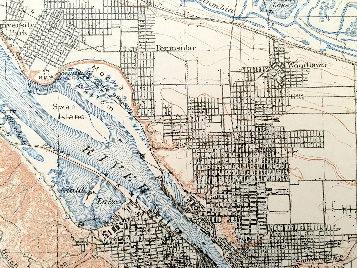
Beautiful, antique map of Portland, Oregon and Columbia River area between Oregon and Washington State. This is an authentic 1905 edition, 1911 print from the U.S. Geological Survey and NOT a computer reproduction.
See what Multnomah County, Oregon & Clarke County, Washington looked like more than 115 years ago. Lots of intricate details and geological contours. Map even has little squares for every house that existed at the time. The USGS cartographers were very thorough back then! On the back is a description of topographic symbols and map guide.
Perfect for the historian, map-lover, the curious or just as a conversation starter. Wonderful and rare. Vintage maps such as this make great gifts.
Edition of 1905, printed 1911
Dimensions: 16 1/2" width x 20" height (The atlas binding on the left margin is another inch.)
----
Features
Cities & Towns: OREGON: St. John, University Park, Penninsular, Woodlawn, Mt. Tabor, Palestine, Montavilla, Russellville, Clarnie, Killgaver, Portland, Woodlawn.
WASHINGTON: Vancouver, Knapp Landing, Felida, Sara, Barberton, Brush Prairie, Vancouver Barracks, Orchards, Fishers.
Points of Interest: Clarke County, Multnomah County, Columbia River, Willamette River, Vancouver Lake, Hayden Island, Swan Island, Rocky Butte, Mt. Tabor, Oregon Slough, Columbia Slough, Government Island, Cougar Canyon, Mill Creek, Shillapoo Lake, Willamette Meridian, Willamette Base Line, Lemmon Island, Guild Lake, Sullivan Gulch, Balch Canyon, Northern Pacific Railroad and many more train tracks, mountains, creeks and rivers.
Condition: Good Vintage condition, commensurate with age. This map is in great shape for being over 110 years old. Has light wear, toning, foxing, edge-wear, as well as pencil in lower right margin, but these will read as vintage character when framed. Canvas binding at left margin has been left on map, for discretion of buyer to keep or remove.
----
We will happily adjust shipping price for multiple purchases. Maps are rolled up and shipped in sturdy mailing tubes, never folded.
Couldn't load pickup availability
Share