My Store
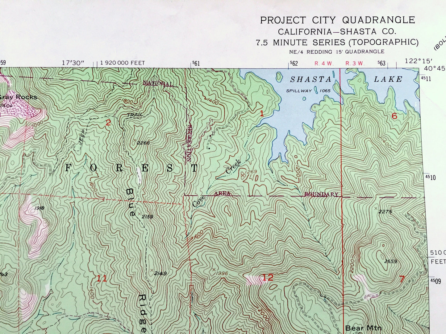
Antique Project City, California 1957 US Geological Survey Topographic Map – Shasta County, Central Valley, Whiskeytown Trinity National, CA
Antique Project City, California 1957 US Geological Survey Topographic Map – Shasta County, Central Valley, Whiskeytown Trinity National, CA
Beautiful, antique map of Project City, California and surrounding Shasta County area. This is an authentic 1957 edition, 1970 print from the U.S. Geological Survey and NOT a computer reproduction.
See what California looked like more than 65 years ago. Lots of intricate details and geological contours. Map even has little squares for every city block that existed at the time. The USGS cartographers were very thorough back then!
Perfect for the historian, map-lover, the curious or just as a conversation starter. Wonderful and rare. Vintage maps such as these make great gifts.
Edition of 1957, printed 1970
Dimensions: 22" width x 27" height
----
Features
Cities & Towns: Project City, Central Valley, Portal Inn, Tunnel Inn, Mountain Gate, Pine Grove.
Points of Interest: Shasta County, Shasta National Forest, Whiskeytown Shasty Trinity Recreation Area, Shasta Lake, Saddle Back, Bass Mountain, Blue Ridge, Bear Mountain, Miller Buttes, Stillwater Creek, Fish Mountain, Shasta College, Churn Creek, and many more hills, mountains, canyons, towns and roads.
Condition: Very Good vintage condition, commensurate with age. This map is in great shape for being over 50 years old. Has light wear and pen mark in lower right corner, which will add to vintage character when framed.
----
We will happily adjust shipping price for multiple purchases. Maps are rolled up and shipped in sturdy mailing tubes, never folded.
Couldn't load pickup availability
Share