My Store
Antique Prospect Peak, California 1957 US Geological Survey Topographic Map – Shasta, Lassen County, Caribou, Sugarloaf, National Park, CA
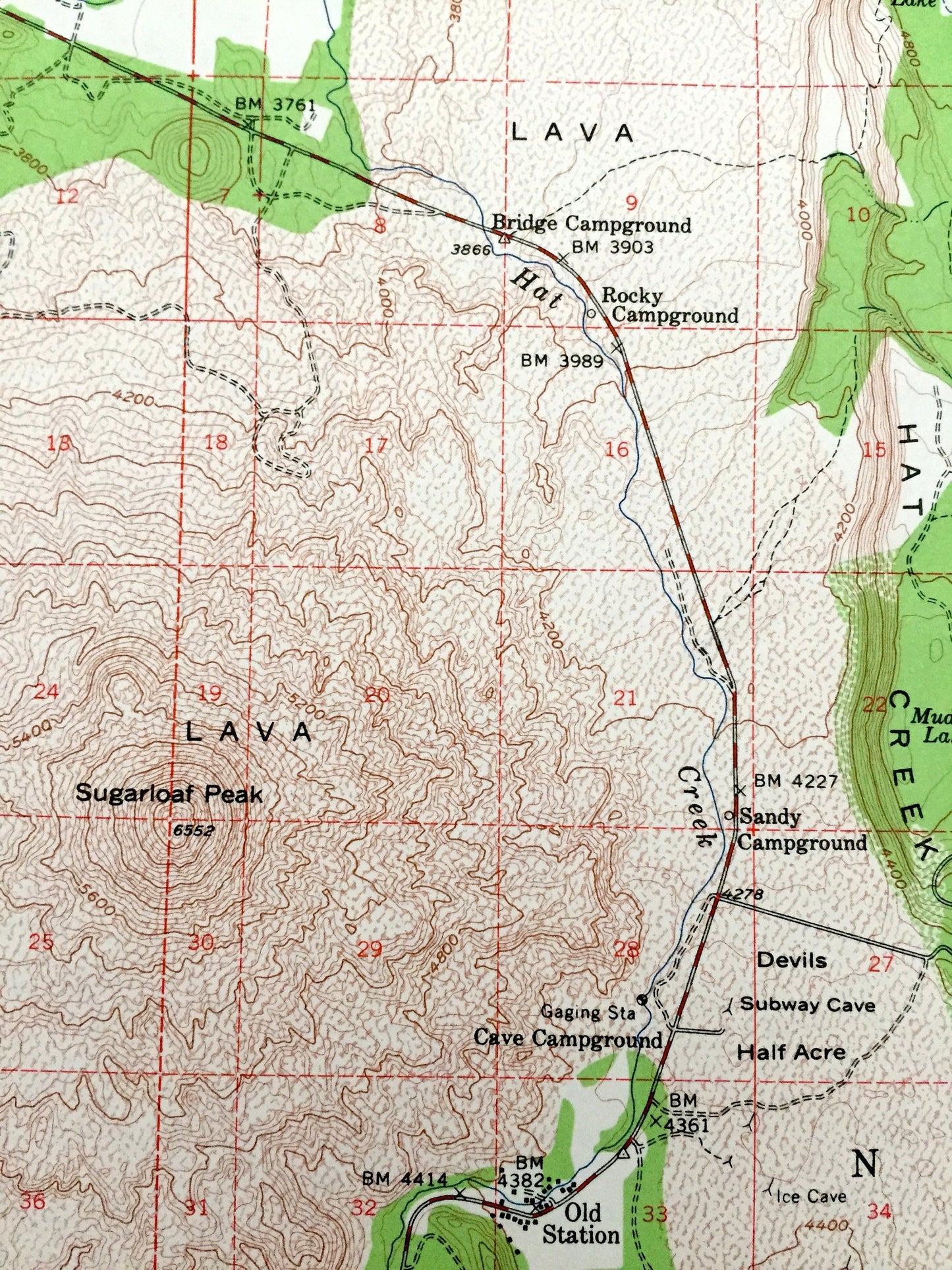
Antique Prospect Peak, California 1957 US Geological Survey Topographic Map – Shasta, Lassen County, Caribou, Sugarloaf, National Park, CA
Beautiful, antique map of Prospect Peak, California and surrounding Shasta & Lassen County area of Lassen National Forest. This is an authentic 1957 edition, 1961 print from the U.S. Geological Survey and NOT a computer reproduction.
See what California looked like over 65 years ago. Lots of intricate details and geological contours. Map even has little squares for every house that existed at the time. The USGS cartographers were very thorough back then!
Perfect for the historian, map-lover, the curious or just as a conversation starter. Wonderful and rare. Vintage maps such as these make great gifts.
Edition of 1957, printed 1961
Dimensions: 17" width x 21" height
----
Features
Cities & Towns: Old Station, Smoky Cabin, Mountain Home.
Points of Interest: Shasta County, Lassen County, Lassen National Forest, Lassen Volcanic National Park, Prospect Peak, Sugarloaf Peak, Badger Mountain, Potato Butte, Little Potato Butte, Snug Lake, Butte Lake, Halls Flat, Butte Creek Rim, Hat Mountain, Cluster Lakes, Fantasic Lava Beds, Painted Dunes, Cinger Cone, Caribou Peak Wild Area, Hat Creek, and lots more hills, mountains, canyons, creeks, houses, roads, ranches and camps.
Condition: Very Good Vintage condition, commensurate with age. This map is in great shape for being over 60 years old.
----
We will happily adjust shipping price for multiple purchases. Maps are rolled up and shipped in sturdy mailing tubes, never folded.
Couldn't load pickup availability
Share