My Store
Antique Quantico, Virginia & Maryland 1952 US Geological Survey Topographic Map – Prince William County Cherry Hill Melrose Gardens VA
Antique Quantico, Virginia & Maryland 1952 US Geological Survey Topographic Map – Prince William County Cherry Hill Melrose Gardens VA
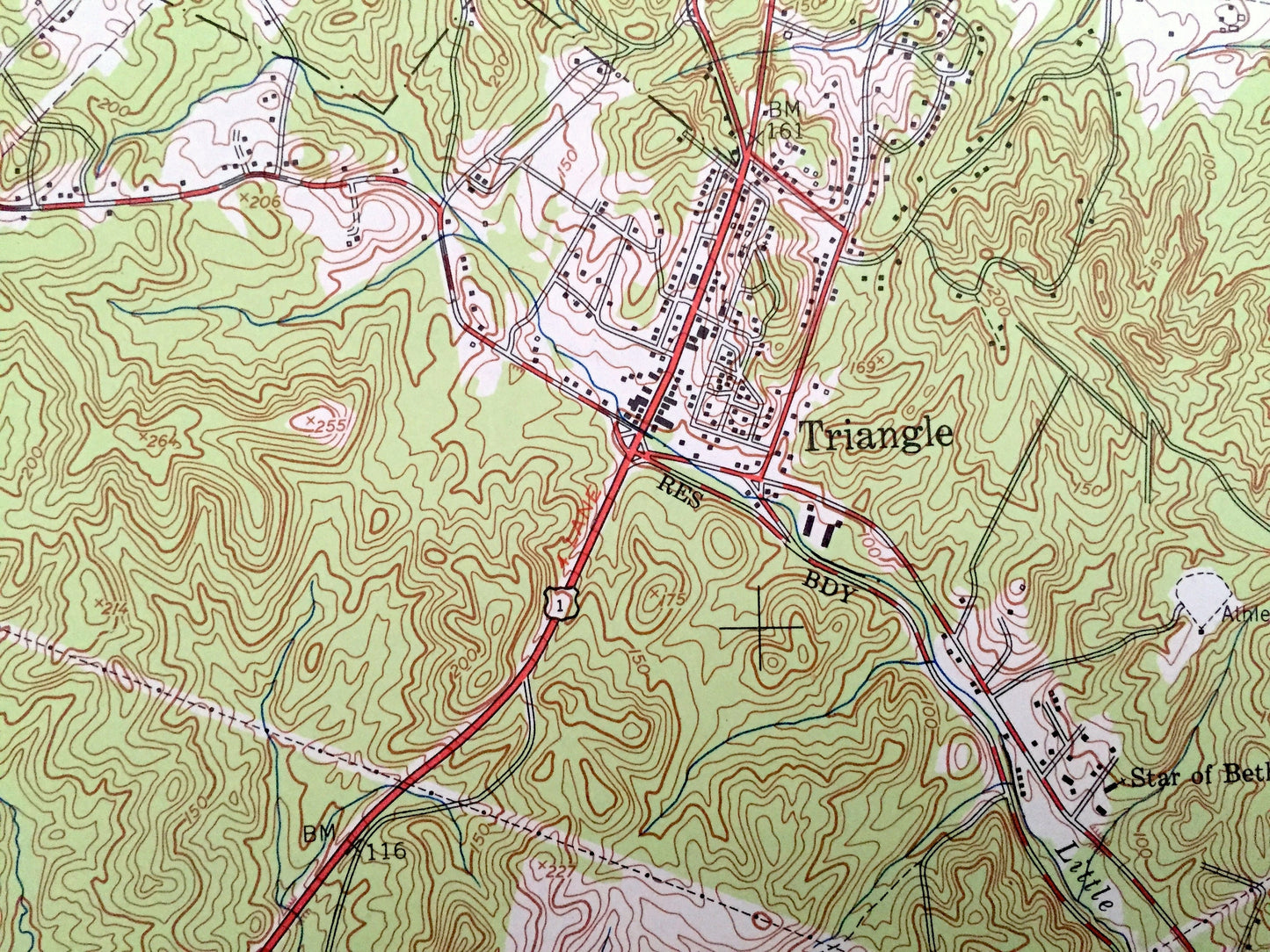
Beautiful, antique map of historic Quantico, Virginia and surrounding Prince William, Stafford, and Charles County area. This is an authentic 1952 print from the U.S. Geological Survey and NOT a computer reproduction.
See what Quantico and the Potomac looked like almost 70 years ago. Lots of intricate details and geological contours. Map even has little squares for every house that existed at the time. The USGS cartographers were very thorough back then!
Perfect for the historian, map-lover, the curious or just as a conversation starter. Wonderful and rare. Maps such as these make great gifts.
Edition of 1952, printed 1952
Dimensions: 17" width x 21" height
----
Features
Cities & Towns: Quantico, Boswells Store, Post Chapel, Chamberlain Village, Thomason Village, Triangle, Melrose Gardens, Dumfries, Forest Park, Prince William, Neabsco, Cherry Hill.
Points of Interest: Potomac River, Quantico Creek, Chopawamsic Creek, Quantico Marine Base, Goose Bay, Moss Point, Richmond Fredericksburg and Potomac Railroad, Possum Point, Powells Creek, Neabsco Creek, and lots more streams, marshes, houses, roads and railroads.
Condition: Very Good condition, commensurate with age. This map is in incredible shape for being almost 70 years old.
----
We will happily adjust shipping price for multiple purchases. Maps are rolled up and shipped in sturdy mailing tubes, never folded.
Couldn't load pickup availability
Share