My Store
Antique Quebec, Canada 1962 US Geological Survey Topographic Map – Charlesbough, Orsainville, Giffard, Beauport, Victoriaville, Loretteville
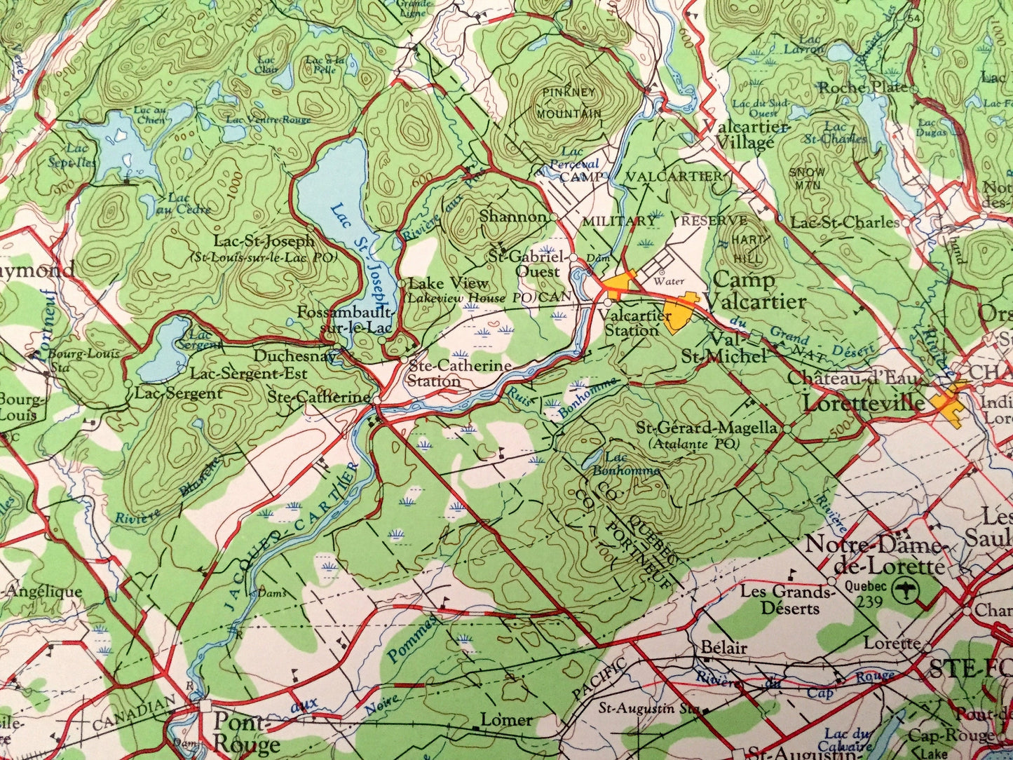
Antique Quebec, Canada 1962 US Geological Survey Topographic Map – Charlesbough, Orsainville, Giffard, Beauport, Victoriaville, Loretteville
Beautiful, antique map of Quebec, Canada and surrounding Maine areas. This is a 1962 edition, 1966 print from the U.S. Geological Survey and NOT a computer reproduction.
See what Quebec, Canada and Maine looked like over 60 years ago. Lots of intricate details and geological contours. Map even has little squares for every house that existed at the time. The USGS cartographers were very thorough back then!
Perfect for the historian, map-lover, the curious or just as a conversation starter. Wonderful and rare. Vintage maps such as these make great gifts.
Edition of 1962, printed 1966
Dimensions: 29" width x 22" height
----
Features
Cities & Towns: Quebec, Ste Foy, Notre Dame de Lorette, Camp Valcartier, St. Raymond, Princeville, Plessisville, Bernierville, Arthabaska, Black Lake, St. George, Ste Marie, Leeds Village, Thetford Mines, Charlesbough, Orsainville, Giffard, Beauport, Victoriaville, Loretteville.
Points of Interest: St. Lawrence River, Ile D'Orleans, Riviere De La Chaudiere, Chenal de L'Ile D'Orleans, and lots more hills, mountains, lakes, rivers, creeks, roads, highways and railroads.
Condition: Good Vintage condition, commensurate with age. This map is in great shape for being over 55 years old. Has some edge-wear but this will all add to vintage character when framed.
----
We will happily adjust shipping price for multiple purchases. Maps are rolled up and shipped in sturdy mailing tubes, never folded.
Couldn't load pickup availability
Share