My Store
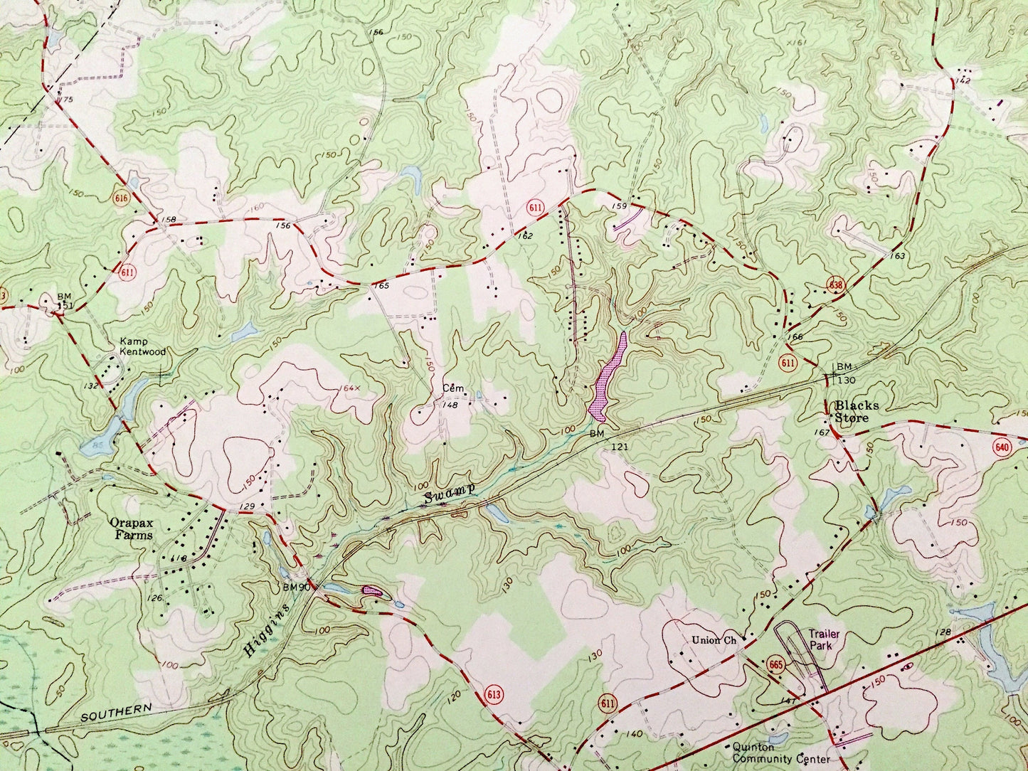
Antique Quinton, Virginia 1965 US Geological Survey Topographic Map – Hanover, New Kent, Henrico County, Orapax Farms, Bottoms Bridge, VA
Antique Quinton, Virginia 1965 US Geological Survey Topographic Map – Hanover, New Kent, Henrico County, Orapax Farms, Bottoms Bridge, VA
Beautiful, antique map of Quinton, Virginia and surrounding Hanover, New Kent & Henrico County area. This is an authentic 1965 edition, 1987 print from the U.S. Geological Survey and NOT a computer reproduction.
See what Virginia looked like over 55 years ago. Lots of intricate details and geological contours. Map even has little squares for every house that existed at the time. The USGS cartographers were very thorough back then!
Perfect for the historian, map-lover, the curious or just as a conversation starter. Wonderful and rare. Vintage maps such as these make great gifts.
Edition of 1965, printed 1987
Dimensions: 22" width x 27" height
----
Features
Cities & Towns: Quinton, Woodlawn, Liggins Corner, Alexanders Corner, Holts Corner, Hampstead, Westwood, Orapax Farms, Blacks Store, Bradley Acres, Meadow, Currituck Farms, Bottoms Bridge, Woodhaven Shores.
Points of Interest: Hanover County, New Kent County, Henrico County, Cattail Swamp Pond, Parsleys Millpond, Parsleys Creek, Flanagans Millpond, New Kent County Airport, Crumps Swamp, Chickahominy River, Black Creek and many more hills, streams, ponds, houses, schools, churches and roads.
Condition: Very Good Vintage condition, commensurate with age. This map is in great shape for being over 35 years old. Has light wear but this will add to vintage character when framed.
----
We will happily adjust shipping price for multiple purchases. Maps are rolled up and shipped in sturdy mailing tubes, never folded.
Couldn't load pickup availability
Share