My Store
Antique Racine, Wisconsin 1958 US Geological Survey Topographic Map – Milwaukee, Kenosha, Carrollville, Greendale, Lake Michigan, Chicago IL
Antique Racine, Wisconsin 1958 US Geological Survey Topographic Map – Milwaukee, Kenosha, Carrollville, Greendale, Lake Michigan, Chicago IL
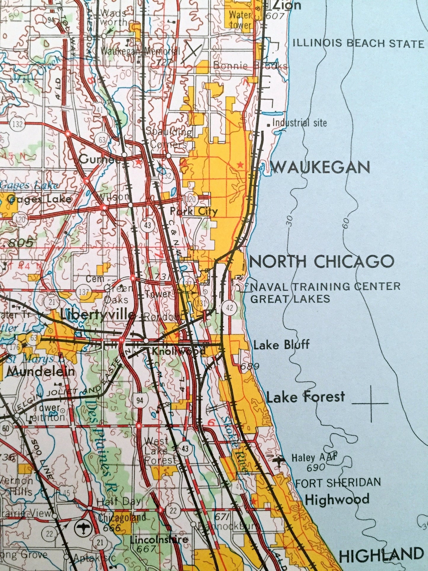
Beautiful, antique map of Racine, Wisconsin and surrounding Michigan and Illinois areas, including Chicago. This is an authentic 1958 edition, 1971 print from the U.S. Geological Survey and NOT a computer reproduction.
See what Wisconsin, Michigan and Illinois looked like over 60 years ago. Lots of intricate details and geological contours. Map is incredibly large and in the grand 1:250,000 scale. The USGS cartographers were very thorough back then!
Perfect for the historian, map-lover, the curious or just as a conversation starter. Wonderful and rare. Vintage maps such as these make great gifts.
Edition of 1958, printed 1971
Dimensions: 29" width x 22" height
----
Features
Cities & Towns: WISCONSIN - Racine, Saint Francis, South Milwaukee, Sturtevant, North Bay, Oakwood, Milwaukee, Kenosha, Carrollville, Greendale, Cudahy.
MICHIGAN - Saint Joseph, Fairplain, Benton Harbor, Benton Heights, Watervliet, Paw Paw Lake, Hartford, Bangor, South Haven, Holland, Zeeland, Virginia Park, Beechwood.
ILLINOIS - Chicago, Park Ridge, Des Plaines, Glenview, Skokie, Evanston, Lincolnwood, Arlington Heights, Prospect Heights, Wilmette, Kenilworth, Glencoe, Highland Park, Deerfield, Highwood, Lake Forest, North Chicago, Waukegan, Zion, Winthrop Harbor, Libertyville.
Points of Interest: WISCONSIN - Lake Michigan, Des Plaines River, Kinnickinnic River, Root River and lots more hills, mountains, lakes, rivers, creeks, roads, highways and railroads.
MICHIGAN - Lake Michigan, Lake Macatawa, Paw Paw Lake, Merriman Lake, Allegan State Forest, St. Joesph River, Pigeon River, Thunder Mountain, Mann Creek, Cedar Creek and lots more hills, mountains, lakes, rivers, creeks, roads, highways and railroads.
ILLINOIS - Lake Michigan, Des Plaines River, Illinois Beach State Park, Fort Sheridan, Wilmette Harbor, Busse Forest Preserve, Gages Lake, Mill Creek and lots more hills, mountains, lakes, rivers, creeks, roads, highways and railroads.
Condition: Good Vintage condition, commensurate with age. This map is in great shape for being 50 years old. Has some light edge-wear and old fold lines as issued, but these will flatten easily and all of which will read as vintage character when framed.
----
We will happily adjust shipping price for multiple purchases. Maps are rolled up and shipped in sturdy mailing tubes, never folded.
Couldn't load pickup availability
Share