My Store
Antique Reading, Massachusetts 1951 US Geological Survey Topographic Map – Lynnfield, Middleton, Andover, Peabody Wakefield Saugus Woburn MA
Antique Reading, Massachusetts 1951 US Geological Survey Topographic Map – Lynnfield, Middleton, Andover, Peabody Wakefield Saugus Woburn MA
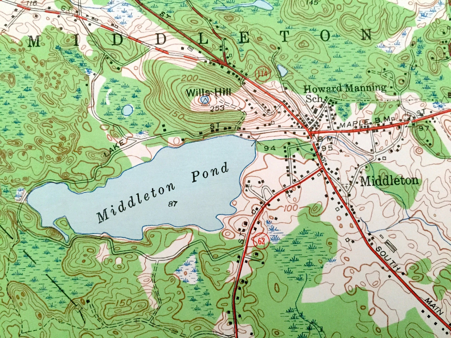
Beautiful, antique map of Reading, Massachusetts area, including Reading, Lynnfield, Peabody, Wakefield and Andover. This is an authentic 1951 print from the U.S. Geological Survey and NOT a computer reproduction.
See what Middlesex & Essex County looked like 70 years ago. Lots of intricate details and geological contours. Map even has little squares for every house that existed at the time. The USGS cartographers were very thorough back then!
Perfect for the historian, map-lover, the curious or just as a conversation starter. Wonderful and rare. Vintage maps such as these make great gifts.
Edition of 1951, printed 1951
Dimensions: 22" width x 27" height
----
Features
Cities & Towns: Andover, North Andover, North Reading, Middleton, Reading, Lynnfield, Peabody, Wakefield, Saugus, Lynn, Howe, West Village, Lynnfield Center, South Lynnfield, Woburn.
Points of Interest: Cedar Swamp, Middleton Pond, Lake Quannapowitt, Pilling Pond, Swan Pond, Military Police Camp, Uptons Hill, Wills Brook, Hawkes Pond, Mill Meadown, Ipswich River, Devils Dishfull Pond, Waldens Hill, Martins Pond, Ponde One, Salem Pond, Lynn Woods, and lots more, hills, brooks, ponds, marshes, roads and train tracks.
Condition: Good Vintage condition, commensurate with age. This map is in incredible shape for being 70 years old. Map has punch holes but these are easily concealed with framing or placing a similar-colored paper behind the map, as can be seen in the photos.
----
We will happily adjust shipping price for multiple purchases. Maps are rolled up and shipped in sturdy mailing tubes, never folded.
Couldn't load pickup availability
Share