My Store
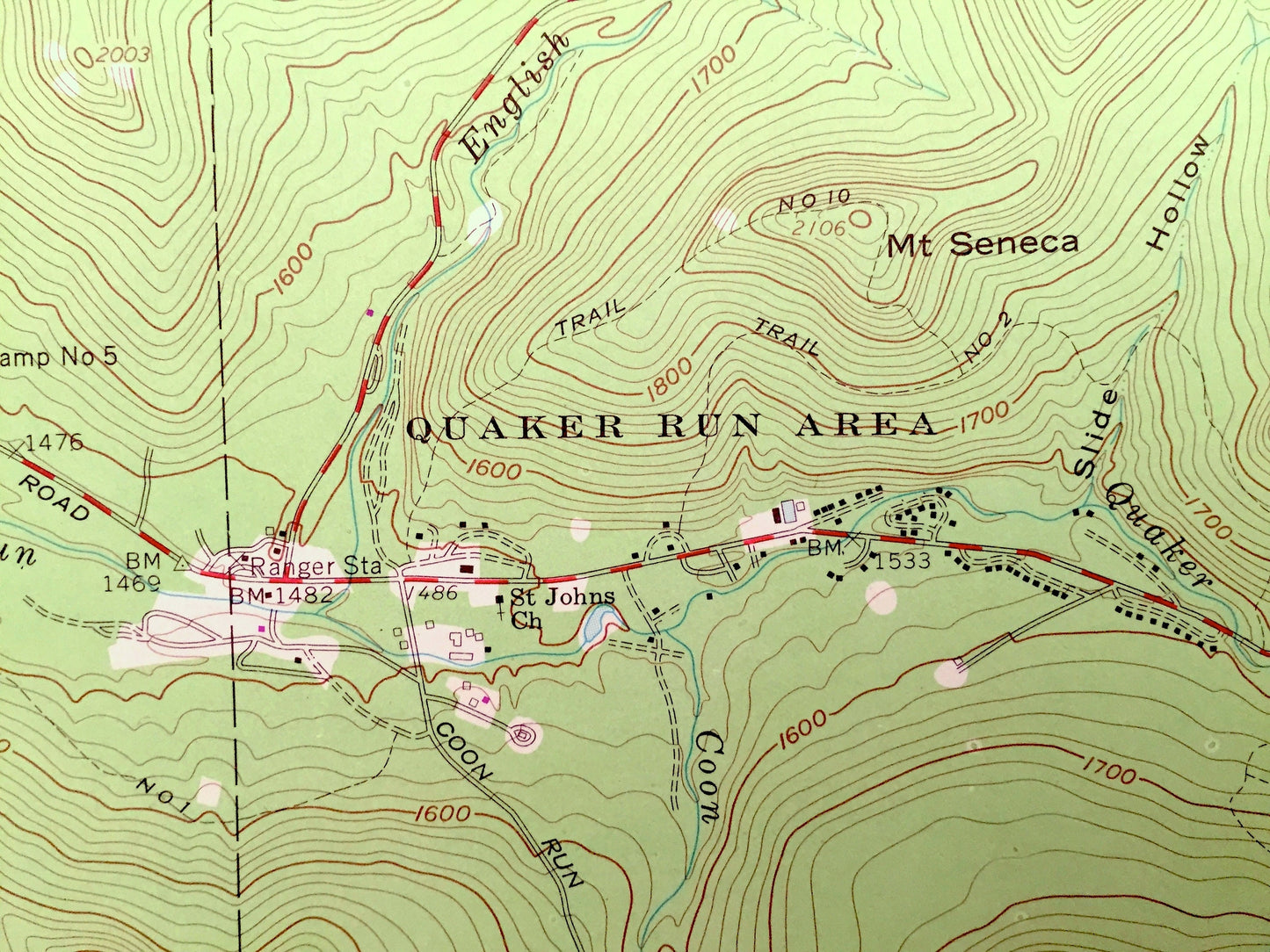
Antique Red House, New York 1962 US Geological Survey Topographic Map – Cattaraugus County, Cold Spring, Elko Allegany Indian Reservation NY
Antique Red House, New York 1962 US Geological Survey Topographic Map – Cattaraugus County, Cold Spring, Elko Allegany Indian Reservation NY
Beautiful, antique map of Red House, New York and surrounding Cattaraugus County area. This is an authentic edition of 1962 edition, 1980 print from the U.S. Geological Survey and NOT a computer reproduction.
See what New York looked like almost 60 years ago. Lots of intricate details and geological contours. Map even has little squares for every house that existed at the time. The USGS cartographers were very thorough back then!
Perfect for the historian, map-lover, the curious or just as a conversation starter. Wonderful and rare. Vintage maps such as these make great gifts.
Edition of 1962, printed 1980
Dimensions: 22" width x 27" height
----
Features
Cities & Towns: Red House, Cold Spring, Elko, Allegany Indian Reservation.
Points of Interest: Allegany State Park, Allegheny River, Quaker Lake, Quaker Run Area, Mount Tuscarora, Red House Brook, Mount Oneida, Allegheny Reservoir, Mount Onondaga, Mount Seneca, Mount Cayuga, Mount Mohawk, and many more roads, houses, reservoirs, ponds, and hills.
Condition: Very Good condition, commensurate with age. This map is in incredible shape for being almost 40 years old.
----
We will happily adjust shipping price for multiple purchases. Maps are rolled up and shipped in sturdy mailing tubes, never folded.
Couldn't load pickup availability
Share