My Store
Antique Redondo Beach, California 1963 US Geological Survey Topographic Map – Los Angeles County, San Pedro, Torrance, Hermosa, Clifton, CA
Antique Redondo Beach, California 1963 US Geological Survey Topographic Map – Los Angeles County, San Pedro, Torrance, Hermosa, Clifton, CA
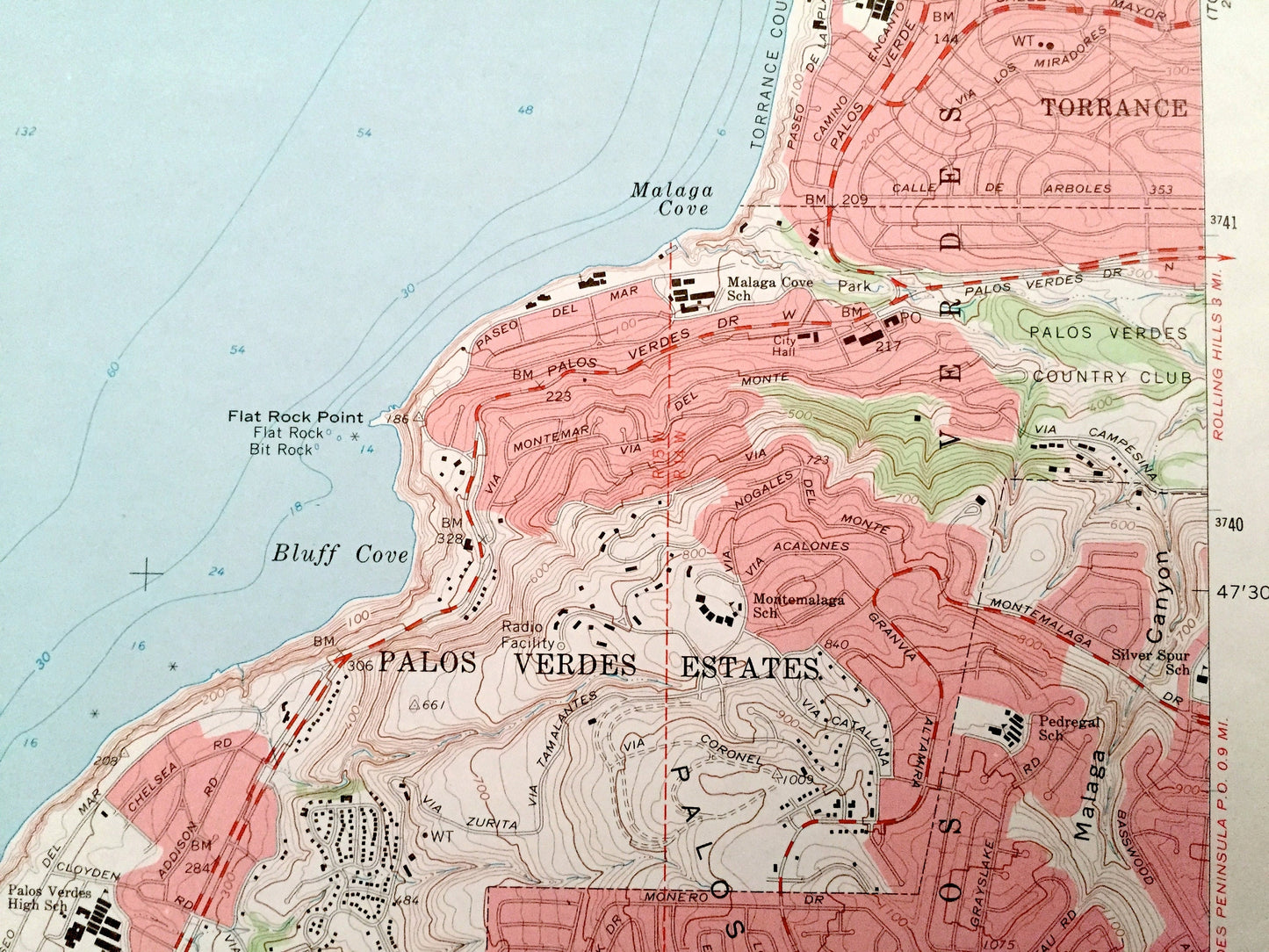
Beautiful, antique map of Redondo Beach, California and surrounding Los Angeles County area. This is an authentic 1963 edition, 1965 print from the U.S. Geological Survey and NOT a computer reproduction.
See what California looked like 60 years ago. Lots of intricate details and geological contours. Map even has little squares for every house that existed at the time. The USGS cartographers were very thorough back then!
Perfect for the historian, map-lover, the curious or just as a conversation starter. Wonderful and rare. Vintage maps such as these make great gifts.
Edition of 1963, printed 1965
Dimensions: 22" width x 30" height
----
Features
Cities & Towns: Redondo Beach, Manhattan Beach, Sausal Redondo, Hermosa Beach, San Pedro, Clifton, Hollywood Riviera, Torrance, Palos Verdes, Palos Verdes Estates, Rolling Hills Estates.
Points of Interest: Los Angeles County, Pacific Ocean, Redondo Canyon, Santa Monica Bay, Redondo Beach State Park, Torrance County Beach, Malaga Canyon, Palos Verdes Hills, Lundada Bay, Abalone Cove, Agua Amarga Canyon, and many more hills, streams, ponds, houses, schools, churches and roads.
Condition: Very Good Vintage condition, commensurate with age. This map is in great shape for being over 55 years old. Has light wear and ex-libris stamp in margin, but this will all add to vintage character when framed.
----
We will happily adjust shipping price for multiple purchases. Maps are rolled up and shipped in sturdy mailing tubes, never folded.
Couldn't load pickup availability
Share