My Store
Antique Rhodesdale, Maryland 1988 US Geological Survey Topographic Map – Dorchester County, Hurlock, Eldorado, Brookview, Nanticoke RIver MD
Antique Rhodesdale, Maryland 1988 US Geological Survey Topographic Map – Dorchester County, Hurlock, Eldorado, Brookview, Nanticoke RIver MD
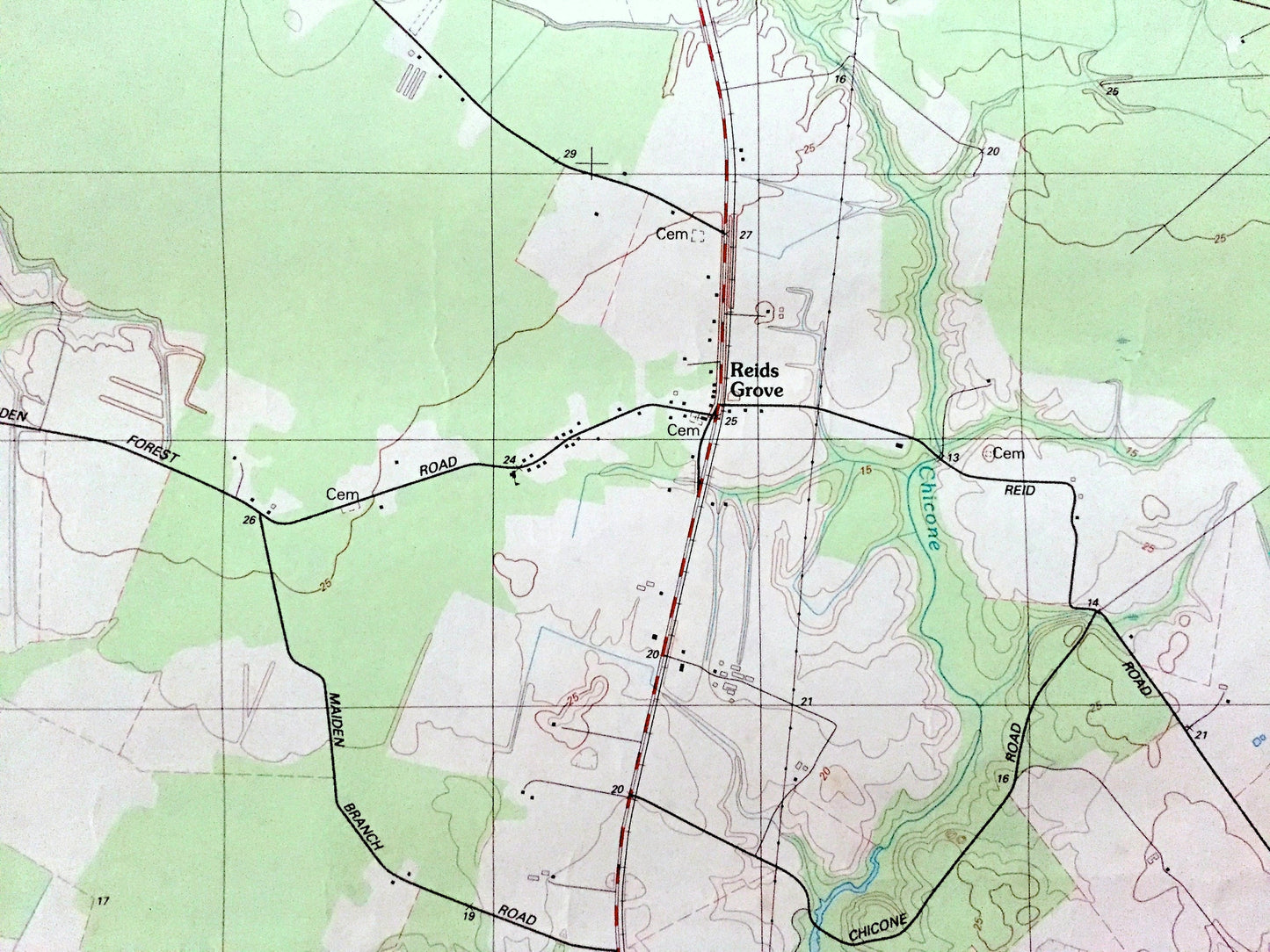
Beautiful, antique map of Rhodesdale, Maryland and surrounding Dorchester County area. This is an authentic 1988 print from the U.S. Geological Survey and NOT a computer reproduction.
See what Maryland looked like over 30 years ago. Lots of intricate details and geological contours. Map even has little squares for every house that existed at the time. The USGS cartographers were very thorough back then!
Perfect for the historian, map-lover, the curious or just as a conversation starter. Wonderful and rare. Vintage maps such as these make great gifts.
Edition of 1988, printed 1988
Dimensions: 22" width x 27" height
----
Features
Cities & Towns: Rhodesdale, Hurlock, Petersburg, Eldorado, Brookview, Reids Grove, Walnut Landing, RIverton, Ralph.
Points of Interest: Dorchester County, Wicomico County, Nanticoke River, Marshyhope Creek, Camp Nanticoke (Henson Scout Reservation), Nanticoke Wildlife Refuge and many more hills, creeks, ponds, houses, schools, railroads, churches and roads.
Condition: Good Vintage condition, commensurate with age. This map is in great shape for being over 30 years old. Has some edge-wear, spotting and toning, but this will all add to vintage character when framed.
----
We will happily adjust shipping price for multiple purchases. Maps are rolled up and shipped in sturdy mailing tubes, never folded.
Couldn't load pickup availability
Share