My Store
Antique Rio Vista, California 1910 US Geological Survey Topographic Map – Brannan Island, Los Ulpinos, Yolo Basin, Ida Ryer Island, CA
Antique Rio Vista, California 1910 US Geological Survey Topographic Map – Brannan Island, Los Ulpinos, Yolo Basin, Ida Ryer Island, CA
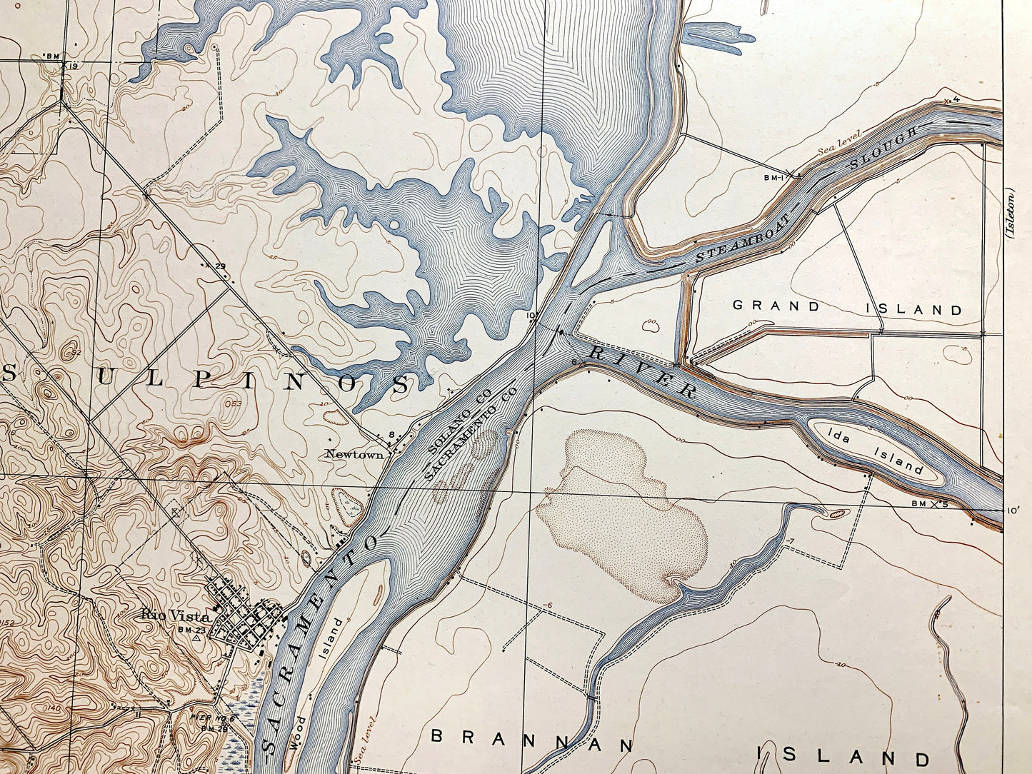
Beautiful, antique map of Rio Vista, California and surrounding Solano, and Sacramento County area on the Sacramento River. This is an authentic 1910 edition, 1936 print from the U.S. Geological Survey and NOT a computer reproduction.
See what California looked like over 110 years ago. Lots of intricate details and geological contours. Map even has little squares for every house that existed at the time. The USGS cartographers were very thorough back then! On the back is a description of topographic symbols and map guide.
Perfect for the historian, map-lover, the curious or just as a conversation starter. Wonderful and rare. Vintage maps such as these make great gifts.
Edition of 1910, printed 1936
Dimensions: 16 1/2" width x 20" height
----
Features
Cities & Towns: Rio Vista, Newtown, Los Ulpinos.
Points of Interest: Solano County, Sacramento County, Sacramento River, Brannan Island, Grand Island, Yolo Basin (no longer existing), Steamboat Slough, Wood Island, Cache Slough, Ryer Island, and lots more mountains, rivers, islands, bays, canyons, small, towns, roads, and train tracks.
Condition: Very Good Vintage condition, commensurate with age. This map is in great shape for being more than 85 years old. Has light wear and pencil in lower margin, but this will add to vintage character when framed.
----
We will happily adjust shipping price for multiple purchases. Maps are rolled up and shipped in sturdy mailing tubes, never folded.
Couldn't load pickup availability
Share