My Store
Antique Roan Mountain, Tennessee 1907 Rock Formation Photographs Illustrations – US Geological Survey – Elizabethton, Johnson City, TN
Antique Roan Mountain, Tennessee 1907 Rock Formation Photographs Illustrations – US Geological Survey – Elizabethton, Johnson City, TN
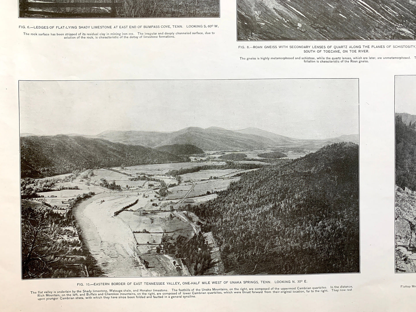
Beautiful, antique set of two plates of photographs of various rock formations of Roan Mountain, Tennessee and surrounding North Carolina and Carter, Mitchell, Yancey, Sullivan, Washington, and Unicoi County area. These are authentic 1907 edition, 1907 prints from the U.S. Geological Survey and are NOT a computer reproductions. They are from a Geologic Atlas folio.
See what Tennessee looked like 110 years ago. Lots of intricate details and geological formations.
Perfect for the historian, map-lover, the curious or just as a conversation starter. Wonderful and rare. Vintage prints such as these make great gifts.
Edition of 1907, printed 1907
Dimensions: 18 1/2" width x 22" height
----
Features
Cities & Towns: Roan Mountain, Elizabethton, Bluff City, Jonesboro, Erwin, Plumtree, Red Hill, Clarrissa, Fish Spring, Highhealth, Housley, Milligan, Watauga, Island Mills, Underwood Springs, Valley, Huntdale, Relief, Fishery, Bakersville.
Points of Interest: Roan Mountain, Watauga River, Iron Mountains, Holston River, Gap Creek Mountain, Pumpkin Patch Mountain, Holston Mountain, Cherokee Mountain, East Tennessee & Western North Carolina Railroad, and lots more hills, mountains, creeks, towns, roads and train tracks.
Condition: Good Vintage condition, commensurate with age. Plates are in great shape for being over 110 years old. Has staple-holes in margin from folio, foxing, toning and edge-wear but this will all add to vintage character when framed.
----
We will happily adjust shipping price for multiple purchases. Maps are rolled up and shipped in sturdy mailing tubes, never folded.
Couldn't load pickup availability
Share