My Store
Antique Roaring Spring, Pennsylvania 1963 US Geological Survey Topographic Map – Blair, Bedford County, Sproul, Claysburg, Friesville, PA
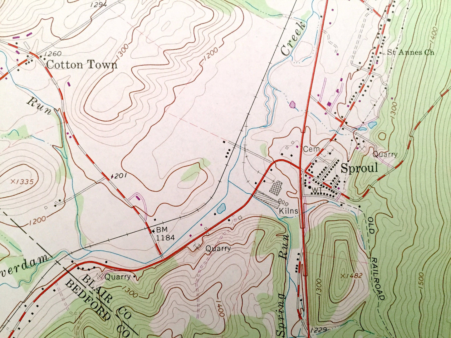
Antique Roaring Spring, Pennsylvania 1963 US Geological Survey Topographic Map – Blair, Bedford County, Sproul, Claysburg, Friesville, PA
Beautiful, antique map of Roaring Spring, Pennsylvania and surrounding Blair and Bedford County area. This is an authentic 1963 edition, 1972 print from the U.S. Geological Survey and NOT a computer reproduction.
See what Pennsylvania looked like over 50 years ago. Lots of intricate details and geological contours. Map even has little squares for every house that existed at the time. The USGS cartographers were very thorough back then!
Perfect for the historian, map-lover, the curious or just as a conversation starter. Wonderful and rare. Vintage maps such as these make great gifts.
Edition of 1963, printed 1972
Dimensions: 22" width x 27" height
----
Features
Cities & Towns: Roaring Spring, Bakers Summit, Bloomfield, Woodbury, Ore Hill, Taylor, McKee, Blair, Vicksburg, Brooks Mills, Leamersville, Smith Corner, Freedom, East Freedom, Claysburg, Friesville, Cotton Town, Sproul, Greenfield, Queen Station, Kimmell.
Points of Interest: Dunning Mountain, State Game Lands, Iron Masters Country Club, Ore Hill Ridge. Penn Central Railroad, Shawnee Park, McKee Gap, Short Mountain, Halter Creek, Frankstown Branch Juniata River, Pawpaw Run, Cabbage Creek, and many more hills, streams, ponds, houses, schools, churches and roads.
Condition: Very Good condition, commensurate with age. This map is in incredible shape for being over 40 years old.
----
We will happily adjust shipping price for multiple purchases. Maps are rolled up and shipped in sturdy mailing tubes, never folded.
Couldn't load pickup availability
Share