My Store
Antique Rockland, Maine 1906 US Geological Survey Topographic Map – Rockport, Camden, Thomaston, Owls Head, Muscle Ridge, St George, Knox ME
Antique Rockland, Maine 1906 US Geological Survey Topographic Map – Rockport, Camden, Thomaston, Owls Head, Muscle Ridge, St George, Knox ME
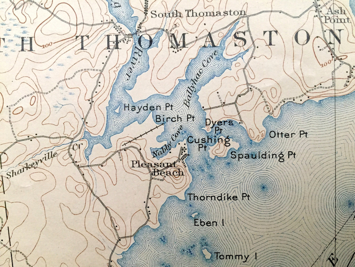
Beautiful, antique map of Rockland, Rockport, Camden, Owl's Head, Thomaston, Maine and surrounding Knox County. This is an authentic 1906 edition, 1918 print from the U.S. Geological Survey and NOT a computer reproduction.
See what the Maine Coast looked like over 110 years ago. Lots of intricate details and geological contours. Map even has little squares for every house that existed at the time. The USGS cartographers were very thorough back then! On the back is a description of topographic symbols and map guide.
Perfect for the historian, map-lover, the curious or just as a conversation starter. Wonderful and rare. Vintage maps such as these make great gifts.
Edition of 1906, printed 1918
Dimensions: 16" width x 20" height
----
Features
Cities & Towns: Hope, Union, Camden, Rockport, Warren, Rockland, Thomaston, Cushing, South Thomaston, Owls Head, Muscle Ridge, St. George, Muscle Ridge, South Hope, East Union, Wattons Mill, Lake City, Melvin Heights, West Rockport, Simonton Corners, Highland, Willis Corners, Rockville, Oakland Park, Blackington Corners, Glen Cove, South Warren, Cushing, Ash Point, Pleasant Beach, Sprucehead, Holiday Beach, Crescent Beach.
Points of Interest: Knox County, Waldo County, Rockland Harbor, Penobscot Bay, St. George River, Muscle Ridge Channel, Rockport Harbor, Alford Lake, Megunticook Lake, Crawford Pond, Grassy Pond, Chickawaukie Pond, Weskeag River, Ballyhae Cove, Mt. Megunticook, Spring Brook, Megunticook River, Hosmer Pond, Sherman Cove, Lilly Pond, Goose River, Beauchamp Point, Indian Island, Porterfield Ledge, Deadman Point, The Graves, Ragged Mountain, Bald Mountain, Oyster River Pond, Beach Hill, The Bod, Keene Brook, Oyster River, Mt. Battux, Dodge Mountain, Bear Hill, Pine Hill, Clam Cove, Jameson Point, Ingraham Hill, pst Hill, Broad Cove, Deep Cove, Owls Head Lighthouse, Monroe Island, Sheep Island, Meadow Brook, Hospital Point, Fisherman Island Passage, Cutters Nubble, Lowell Ledge, Quiggle Brook, Hobbs Pond, Maine Central Railroad and lots more hills, streams, ponds, marshes, houses, islands, coves, roads, railroads.
Condition: "Very Vintage" condition, commensurate with age. This map is in good shape for being over 100 years old. Has some real wear, tape repair, pinholes and pen and ink markings, but this will all read to vintage character when framed. Map has been trimmed in the left bottom corner at some point in its history. This is easily-concealed by placing a similar-colored paper behind the missing area when framing, as seen in the photos.
----
We will happily adjust shipping price for multiple purchases. Maps are rolled up and shipped in sturdy mailing tubes, never folded.
Couldn't load pickup availability
Share