My Store
Antique Rockville, Connecticut 1944 US Geological Survey Topographic Map – Andover, Bolton, Coventry, Tolland, Vernon, Manchester, CT
Antique Rockville, Connecticut 1944 US Geological Survey Topographic Map – Andover, Bolton, Coventry, Tolland, Vernon, Manchester, CT
Beautiful, antique map of Rockville, Connecticut, Tolland County and Hartford County. This is an authentic 1944 print from the U.S. Geological Survey and NOT a computer reproduction.
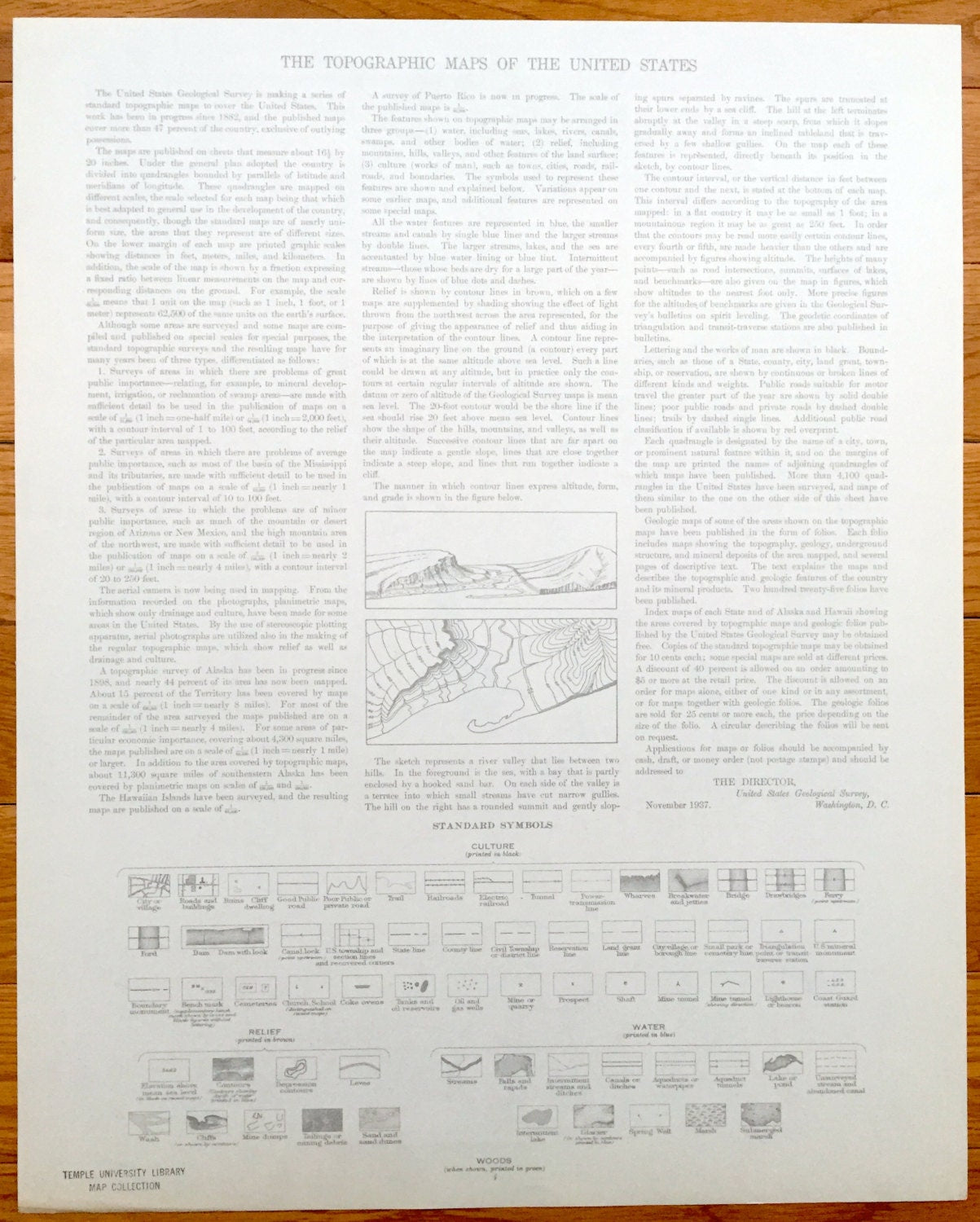
See what Rockville and surrounding area just east of Hartford looked like 80 years ago. Lots of intricate details and geological contours. Map even has little squares for every house that existed at the time. The cartographers were very thorough back then! On the back is a description of topographic symbols and map guide.
Perfect for the historian, map-lover, the curious or just as a conversation starter. Wonderful and rare. Maps such as these make great gifts.
Edition of 1944, printed 1944
Dimensions: 16" width x 20 1/2" height
----
Features
Cities & Towns: Ellington, Rockville, Vernon, Bolton, Manchester, Andover, Coventry, North Coventry, Tolland, Talcottville, Highland Park, Manchester Green, Bolton Notch, South Windsor, Vernon Center, Quarryville, Lydallville.
Points of Interest: Skungemaug River, Shenipsit Lake, Hockanum River, Tankerhoosen River, North East School, Grant Hill School, Howard Reservoir, Willimantic Reservoir, Highland Park School, Vernon Church and lots more hills, mountains, creeks, towns, schools, and roads.
Condition: Very Good Vintage condition, commensurate with age. This map is in great shape for being 80 years old. Has light and toning, but this will add to character when framed.
----
We will happily adjust shipping price for multiple purchases. Maps are shipped rolled up in sturdy mailing tubes, never folded.
Couldn't load pickup availability
Share