My Store
Antique Rockwood, Michigan 1967 US Geological Survey Topographic Map – Wayne, Monroe County, Gibraltar, Grosse Ile, Milleville Beach, MI
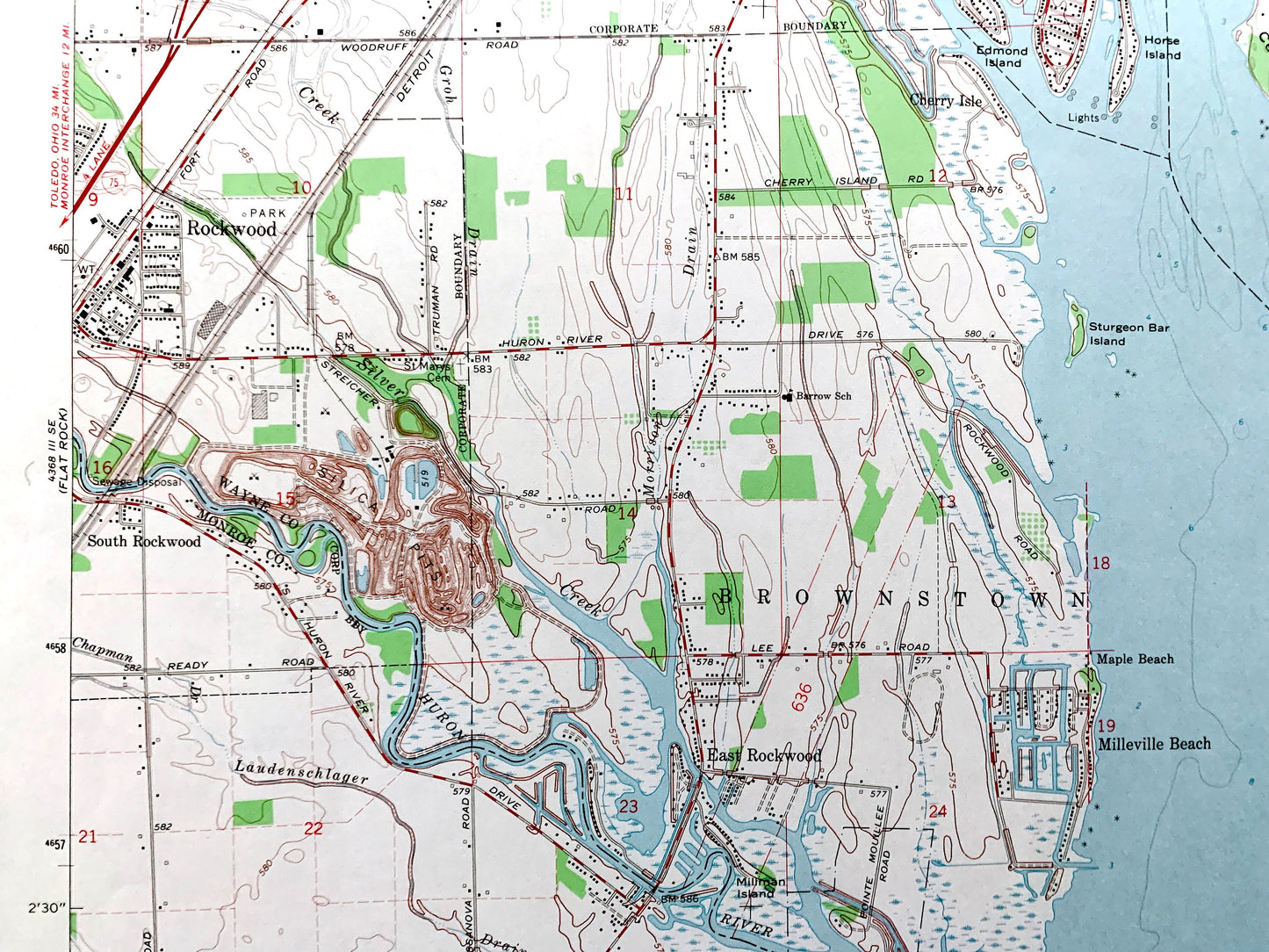
Antique Rockwood, Michigan 1967 US Geological Survey Topographic Map – Wayne, Monroe County, Gibraltar, Grosse Ile, Milleville Beach, MI
Beautiful, antique map of Rockwood, Michigan and surrounding Wayne County & Monroe County area, including a bit of Essex County, Ontario. This is an authentic 1967 edition, 1969 print from the U.S. Geological Survey and is NOT a computer reproduction.
See what Michigan looked like over 55 years ago. Lots of intricate details and geological contours. Map even has little squares for every house that existed at the time. The USGS cartographers were very thorough back then!
Perfect for the historian, map-lover, the curious or just as a conversation starter. Wonderful and rare. Vintage maps such as this make great gifts.
Edition of 1967, printed 1969
Dimensions: 22" width x 27" height
----
Features
Cities & Towns: Rockwood, Trenton, Brownstown, Berlin, Grosse Ile, Woodhaven, Gibraltar, Cherry Isle, South Rockwood, Maple Beach, Milleville Beach.
Points of Interest: Wayne County, Monroe County, Lake Erie, Grosse Ile, Grosse Ile Naval Air Station, Detroit River, Celeron Island, Meso Island, Hickory Island, Sugar Island, Edmond Island, Huron River, Pointe Mouillee State Game Area, Mouillee Creek, Livingston Channel, and many more lakes, roads, towns and rivers.
Condition: Very Good Vintage condition, commensurate with age. This map is in great shape for being over 50 years old. Has light wear and ex-library stamp in margin, but this will all add to character when framed.
----
We will happily adjust shipping price for multiple purchases. Maps are rolled up and shipped in sturdy mailing tubes, never folded.
Couldn't load pickup availability
Share