My Store
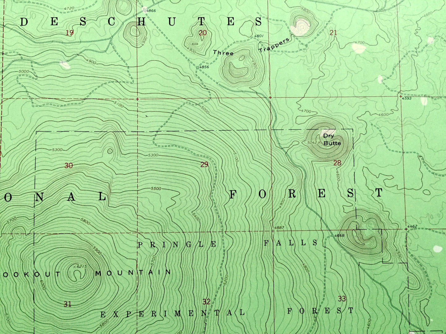
Antique Round Mountain, Oregon 1963 US Geological Survey Topographic Map – Deschutes County, Pringle Falls Experimental Forest, OR
Antique Round Mountain, Oregon 1963 US Geological Survey Topographic Map – Deschutes County, Pringle Falls Experimental Forest, OR
Beautiful, antique map of Round Mountain, Oregon and surrounding Deschutes County area. This is an authentic 1963 edition, 1964 print from the U.S. Geological Survey and NOT a computer reproduction.
See what Oregon looked like over 55 years ago. Lots of intricate details and geological contours. Map even has little squares for every house that existed at the time. The USGS cartographers were very thorough back then!
Perfect for the historian, map-lover, the curious or just as a conversation starter. Wonderful and rare. Vintage maps such as these make great gifts.
Edition of 1963, printed 1964
Dimensions: 22" width x 27" height
----
Features
Points of Interest: Deschutes National Forest, Pringle Falls Experimental Forest, Lookout Mountain, Round Mountain Pass, Slah Butte, Lolah Butte, Lumrum Butte, Palanush Butte, Fall River, Fall River Guard Station, and many more hills, streams, ponds, houses, schools, railroads, churches and roads.
Condition: Very Good Vintage condition, commensurate with age. This map is in great shape for being over 55 years old. Has light edge-wear but will read as character when framed.
----
We will happily adjust shipping price for multiple purchases. Maps are rolled up and shipped in sturdy mailing tubes, never folded.
Couldn't load pickup availability
Share