My Store
Antique Royalston, Massachusetts 1946 US Geological Survey Topographic Map – Richmond, Orange, Athol, Fitzwilliam, New Hampshire, MA NH
Antique Royalston, Massachusetts 1946 US Geological Survey Topographic Map – Richmond, Orange, Athol, Fitzwilliam, New Hampshire, MA NH
Beautiful, antique map of Royalston, Orange, Athol, South Royalston and West Royalston, Massachusetts, including surrounding New Hampshire towns of Fitzwilliam and Richmond. This is an authentic 1946 print from the U.S. Geological Survey and is NOT a computer reproduction.
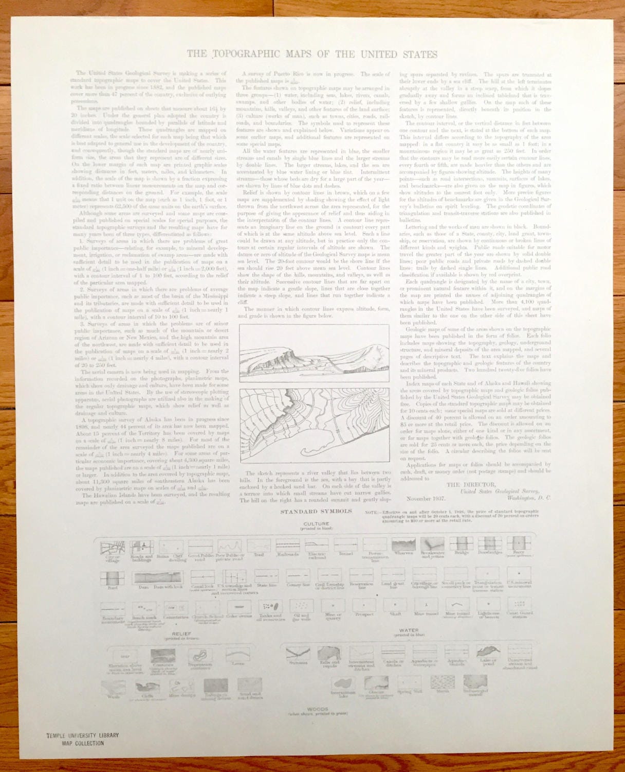
See what Worcester, Orange and Cheshire Counties looked like over 75 years ago. Lots of intricate details and geological contours. Map even has little squares for every house that existed at the time. The USGS cartographers were very thorough back then! On the back is a description of topographic symbols and map guide.
Perfect for the historian, map-lover, the curious or just as a conversation starter. Wonderful and rare. Vintage maps such as these make great gifts.
Edition of 1946, printed 1946
Dimensions: 17" width x 21" height
----
Features
Cities & Towns: Massachusetts: West Royalston, Royalston, South Royalston, Orange, Freyville, Athol, Chestnut Hill, Packard Heights, Tully, Neale Place.
New Hampshire: Richmond, Fitzwilliam.
Points of Interest: Cook Hill, Sportsman Pond, Laurel Lake, Long Pond, Little Pond, Tully Pond, Packard Pond, Little Tully Mountain, East Branch River, Bridgehill Dam, and lots more hills, mountains, streams, ponds, houses,and roads.
Condition: Very Good Vintage condition, commensurate with age. This map is in great shape for being over 75 years years old.
----
We will happily adjust shipping price for multiple purchases. Maps are rolled up and shipped in sturdy mailing tubes, never folded.
Couldn't load pickup availability
Share