My Store
Antique Sacramento, California 1887 US Geological Survey Topographic Map – Yuba, Sutter, Placer, El Dorado, Sheridan, Ewing, Lincoln, CA
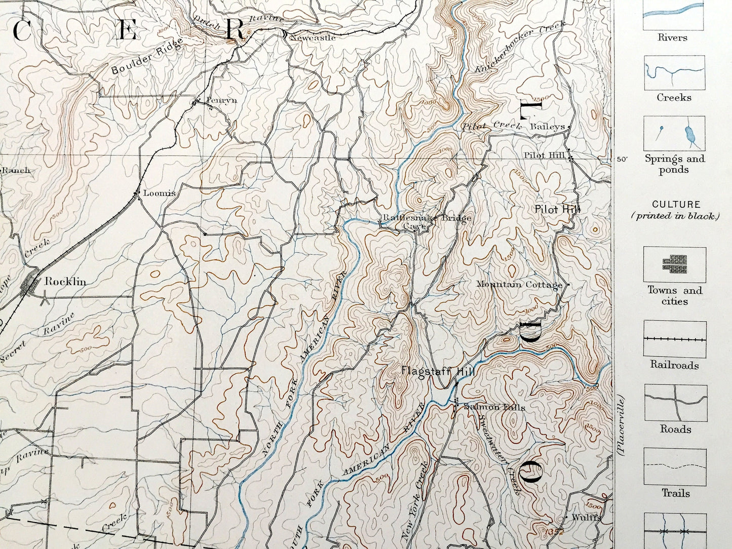
Antique Sacramento, California 1887 US Geological Survey Topographic Map – Yuba, Sutter, Placer, El Dorado, Sheridan, Ewing, Lincoln, CA
Beautiful, antique map of Sacramento, California and surrounding area. This is an authentic 1887 edition, 1893 print from the U.S. Geological Survey and NOT a computer reproduction. It is from a Geologic Atlas folio.
See what California looked like over 135 ago, in the 1800's before most of this land was developed. Lots of intricate details and geological contours. Map even has little squares for every house that existed at the time. The USGS cartographers were very thorough back then! This is one of the rare maps where the topographic symbols and map guide are on the front.
Perfect for the historian, map-lover, the curious or just as a conversation starter. Wonderful and rare. Vintage maps such as these make great gifts.
Edition of 1887, printed 1893
Dimensions: 18 1/2" width x 22" height
----
Features
Cities & Towns: Sacramento, Yuba, Sutter, Placer, El Dorado, Sheridan, Ewing, Lincoln, Valley View, Virginia, Hotaling, Clipper Gap, Auburn, Ophir, Gold Hill, Newcastle, Baileys, Whitney Ranch, Witney, Rocklin, Pleasant Grove, Roseville, Loomis, Penryn, Doty Flat, Limekiln, Pilot HIll, Mountain Cottage, Salmon Falls, Mormon Island, Ashland, Orange Vale, Folsom, Antelope, 12 Mile House, Homestead, Hospital, Brighton, Perkins, Freeport, Mayhews, Walsh, Routier, Mills, Cornell, Salsbury, Natoma, Alders, White Rock, Cothrins, Clarksville, Dormodys, Wulffs.
Points of Interest: American River, American Basin, Bear River, Arcade Creek, Morrison Creek, Ben Bolt, Auburn Ravine, Pleasant Grove Creek, Yankee Slough, Bald Hill, Rattlesnake Bridge, Flagstaff Hill, Folsom Prison Penitentiary, Sacramento and Placerville Railroad and lots more mountains, hills, creeks, train tracks and roads.
Condition: Very Good Vintage condition, commensurate with age. This map is in great shape for being over 125 years old. Has light edge-wear and thread holes in the margin but this will read as vintage character when framed.
----
We will happily adjust shipping price for multiple purchases. Maps are rolled up and shipped in sturdy mailing tubes, never folded.
Couldn't load pickup availability
Share