My Store
Antique Sagamore, Massachusetts 1940 US Geological Survey Topographic Map – Barnstable County, Plymouth, Sandwich, Bourne, Cape Cod Beach MA
Antique Sagamore, Massachusetts 1940 US Geological Survey Topographic Map – Barnstable County, Plymouth, Sandwich, Bourne, Cape Cod Beach MA
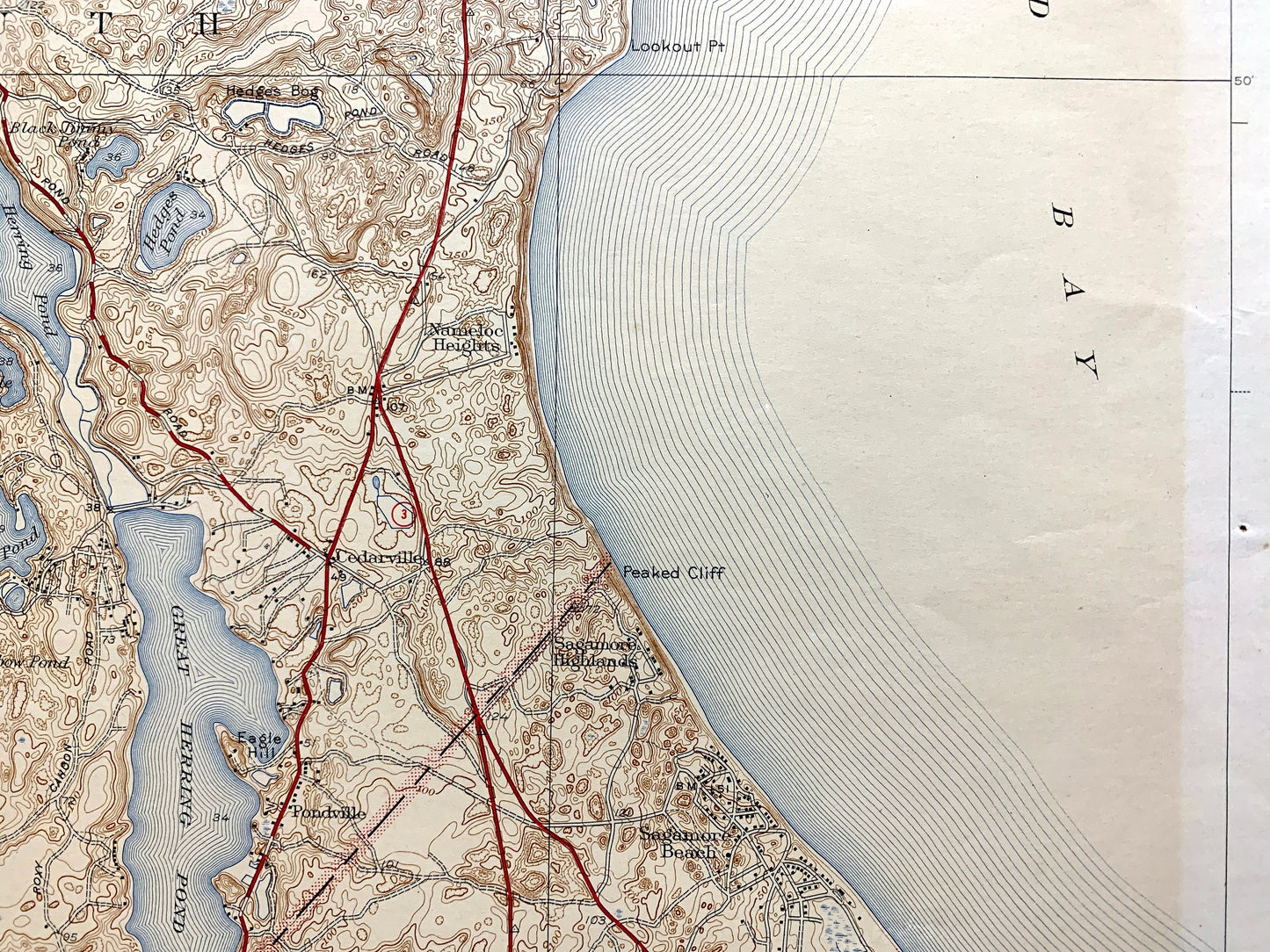
Beautiful, antique map of Sagamore, Massachusetts and surrounding Barnstable & Plymouth County area. This is an authentic 1940 edition, 1942 print from the U.S. Geological Survey and NOT a computer reproduction.
See what Massachusetts looked like over 80 years ago. Lots of intricate details and geological contours. Map even has little squares for every house that existed at the time. The USGS cartographers were very thorough back then! On the back is a description of topographic symbols and map guide.
Perfect for the historian, map-lover, the curious or just as a conversation starter. Wonderful and rare. Vintage maps such as these make great gifts.
Edition of 1940, printed 1942
Dimensions: 16 1/2" width x 20" height
----
Features
Cities & Towns: Sagamore, Sandwich, Bourne, Sagamore Beach, Sagamore Highlands, Pondville, Cedarville, Nameloc Heights, Plymouth, Halfway Pond, Long Pond, Vallersville, Eastland Heights, Ellisville, Scusset Beach.
Points of Interest: Plymouth County, Barnstable County, Cape Cod Bay, Cape Cod Canal, New York New Haven and Hartford Railroad, Camp Edwards Military Reservation, Shawme-Crowell State Forest, Sagamore Hill, Buttermilk Bay, Great Herring Pond, Island Pond, Sandy Pond, Bay Hill, Peaked Cliff, Mountain Hill, Bloody Pond, Myles Standish State Forest, Long Pond, Halfway Pond, and many more hills, streams, ponds, houses, schools, churches and roads.
Condition: Good or "Very Vintage" condition, commensurate with age. This map is in great shape for being over 80 years old. Has light edge-wear, toning, pencil marks, as well as areas of discoloration, but will add to vintage character when framed.
----
We will happily adjust shipping price for multiple purchases. Maps are rolled up and shipped in sturdy mailing tubes, never folded.
Couldn't load pickup availability
Share