My Store
Antique Salinas, California 1947 US Geological Survey Topographic Map – Santa Rita, Spreckels, Old Hilltown, East Garrison, Bolsa Knolls, CA
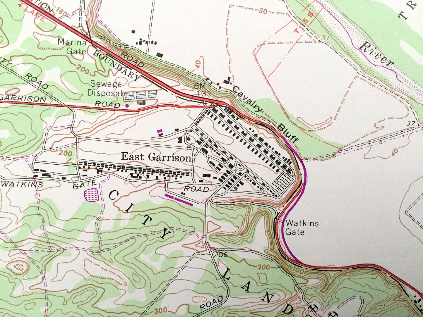
Antique Salinas, California 1947 US Geological Survey Topographic Map – Santa Rita, Spreckels, Old Hilltown, East Garrison, Bolsa Knolls, CA
Beautiful, antique map of Salinas, California and surrounding Salinas Valley and Monterey County area. This is an authentic 1947 edition, 1968 print from the U.S. Geological Survey and is NOT a computer reproduction.
See what Salinas Valley looked like over 75 years ago. Lots of intricate details and geological contours. Map even has little squares for every house that existed at the time. The USGS cartographers were very thorough back then!
Perfect for the historian, map-lover, the curious or just as a conversation starter. Wonderful and rare. Vintage maps such as these make great gifts.
Edition of 1947, printed 1968
Dimensions: 22" width x 27" height
----
Features
Cities & Towns: Salinas, Santa Rita, Spreckels, Old Hilltown, East Garrison, Confederate Corners, Bolsa Knolls.
Points of Interest: Salinas Valley, El Chamisal, El Toro, Monterey County, El Tucho, Las Salinas, Salinas River, Nacional, Pilarcitos Ridge, Sandstone Ridge, Bolsa de las Escorpinas, Los Gatos or Santa Rita, Alisal Slough, Rincon de Sanjon, and lots more mountains, canyons, small towns, creeks, rivers, roads, schools, churches and train tracks.
Condition: Very Good Vintage condition, commensurate with age. This map is in great shape for being over 50 years old. Light wear, but this will add to vintage character when framed.
----
We will happily adjust shipping price for multiple purchases. Maps are rolled up and shipped in sturdy mailing tubes, never folded.
Couldn't load pickup availability
Share