My Store
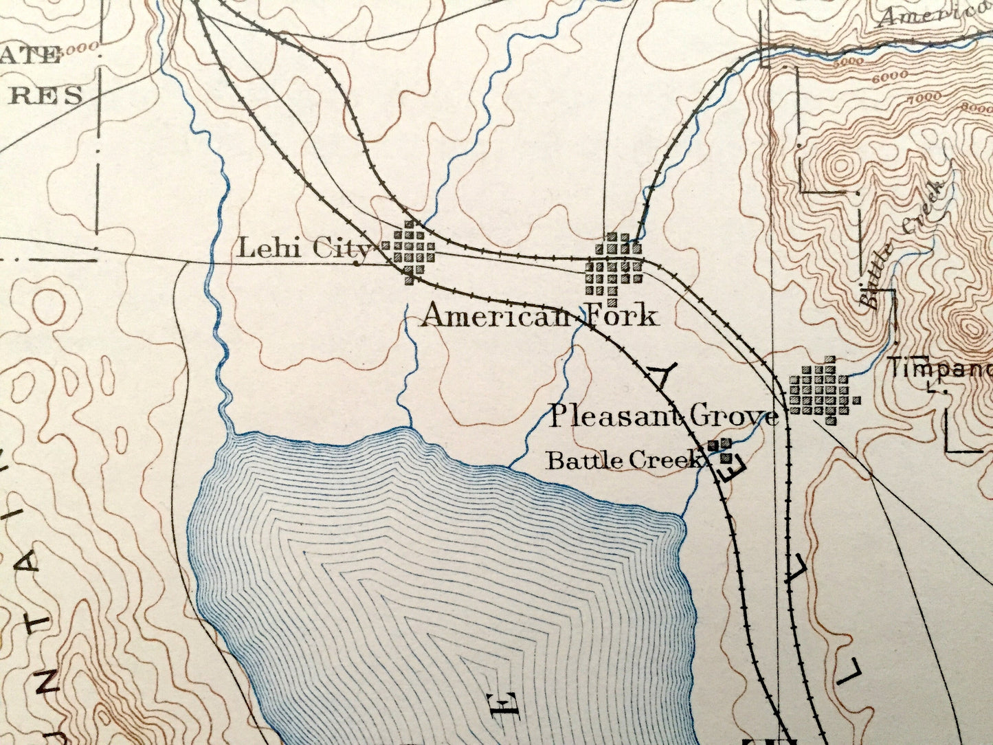
Antique Salt Lake City, Utah 1885 US Geological Survey Topographic Map – Provo, Farmington, Lehi, American Fork, Pleasant Grove, Salem, UT
Antique Salt Lake City, Utah 1885 US Geological Survey Topographic Map – Provo, Farmington, Lehi, American Fork, Pleasant Grove, Salem, UT
Beautiful, antique map of Salt Lake City, Provo, Utah and surrounding area. This is an authentic 1885 edition, 1930 print from the U.S. Geological Survey and NOT a computer reprint.
See what Utah looked like over 135 years ago. Lots of intricate details and geological contours. Map even has little squares for every house that existed. The USGS cartographers were very thorough back then! On the back is a description of topographic symbols and map guide. On the back is a description of topographic symbols and map guide.
Perfect for the historian, map-lover, the curious or just as a conversation starter. Wonderful and rare. Vintage maps such as these make great gifts.
Edition of 1885, printed 1930
Dimensions: 16 1/2" width x 20" height
----
Features
Cities & Towns: Salt Lake City, Provo, Farmington, Lehi City, American Fork, Pleasant Grove, Springville, Spanish Fork, Salem, Payson, more.
Points of Interest: Great Salt Lake, Utah Lake, Wasatch National Forest, Strawberry Valley Bird Reserve, Wasatch Mountains, Morgan Summit, Uinta National Forest, Provo Valley.
Condition: Good Vintage condition, commensurate with age. This map is in great shape for being over 90 years old. Has light edge-wear and ex-libris stamps in margin, but this will add to vintage character when framed.
----
We will happily adjust shipping price for multiple purchases. Maps are rolled up and shipped in sturdy mailing tubes, never folded.
Couldn't load pickup availability
Share