My Store
Antique San Diego, California 1904 US Geological Survey Topographic Map – San Ysidro, Fruitdale, Imperial Beach, Otay Valley, Chula Vista CA
Antique San Diego, California 1904 US Geological Survey Topographic Map – San Ysidro, Fruitdale, Imperial Beach, Otay Valley, Chula Vista CA
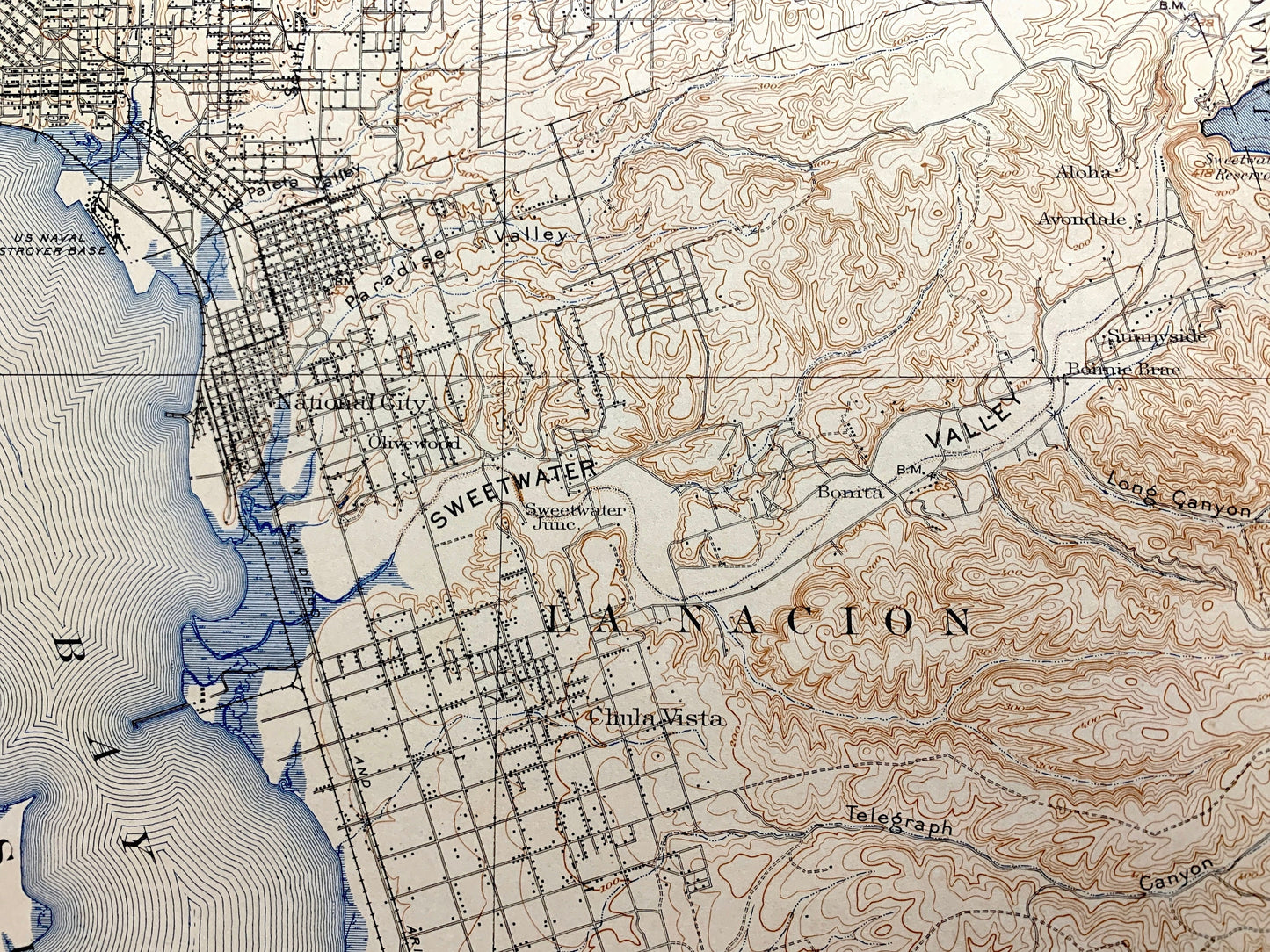
Beautiful, antique map of San Diego, California and surrounding San Diego County on the Pacific Coast. This is an authentic 1904 edition, 1928 print from the U.S. Geological Survey and NOT a computer reproduction.
See what California looked like 120 years ago. Lots of intricate details and geological contours. Map even has little squares for every house that existed at the time. The USGS cartographers were very thorough back then!
Perfect for the historian, map-lover, the curious or just as a conversation starter. Wonderful and rare. Vintage maps such as these make great gifts.
Edition of 1904, printed 1928
Dimensions: 18" width x 22" height
----
Features
Cities & Towns: San Diego, La Nacion, Coronado Heights, Fruitdale, Chula Vista, Castle Park, Toay, Palm City, Imperial Beach, South San Diego, Nestor, San Ysidro.
Points of Interest: San Diego County, San Diego Bay, Pacific Ocean, Tia Juana River, Judson Reservoir, Otay River, Otay Valley, Otay Mesa, Smuggler Gulch, San Diego Country Club, Southern Pacific Railroad and many more mountains, canyons, rivers, creeks, towns, cities, roads and train tracks.
Condition: Good Vintage condition, commensurate with age. This map is in great shape for being over 90 years old. Has some real edge-wear, toning, foxing, but this will all add to its vintage character when framed.
----
We will happily adjust shipping price for multiple purchases. Maps are rolled up and shipped in sturdy mailing tubes, never folded.
Couldn't load pickup availability
Share