My Store
Antique San Diego, California 1950 US Geological Survey Topographic Map – La Jolla Bay, National City, Chula Vista, La Mesa, Tijuana, Mexico
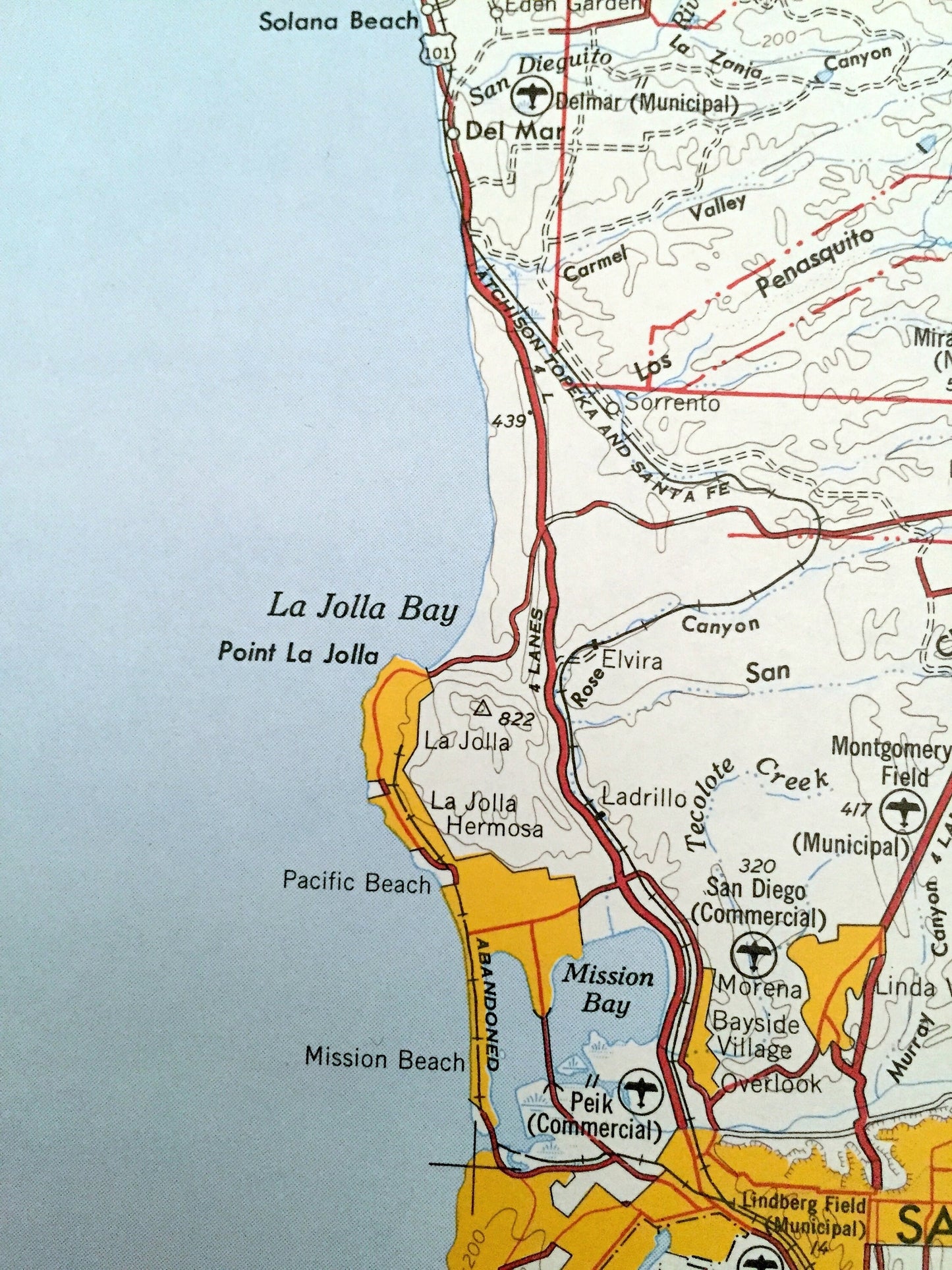
Antique San Diego, California 1950 US Geological Survey Topographic Map – La Jolla Bay, National City, Chula Vista, La Mesa, Tijuana, Mexico
Beautiful, antique topographic map of San Diego, California and surrounding area. This is an authentic 1950 print from the U.S. Army Corps of Engineers and NOT a computer reproduction.
See what California looked like over 70 years ago. Map is incredibly large and in the grand 1:250,000 scale. Lots of intricate details and geological contours. The cartographers were very thorough back then! On the back is a close-up on the city of San Diego.
Perfect for the historian, map-lover, the curious or just as a conversation starter. Wonderful and rare. Vintage maps such as these make great gifts.
Edition of 1950, printed 1950
Dimensions: 32" width x 24" height
----
Features
Points of Interest: San Diego, La Jolla, National City, Chula Vista, Solana Beach, Del Mar, Pacific Beach, Mission Beach, Coronado, Lemon Grove, La Mesa, El Cajon, Cleveland National Forest, San Vicente Reservoir, Bostonia, Campo Indian Reservation, Camp Lockett, San Diego Bay, Fort Rosecrans Military Reservation, San Ysidro Mountains, Lower Otay Reservoir, Sweetwater Reservoir, Peninsula of San Diego, NAAS Ream Field, Pacific Ocean, Tijuan Mexico, Islas Coronado,, and lots more mountains, canyons, rivers, creeks, valleys, ranches and roads.
Condition: Very good condition, commensurate with age. This map is in incredible shape for being 70 years old. Has light edge-wear but this will add to vintage character when framed.
----
We will happily adjust shipping price for multiple purchases. Maps are rolled up and shipped in sturdy mailing tubes, never folded.
Couldn't load pickup availability
Share