My Store
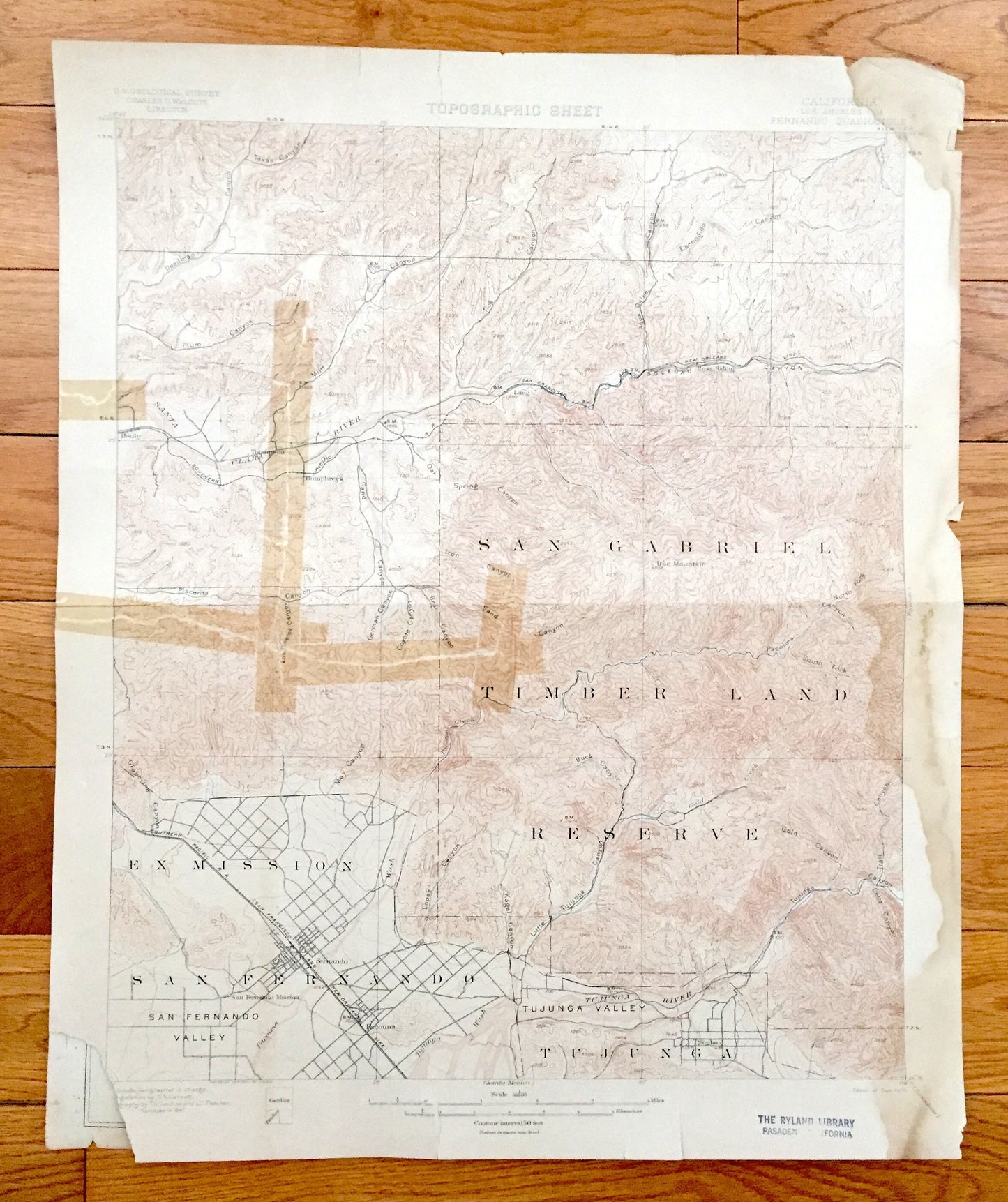
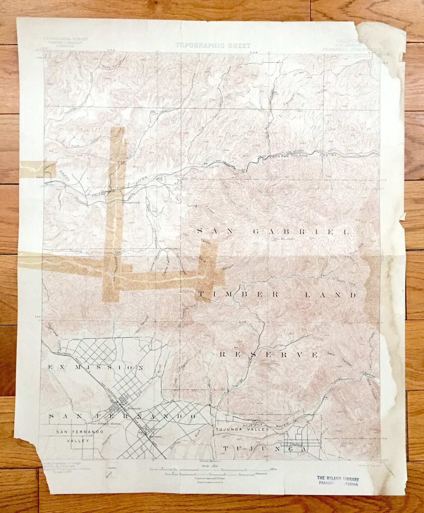
Antique San Fernando, Los Angeles, California 1900 US Geological Survey Topographic Map – Ex Mission, Pacoima Sunland Tujunga San Gabriel CA
Antique San Fernando, Los Angeles, California 1900 US Geological Survey Topographic Map – Ex Mission, Pacoima Sunland Tujunga San Gabriel CA
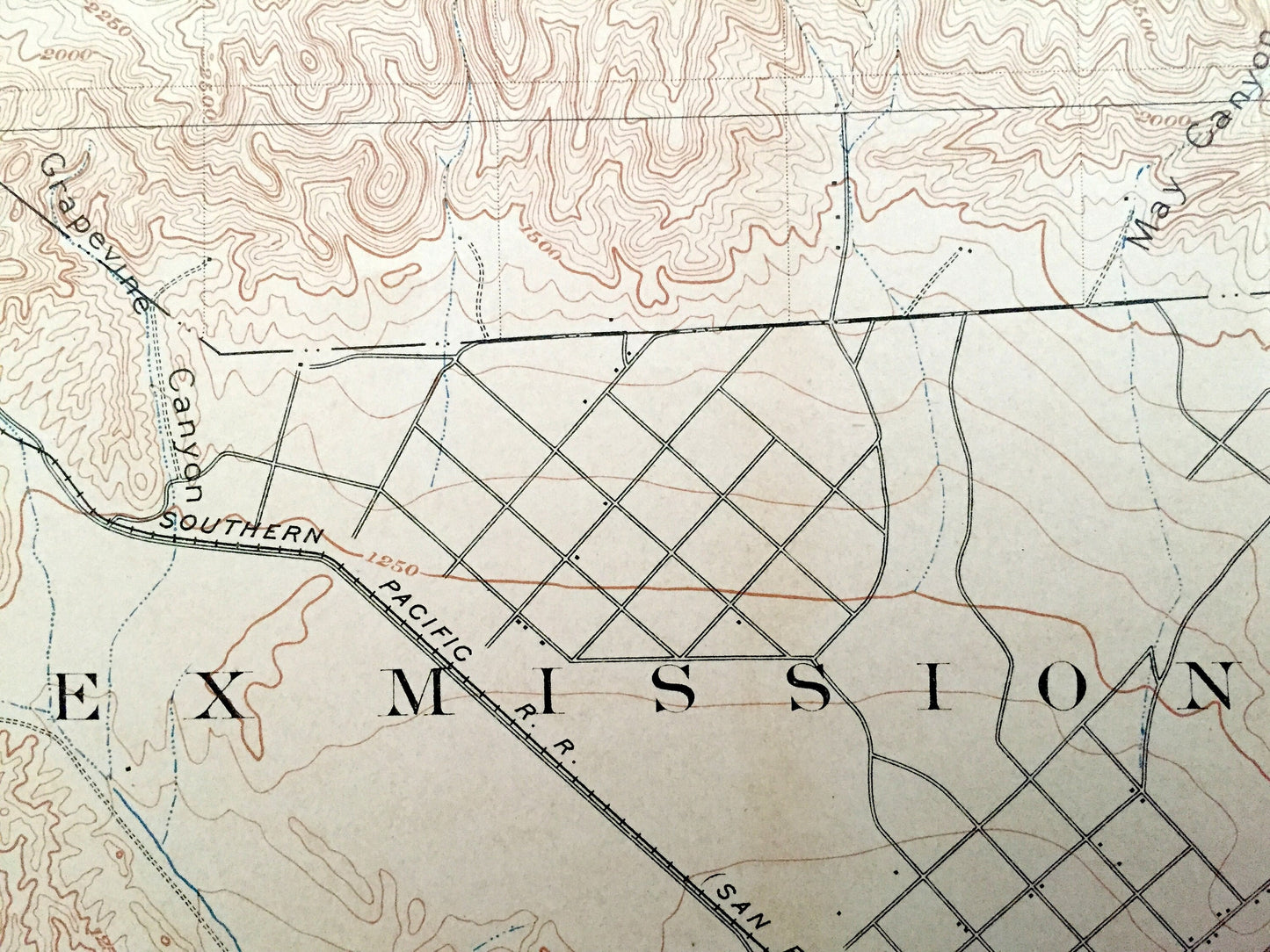
Beautiful, antique map of San Fernando, California and surrounding Los Angeles County area. This is an authentic 1900 print from the U.S. Geological Survey and NOT a computer reproduction.
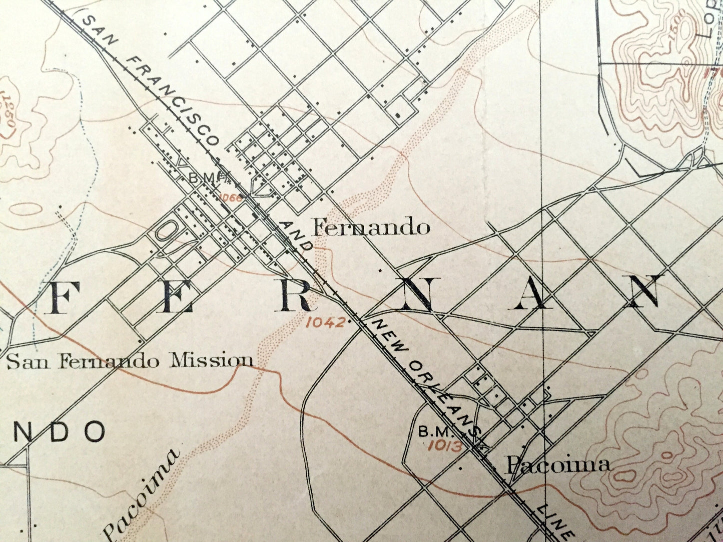
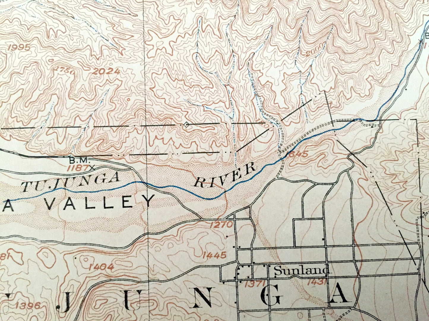
See what the San Fernando Valley looked like more than 110 years ago, before modern development. Lots of intricate details and geological contours. Map even has little squares for every house that existed at the time. The USGS cartographers were very thorough back then! On the back is a description of topographic symbols and map guide.
Perfect for the historian, map-lover, the curious or just as a conversation starter. Wonderful and rare. Vintage maps such as these make great gifts.
Edition of 1900, printed 1900
Dimensions: 16 1/2" width x 20" height
----
Features
Cities & Towns: Ex Mission, San Fernando, Pacoima, Sunland, Tujunga, all in the future Los Angeles.
Points of Interest: San Gabriel Timber Land Reserve, later to become the Angeles National Forest, San Fernando Valley, Tujunga Valley, Santa Clara River, Soledad Canyon, Tujunga Wash, and lots more mountains, canyons, small towns and train tracks.
Condition: Good or "Very Vintage" condition, commensurate with age. This map is in great shape for being 120 years old. Has edge-wear, stains and archival tape repair, all of which will read as vintage character when framed.
----
We will happily adjust shipping price for multiple purchases. Maps are rolled up and shipped in sturdy mailing tubes, never folded.
Couldn't load pickup availability
Share