My Store
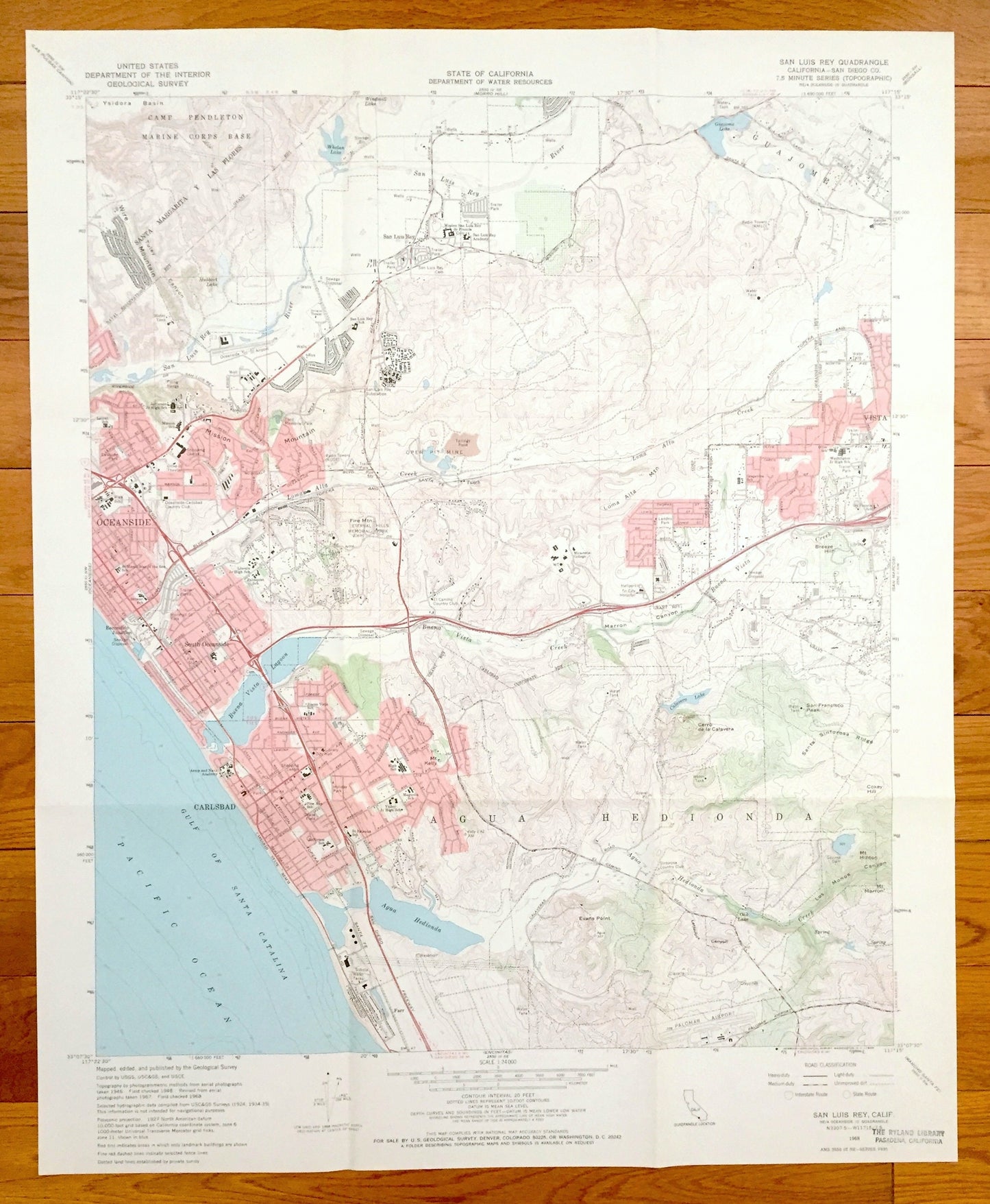
Antique San Luis Rey, California 1968 US Geological Survey Topographic Map – Carlsbad, Oceanside, Escondido Junction, Vista, Farr, CA
Antique San Luis Rey, California 1968 US Geological Survey Topographic Map – Carlsbad, Oceanside, Escondido Junction, Vista, Farr, CA
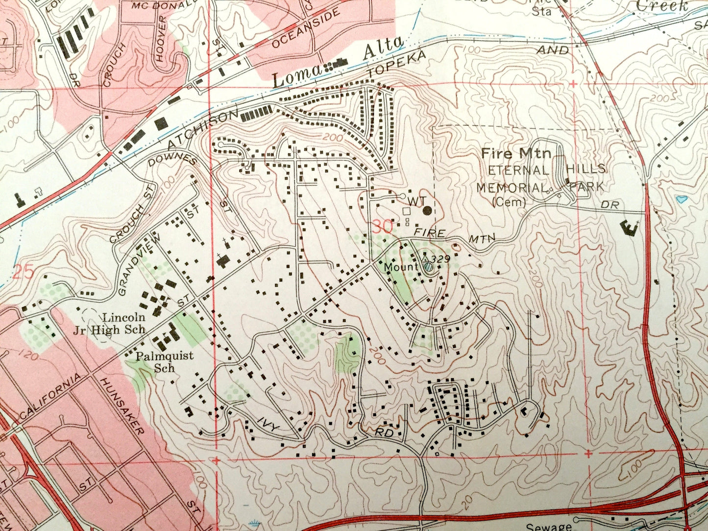
Beautiful, antique map of San Luis Rey, California area, north of San Diego and South of Los Angeles. This is an authentic 1968 edition from the U.S. Geological Survey and NOT a computer reproduction.
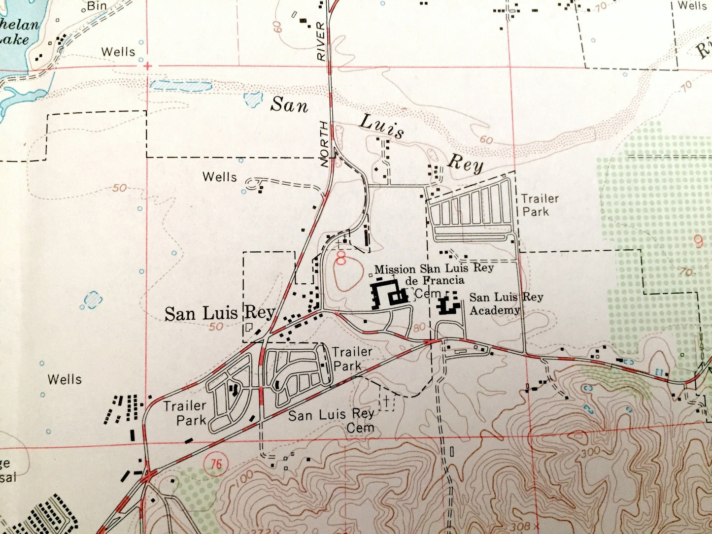
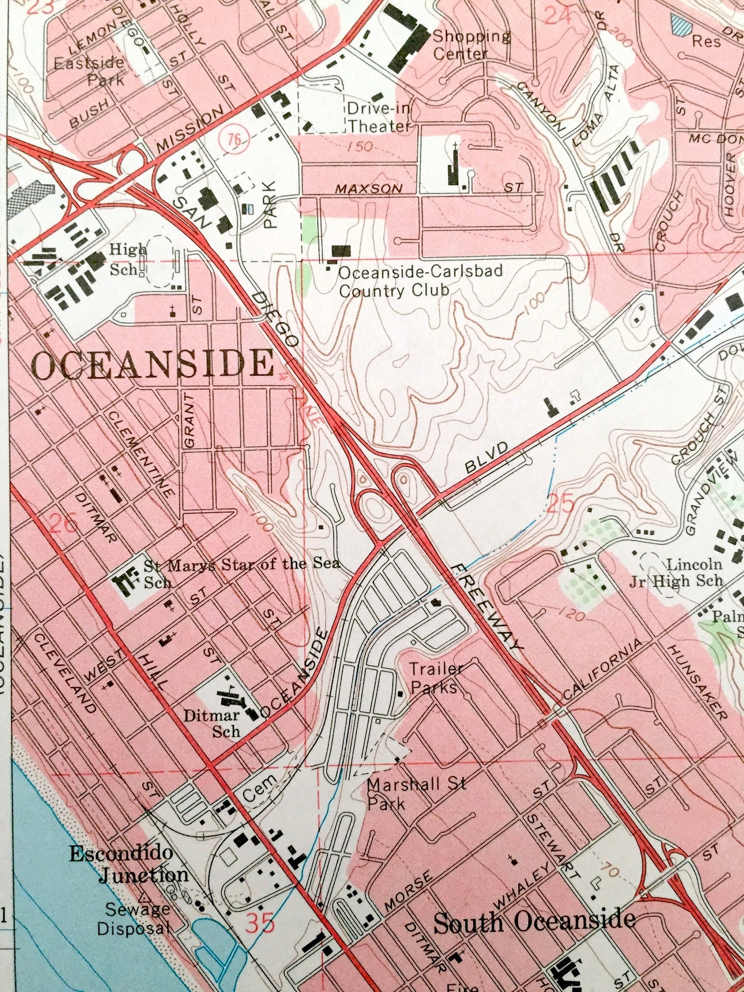
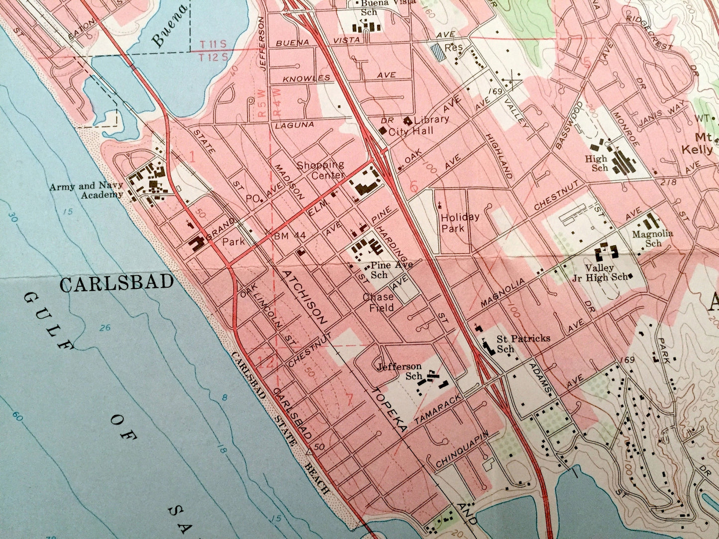
See what San Luis Rey and Oceanside looked like almost 50 years ago. Lots of intricate details and geological contours. Map even has little squares for every house that existed at the time. The USGS cartographers were very thorough back then! On the back is a description of topographic symbols and map guide.
Perfect for the historian, map-lover, the curious or just as a conversation starter. Wonderful and rare. Vintage maps such as these make great gifts.
Edition of 1968, printed 1975
Dimensions: 22" width x 27" height
----
Features
Cities & Towns: Carlsbad, Oceanside, South Oceanside, Escondido Junction, San Luis Rey, Vista, Farr.
Points of Interest: Pacific Ocean, California Coast, Gulf of Santa Catalina, Buena Vista Lagoon, Mission Mountain, San Luis Rey River, Camp Pendleton Marine Corps Base, Guajome, Guajome Lake, Loma Alta Creek, Loma Alta Mountain, Buena Vista Creek, Agua Hedionda, San Diego County, and lots more hills, mountains, brooks, villages, schools, churches, canyons, mines, roads and train tracks.
Condition: Very Good condition, commensurate with age. This map is in incredible shape for being almost 50 years old. Has light wear and folds as-issued, but these will flatten easily and all will add to vintage character when framed.
----
We will happily adjust shipping price for multiple purchases. Maps are rolled up and shipped in sturdy mailing tubes, never folded.
Couldn't load pickup availability
Share