My Store
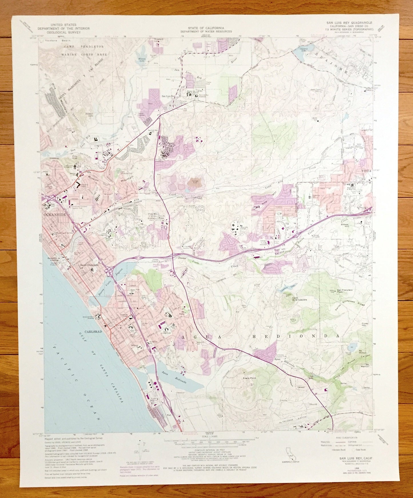
Antique San Luis Rey, California 1968 US Geological Survey Topographic Map – San Diego County, Camp Pendleton, Carlsbad, Oceanside, Vista CA
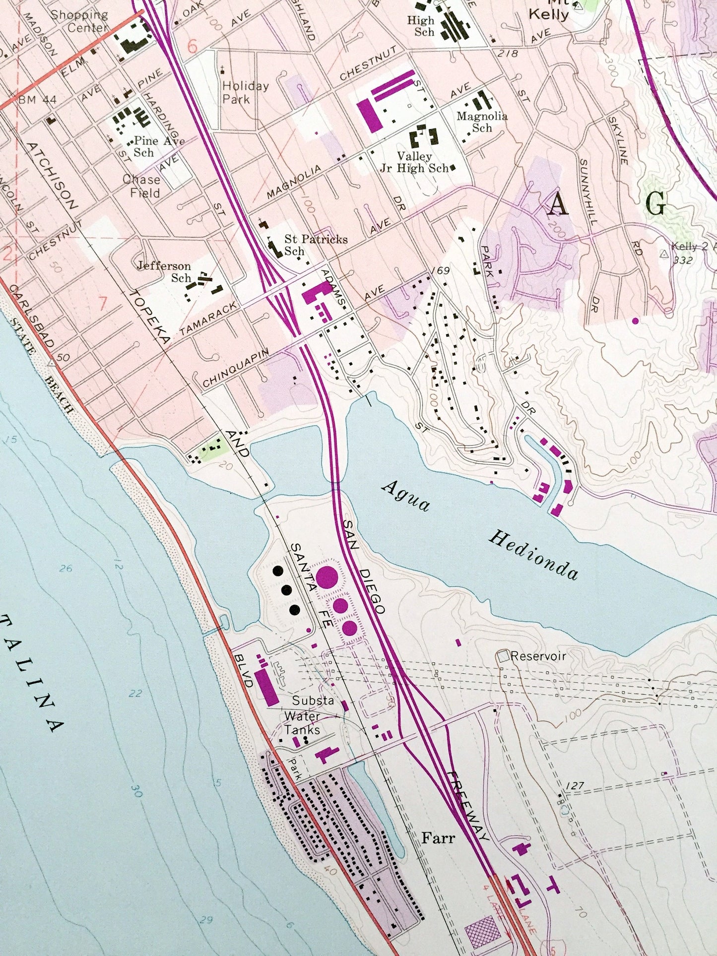
Antique San Luis Rey, California 1968 US Geological Survey Topographic Map – San Diego County, Camp Pendleton, Carlsbad, Oceanside, Vista CA
Beautiful, antique map of San Luis Rey, California and surrounding San Diego County area. This is an authentic 1968 edition, 1975 print from the U.S. Geological Survey and NOT a computer reproduction.
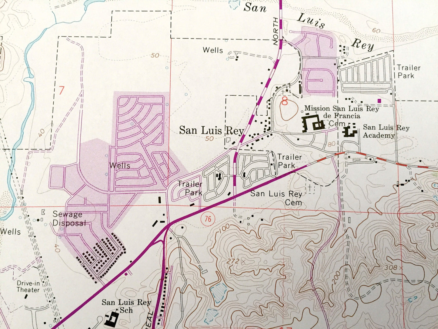
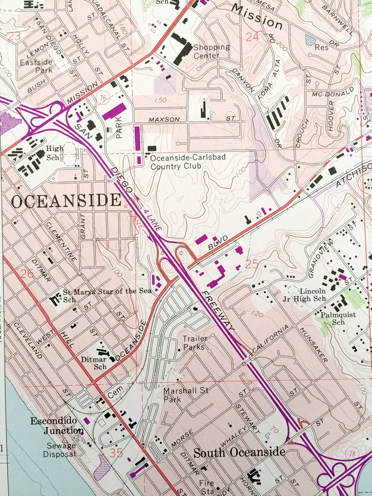
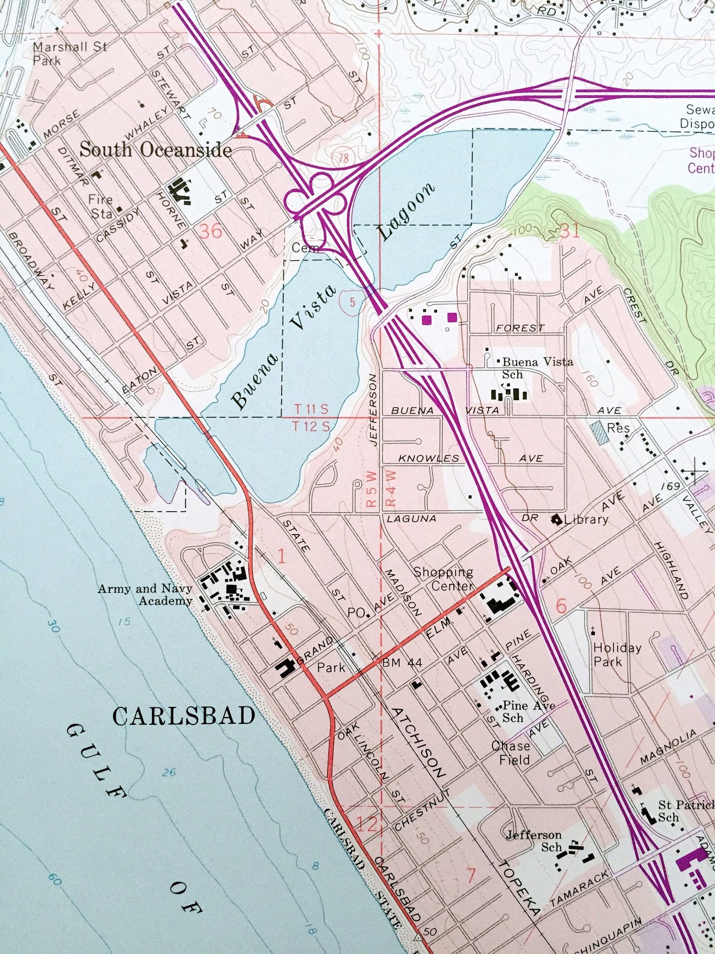
See what the California coastline looked like over 50 years ago. Lots of intricate details and geological contours. Map even has little squares for every house that existed at the time. The USGS cartographers were very thorough back then!
Perfect for the historian, map-lover, the curious or just as a conversation starter. Wonderful and rare. Vintage maps such as these make great gifts.
Edition of 1968, printed 1975
Dimensions: 22" width x 27" height
----
Features
Cities & Towns: Oceanside, Carlsbad, Agua Hedionda, Guajome, Vista, South Oceanside.
Points of Interest: Camp Pendleton Marine Corps Base, Santa Margarita y Las Flores, Gulf of Santa Catalina, Pacific Ocean, Atchison Topeka and Sata Fe Railroad, Buena Vista Lagoon, Mission Mountain, San Francisco Peak, Agua Hedionda, Lorna Alta Mountain, Palomar Airport, Fire Mountain, Eternal Hills Memorial Park, Wire Mountain, and lots more lakes, rivers, roads, creeks, lakes, small towns and roads.
Condition: Very Good condition, commensurate with age. This map is in great shape for being 45 years old.
----
We will happily adjust shipping price for multiple purchases. Maps are rolled up and shipped in sturdy mailing tubes, never folded.
Couldn't load pickup availability
Share