My Store
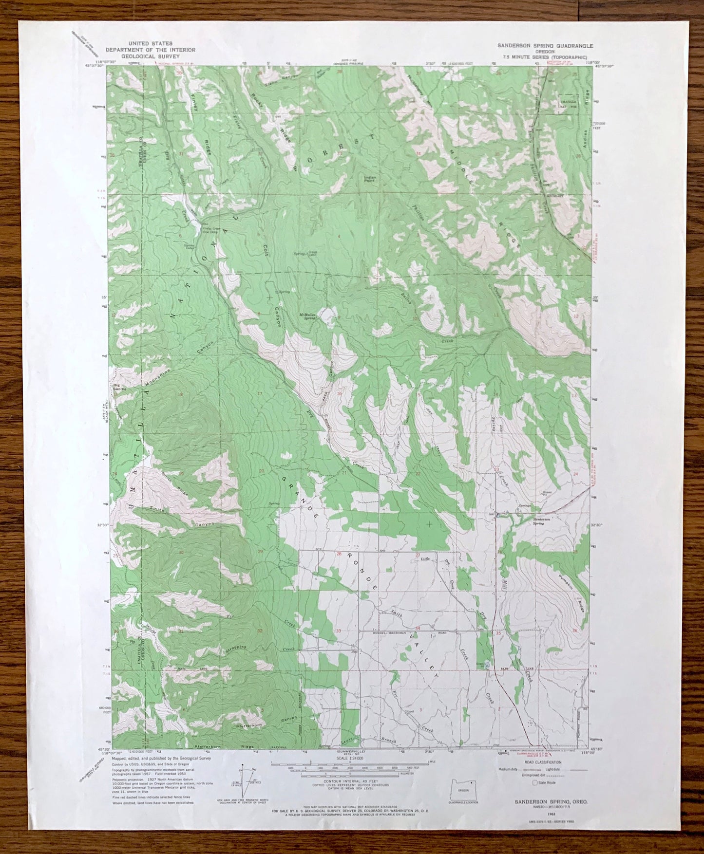
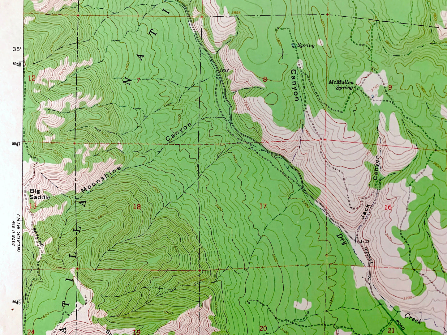
Antique Sanderson Spring, Oregon 1963 US Geological Survey Topographic Map – Umatilla, Union County, Grande Ronde Valley, Colt Canyon, OR
Antique Sanderson Spring, Oregon 1963 US Geological Survey Topographic Map – Umatilla, Union County, Grande Ronde Valley, Colt Canyon, OR
Beautiful, antique map of Sanderson Spring, Oregon and surrounding Umatilla County and Union County areas. This is an authentic 1963 edition, 1965 print from the U.S. Geological Survey and NOT a computer reproduction.
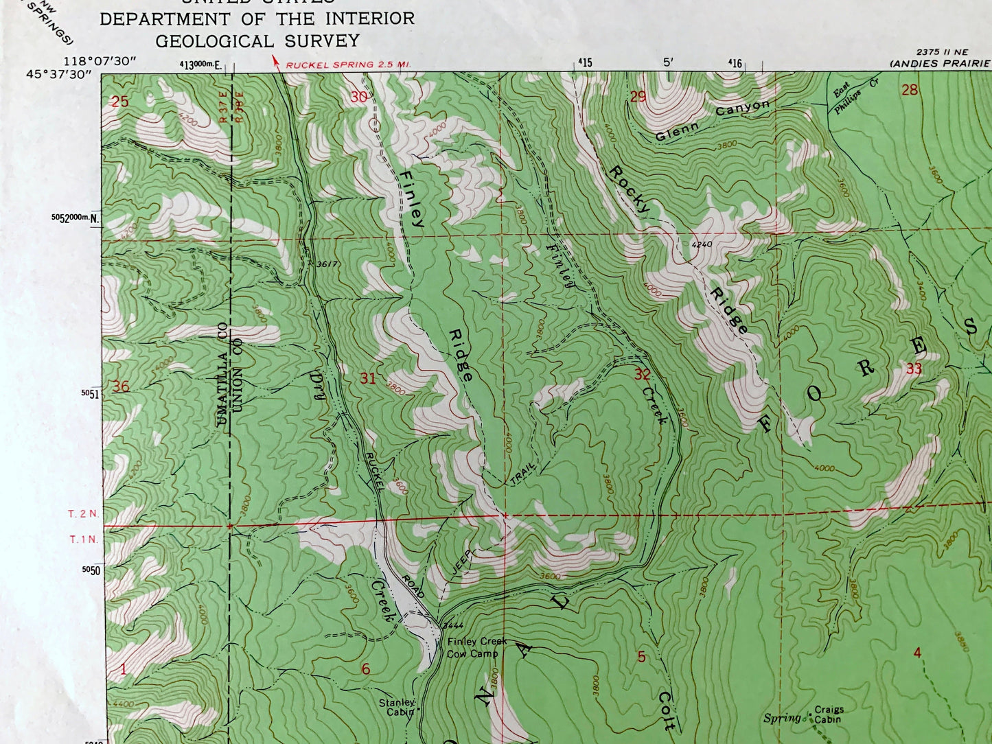
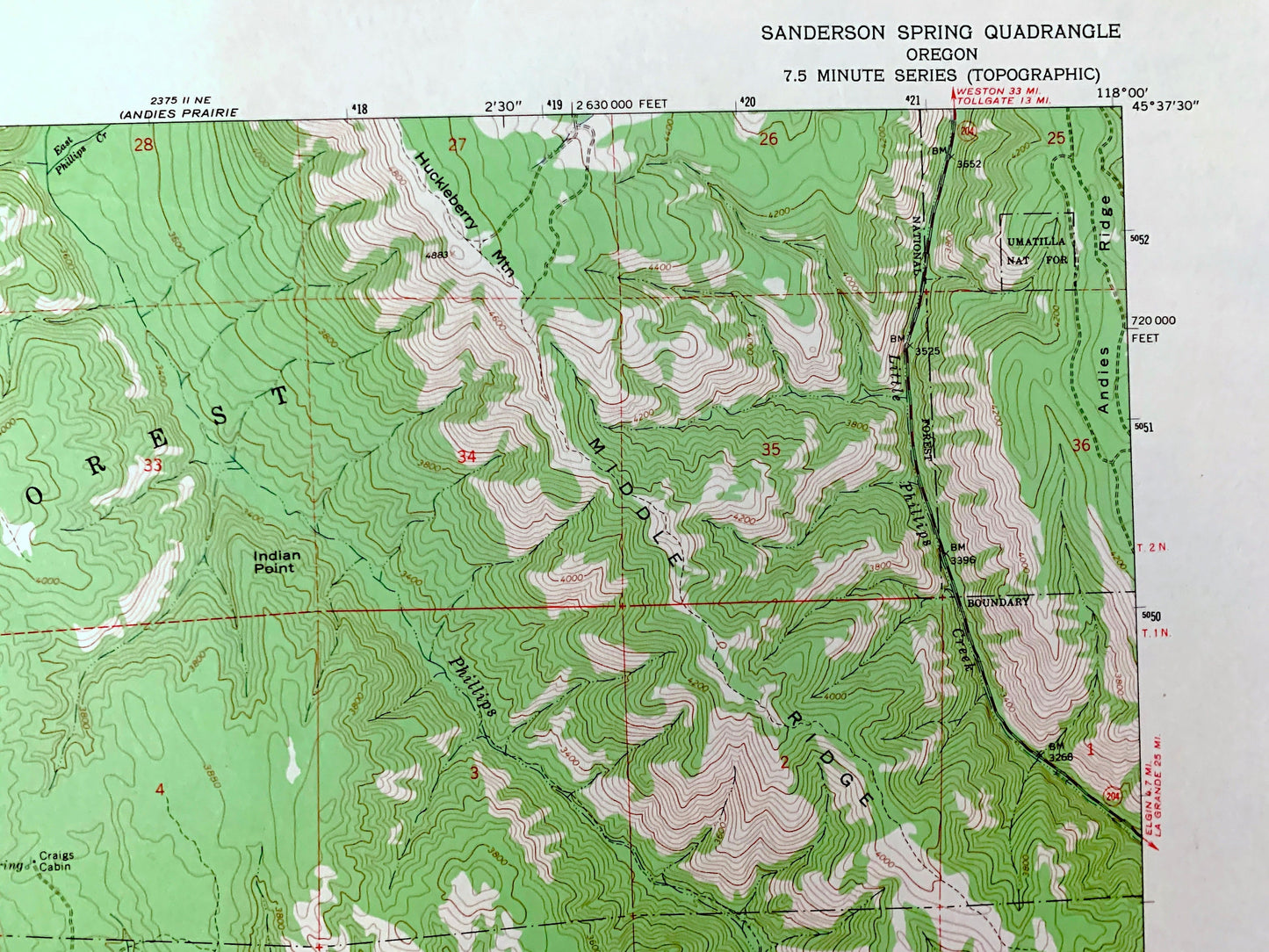
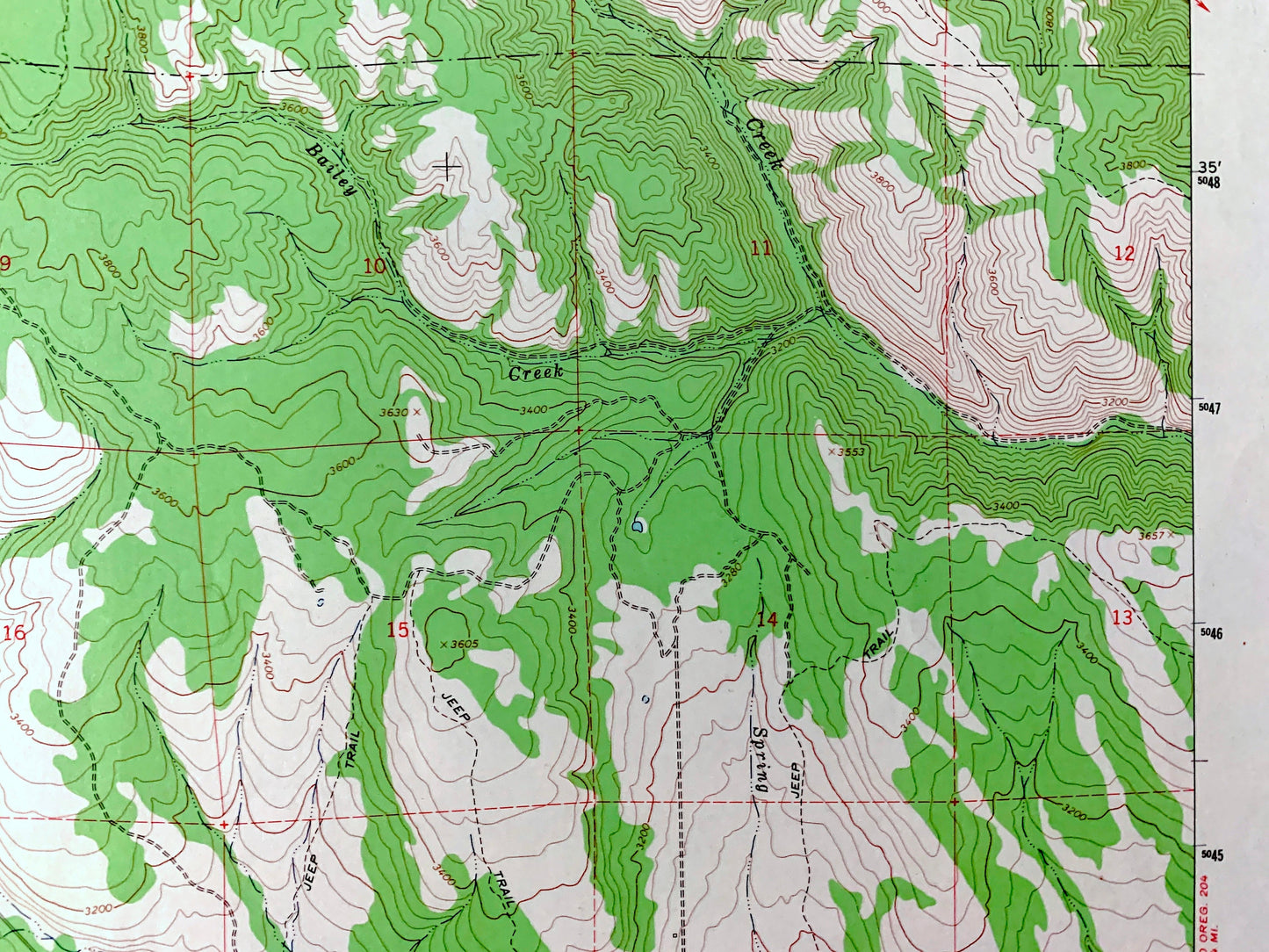
See what Oregon looked like over 55 years ago. Lots of intricate details and geological contours. Map even has little squares for every house that existed at the time. The USGS cartographers were very thorough back then!
Perfect for the historian, map-lover, the curious or just as a conversation starter. Wonderful and rare. Vintage maps such as these make great gifts.
Edition of 1963, printed 1965
Dimensions: 22" width x 27" height
----
Features
Points of Interest: Umatilla National Forest, Finley Creek Cow Camp, Stanley Cabin, Craigs Cabin, Grande Ronde Valley, Colt Canyon, Middle Ridge, Andies Ridge, Huckleberry Mountain, Finley Ridge, Pumpkin Ridge, Phillips Creek, Dry Creek, Spring Creek, Finley Creek, Fir Creek, Strapping Creek, Little Phillips Creek, and many more hills, streams, ponds, houses, schools, railroads, churches and roads.
Condition: Very Good Vintage condition, commensurate with age. This map is in great shape for being over 55 years old. Has light edge-wear but will read as character when framed.
----
We will happily adjust shipping price for multiple purchases. Maps are rolled up and shipped in sturdy mailing tubes, never folded.
Couldn't load pickup availability
Share