My Store
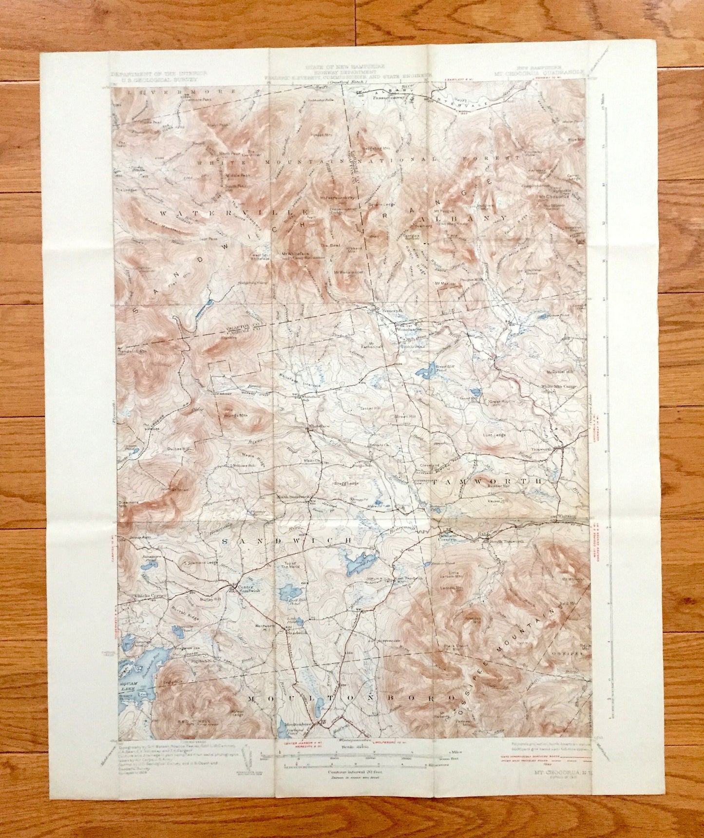
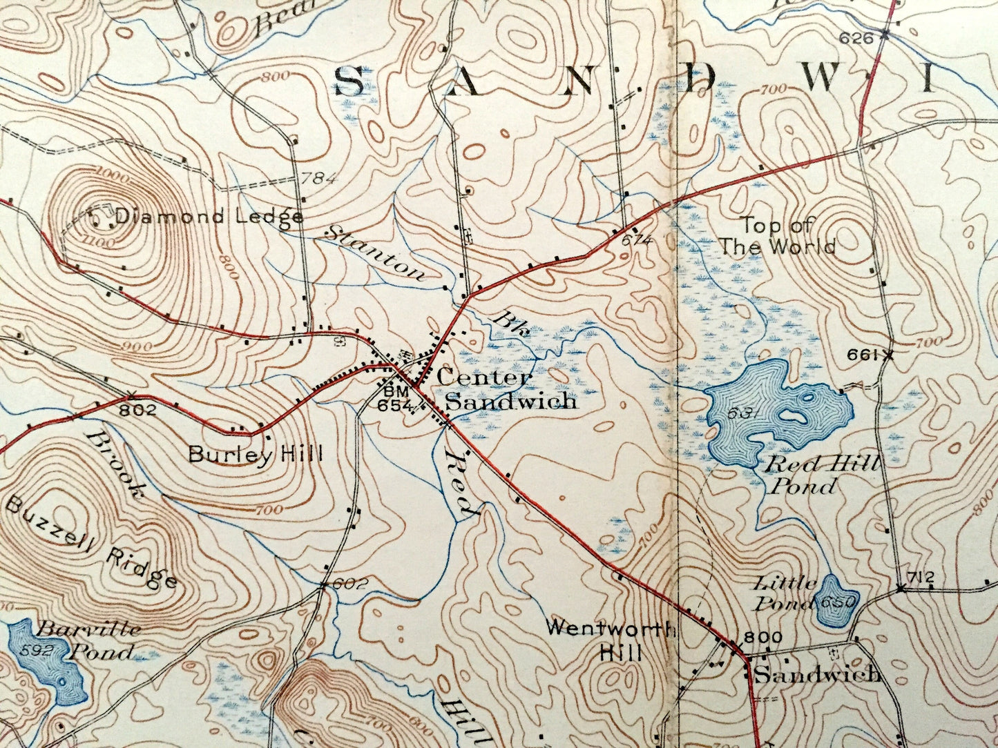
Antique Sandwich, New Hampshire 1931 US Geological Survey Topographic Map – Waterville, Moultonbroro, Squam Lake White Mountains Chocorua NH
Antique Sandwich, New Hampshire 1931 US Geological Survey Topographic Map – Waterville, Moultonbroro, Squam Lake White Mountains Chocorua NH
Beautiful, antique map of The White Mountains, New Hampshire, including Mt. Chocorua, Sandwich Range, Tamworth, Sandwich, Moultonboro, and Squam Lake. This is an authentic 1931 edition, 1931 print from the U.S. Geological Survey and NOT a computer reproduction.
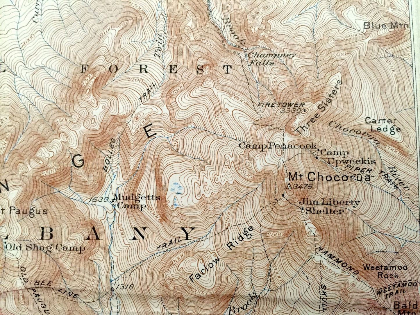
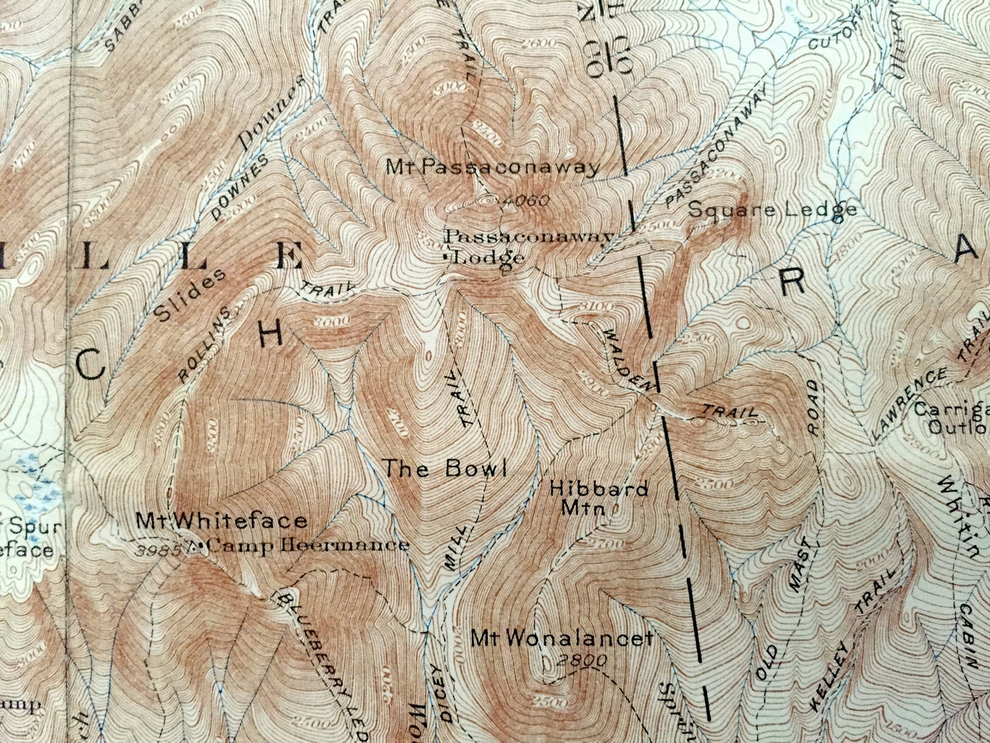
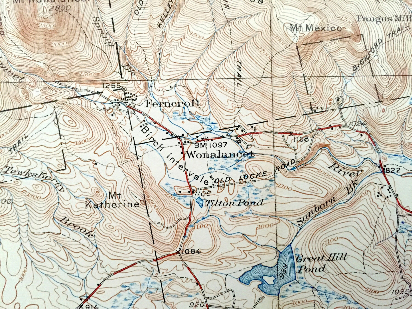
See what the White Mountains of New Hampshire looked like almost 90 years ago. Lots of intricate details and geological contours. Map even has little squares for every house that existed at the time. The USGS cartographers were very thorough back then! On the back is a description of topographic symbols and map guide.
Perfect for the historian, map-lover, the curious or just as a conversation starter. Wonderful and rare. Vintage maps such as these make great gifts.
Edition of 1931, printed 1931
Dimensions: 16 1/2" width x 20" height
----
Features
Cities & Towns: Livermore, Livermore Pass, Waterville, Passaconaway, Albany, Tamworth, Wonalancet, Whiteface, Center Sandwich, Sandwich, Moultonboro, Ossipee, Rennett Corners, Whittier, Chicks Corner, North Sandwich, South Tamworth, Ferncroft.
Points of Interest: Livermore Trail, White Mountain National Forest, Mt. Passaconaway, Passaconaway Lodge, The Bowl, Mt. Whiteface, Camp Heermance, Mt. Wonalanoet, Hedgehog camp, Flat Mountain Ponds, Jose Bridge, Sandsich Mountain, Logging Railroad, White Church, Fellows School, Friends Church, East Sandwich Chapel, Dandwich Bay, Mt. Israel, Osssipee Mountains, White Mountain Camp, Jim Liberty Shelter, Mt. Chocorua, Camp Penacook, Three Sisters, Fire Tower, Passaconaway Cutoff, Oliverian Trail, Sabbaday Falls, and lots more trails, hills, mountains, streams, ponds, houses and roads.
Condition: Good or "Very Vintage" condition, commensurate with age. This map is in great shape for being about 90 years old. Map has some edge-wear, foxing, toning and folds as-issued, but these will flatten easily and all of which will read as vintage character when framed.
----
We will happily adjust shipping price for multiple purchases. Maps are rolled up and shipped in sturdy mailing tubes, never folded.
Couldn't load pickup availability
Share