My Store
Antique Santa Ana, California 1955 US Geological Survey Topographic Map – Los Angeles, Temecula, Oceanside, Palm Springs, Ramona, Coachella
Antique Santa Ana, California 1955 US Geological Survey Topographic Map – Los Angeles, Temecula, Oceanside, Palm Springs, Ramona, Coachella
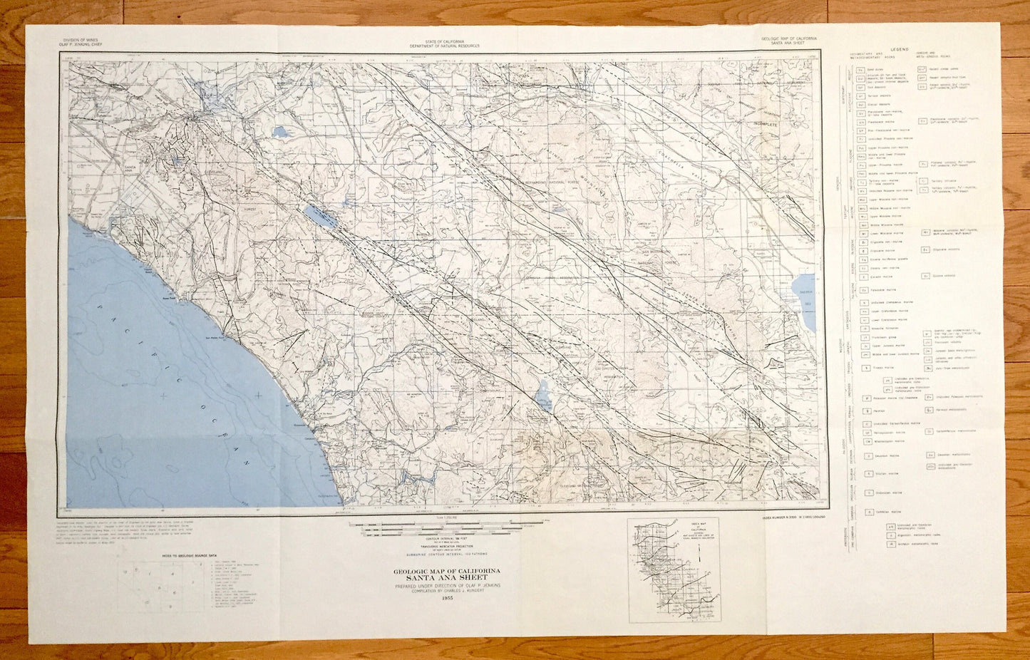
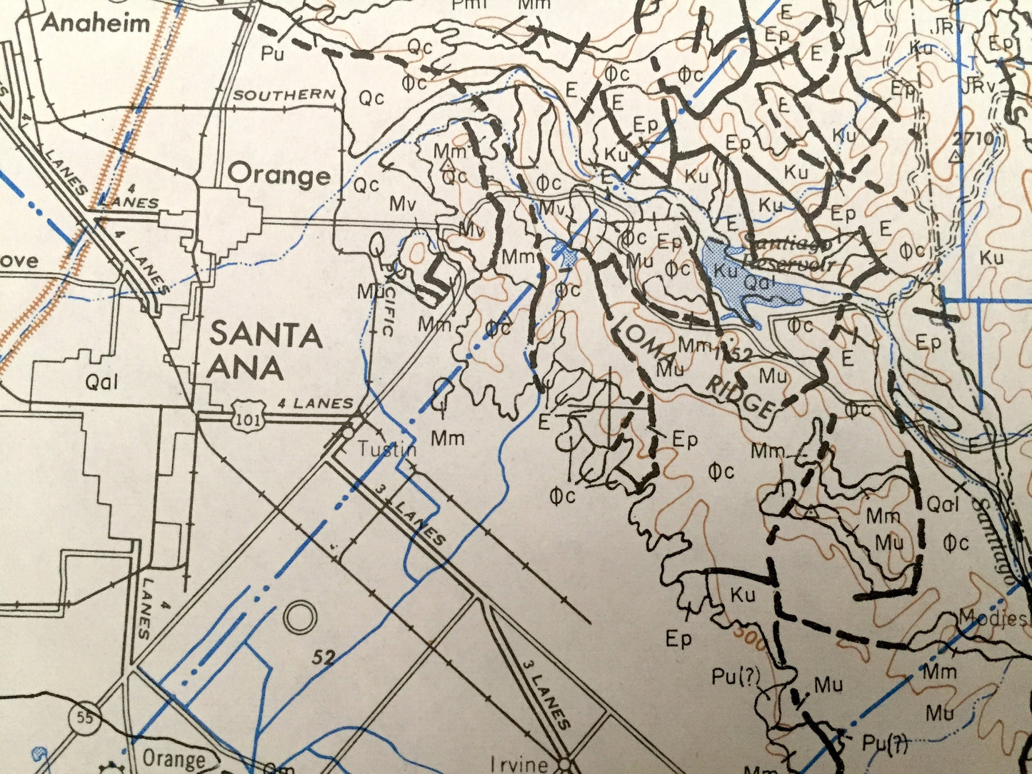
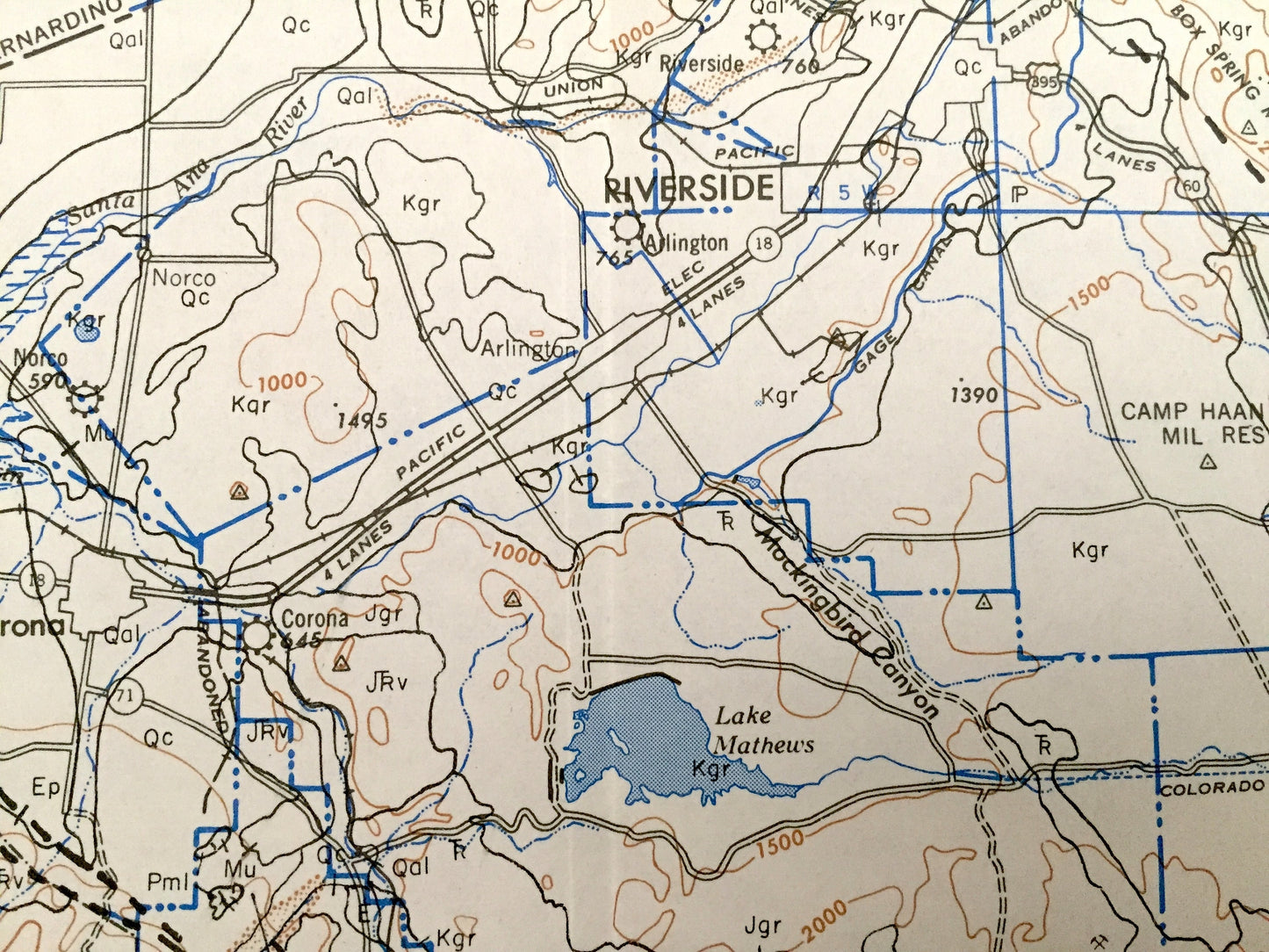
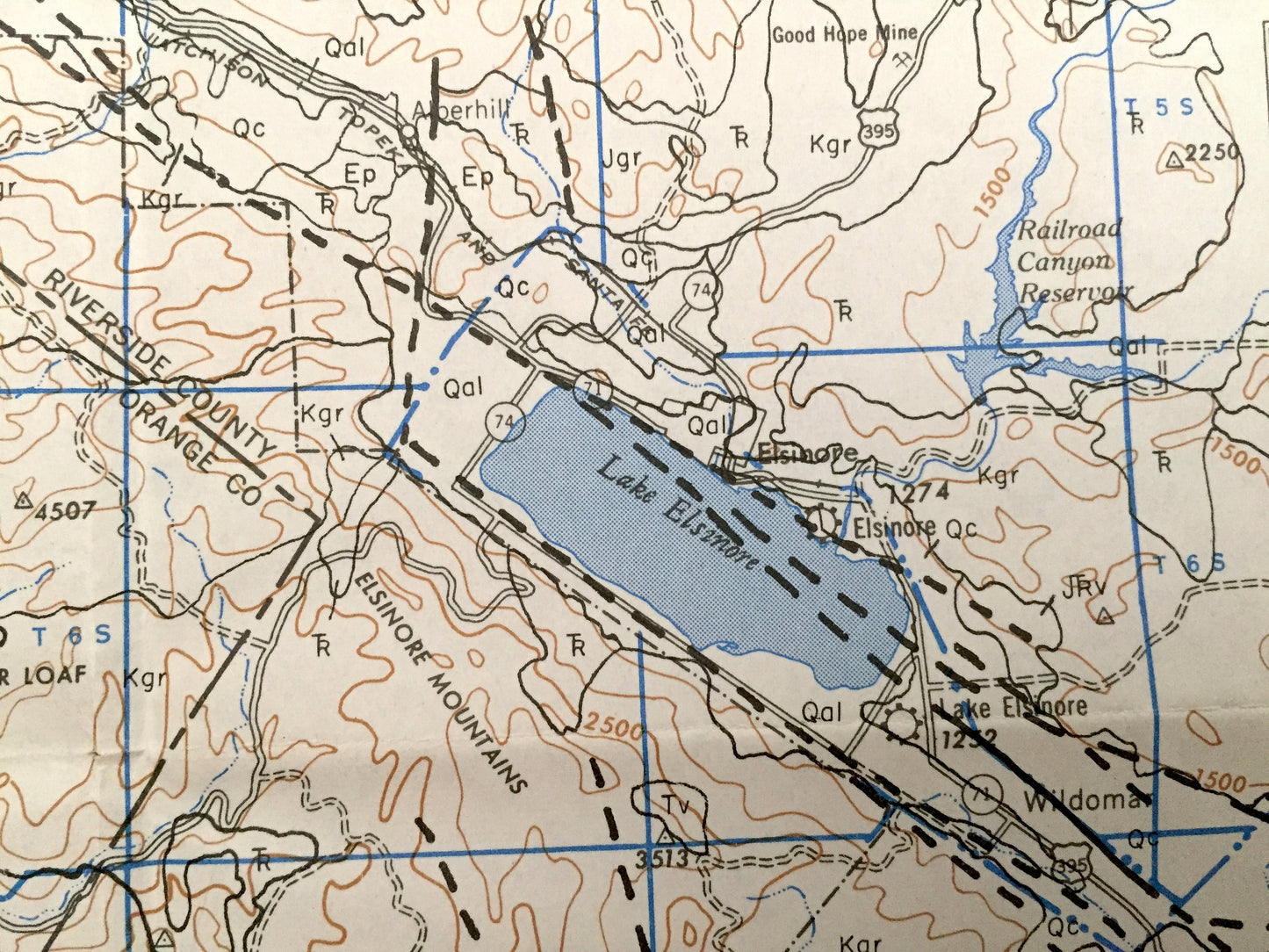
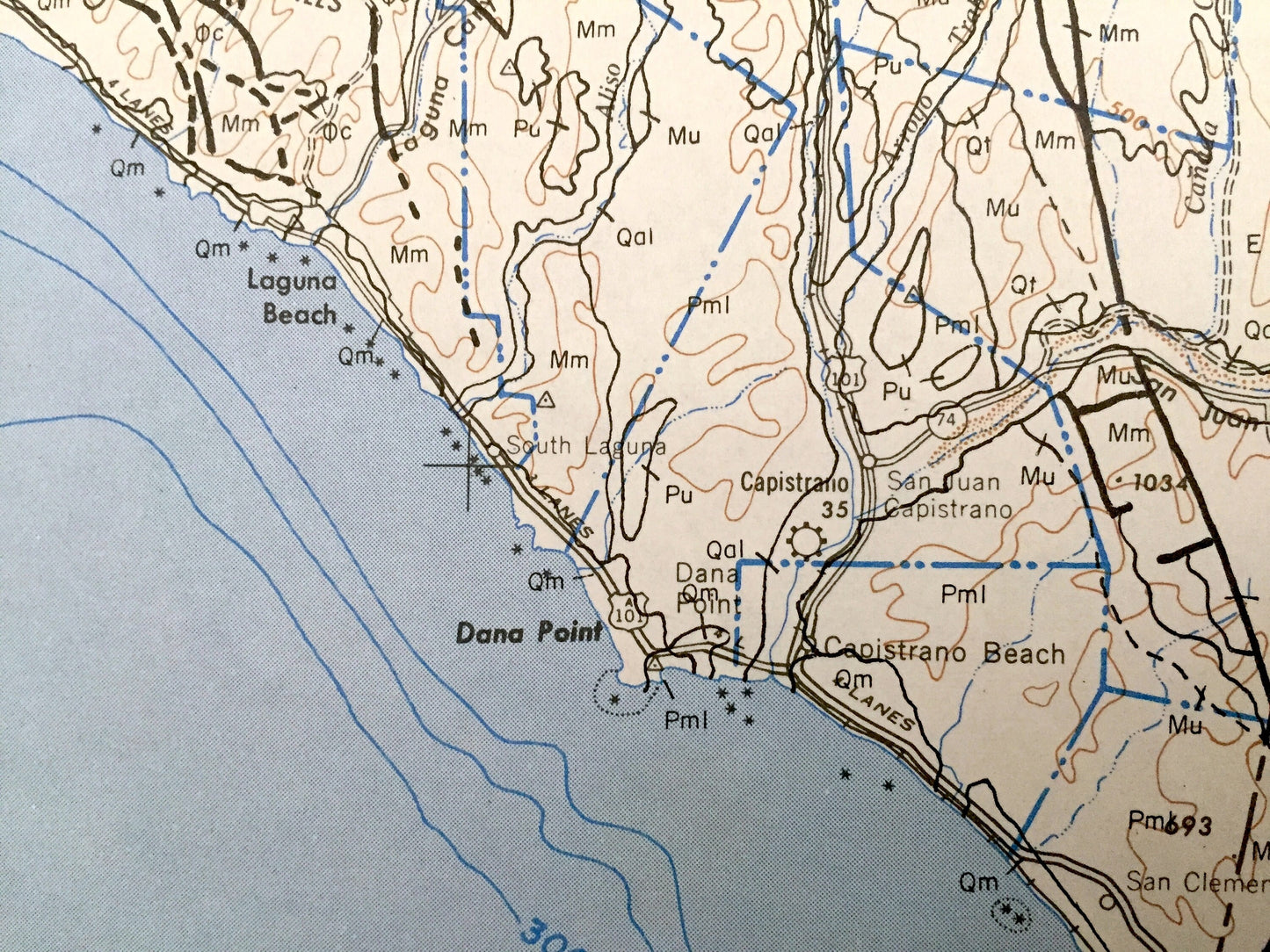
Beautiful, antique geologic map and explanatory chart of Santa Ana, California and surrounding Los Angeles County area. This is an authentic 1955 edition from the U.S. Geological Survey and NOT a computer reproduction.
See what California looked like over 60 years ago. Lots of intricate details and geological contours. Map even has symbols of the different types rocks located in each area. The USGS cartographers were very thorough back then!
Perfect for the geologist, historian, map-lover, the curious or just as a conversation starter. Wonderful and rare. Vintage maps such as these make great gifts.
Edition of 1955
Dimensions: 38 1/4" width x 24" height
----
Features
Cities & Towns: San Bernardino, Temecula, Oceanside, Escondido, Ramona, Palm Springs, Los Angeles, Santa Ana, Newport Beach.
Points of Interest: Pacific Ocean, Cleveland National Forest, Santa Rosa Mountains, Lake Henshaw, Jacinto Mountains, Borego Valley, Lake Elsinore, Los Coyotes Indian Reservation, Coachella Valley, Salton Sea and many more cities, towns, mountains, reservations, lakes, points, beaches, valleys and more.
Condition: Very Good condition, commensurate with age. This map is in incredible shape for being over 60 years old. This map was most likely used in the field. Has pencil markings, which will read as vintage character when framed.
----
We will happily adjust shipping price for multiple purchases. Maps are rolled up and shipped in sturdy mailing tubes, never folded.
Couldn't load pickup availability
Share