My Store
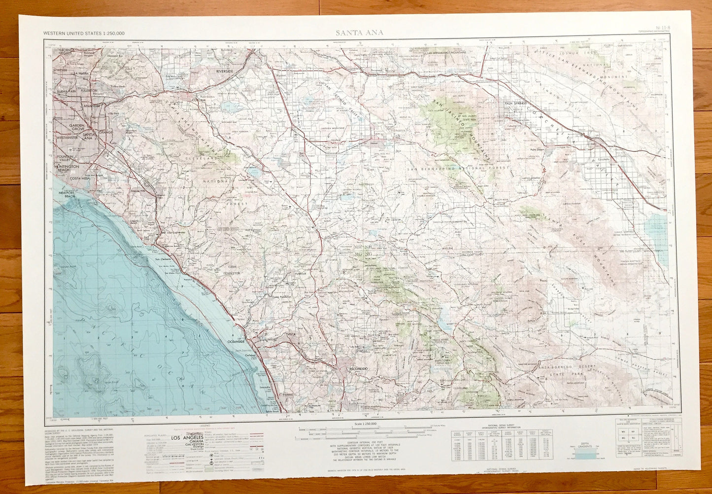
Antique Santa Ana, California 1959 US Geological Survey Topographic Map – Newport Beach, Huntington, Anaheim, Palm Springs, Coachella, CA
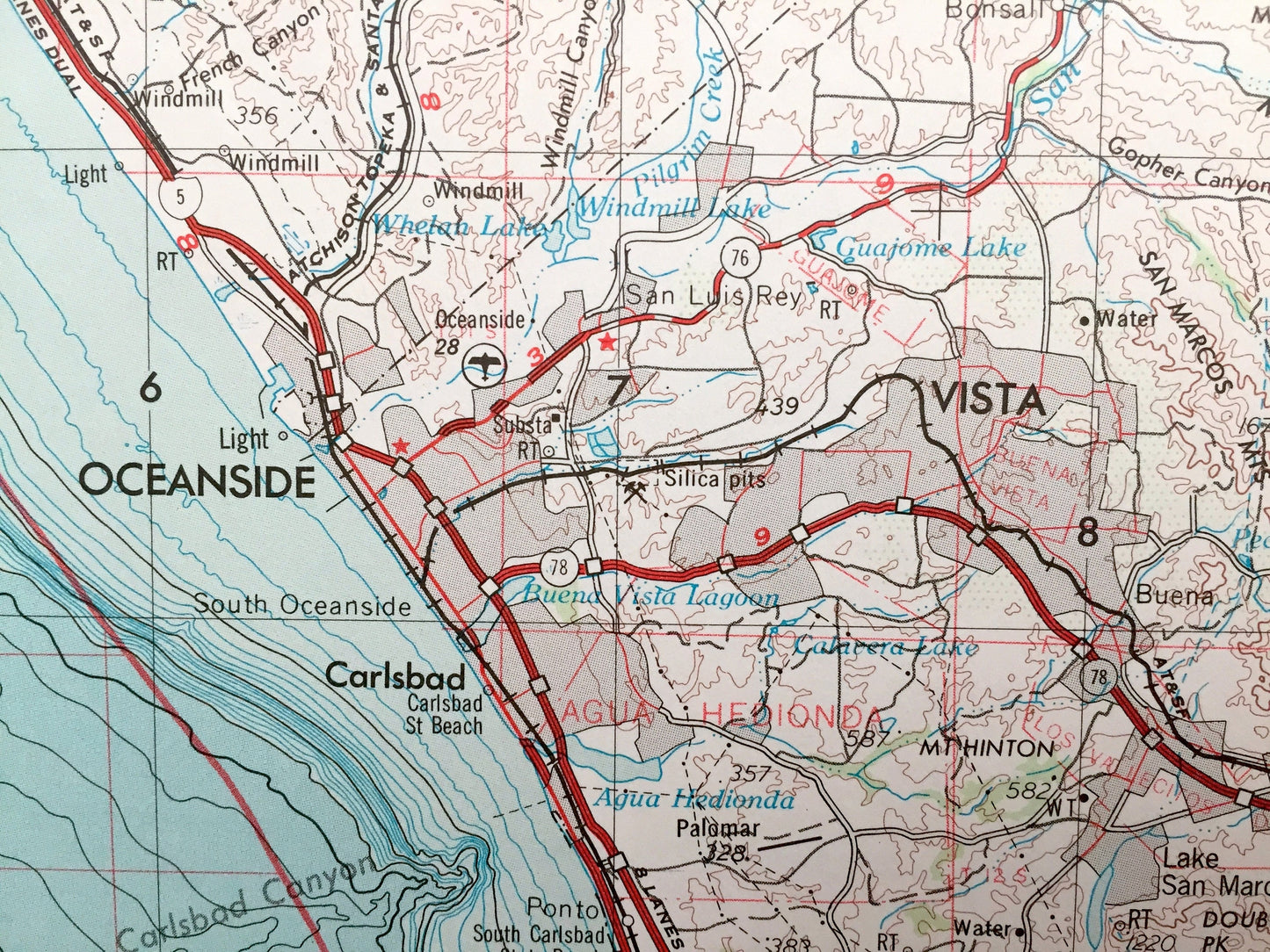
Antique Santa Ana, California 1959 US Geological Survey Topographic Map – Newport Beach, Huntington, Anaheim, Palm Springs, Coachella, CA
Beautiful, antique map of Santa Ana, California and surrounding area. This is an authentic 1959 edition, 1980 print from the U.S. Geological Survey and NOT a computer reproduction.
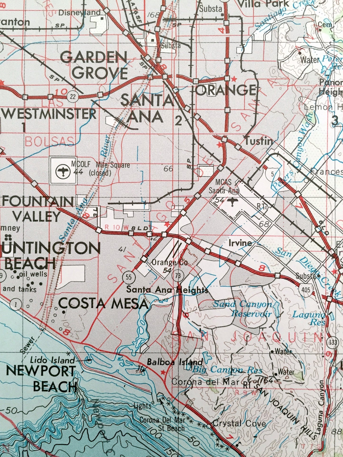
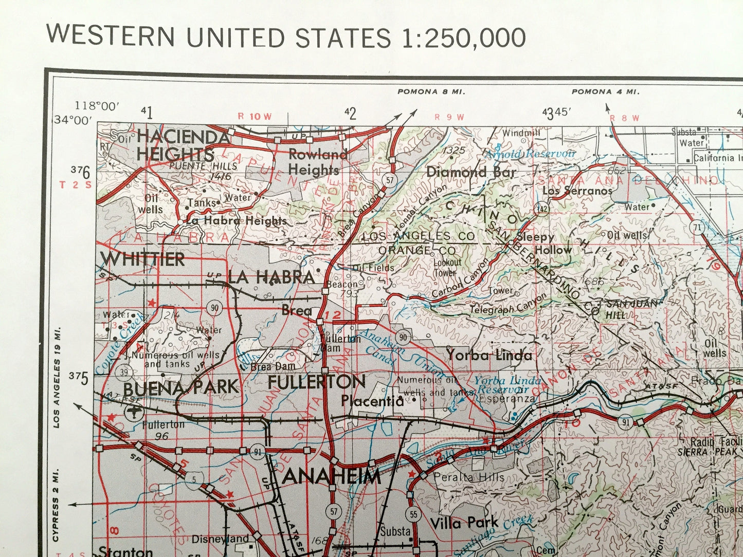
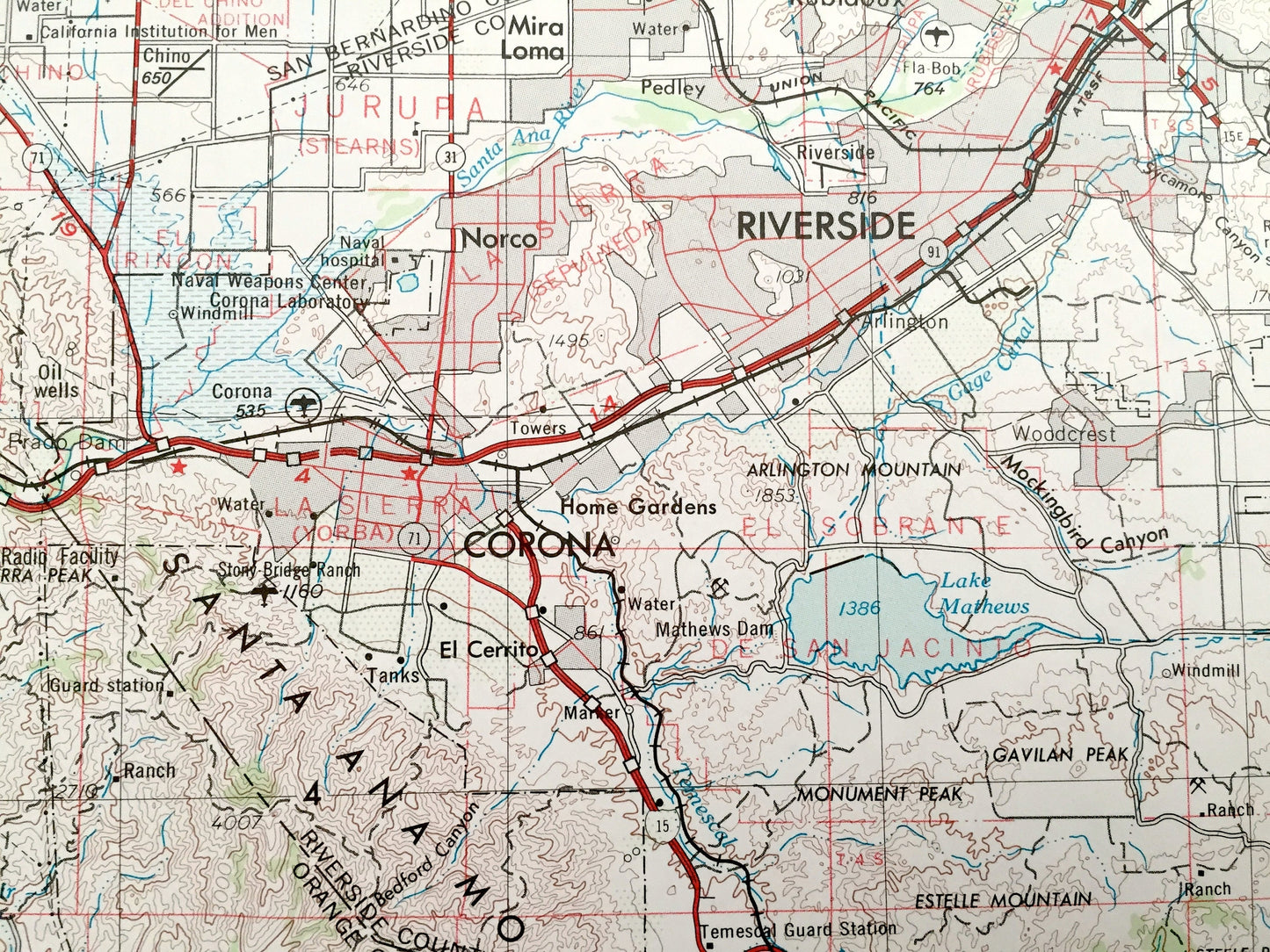
See what California looked like over 60 years ago. Lots of intricate details and geological contours. Map is incredibly large and in the grand 1:250,000 scale. Lots of intricate details and geological contours. The USGS cartographers were very thorough back then!
Perfect for the historian, map-lover, the curious or just as a conversation starter. Wonderful and rare. Vintage maps such as these make great gifts.
Edition of 1959, printed 1980
Dimensions: 32" width x 22" height
----
Features
Cities & Towns: Newport Beach, Huntington Beach, Costa Mesa, Santa Ana, Fountain Valley, Vista, Westminster, Garden Grove, Orange, Anaheim, Buena Park, Fullerton, Whittier, La Habra, Hacienda Heights, Riverside, San Juan Capistrano, Oceanside, Vista, Escondido, Palm Springs, Coachella, Corona, Carlsbad.
Points of Interest: Pacific Ocean, Gulf of Santa Catalina, Santa Ana Mountains, San Jacinto Valley, Cleveland National Forest, San Jacinto Mountains, San Bernardino National Forest, Indio Hills, Coachella Valley, Joshua Tree, Santa Rosa Mountains, and lots more hills, streams, ponds, marshes, houses, islands, coves, roads, railroads.
Condition: Very Good condition, commensurate with age. This map is in great shape for being over 40 years old.
----
We will happily adjust shipping price for multiple purchases. Maps are rolled up and shipped in sturdy mailing tubes, never folded.
Couldn't load pickup availability
Share