My Store
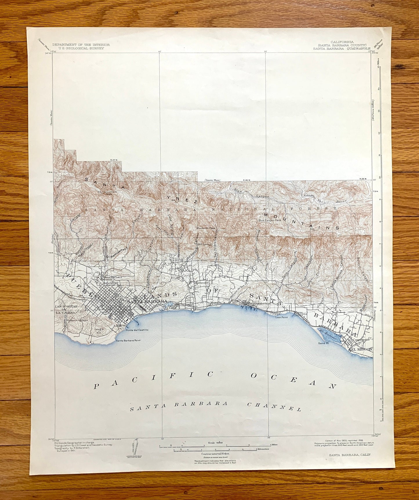
Antique Santa Barbara, California 1903 US Geological Survey Topographic Map – Montecito, Summerland, El Rincon, Santa Ynez Mountains CA
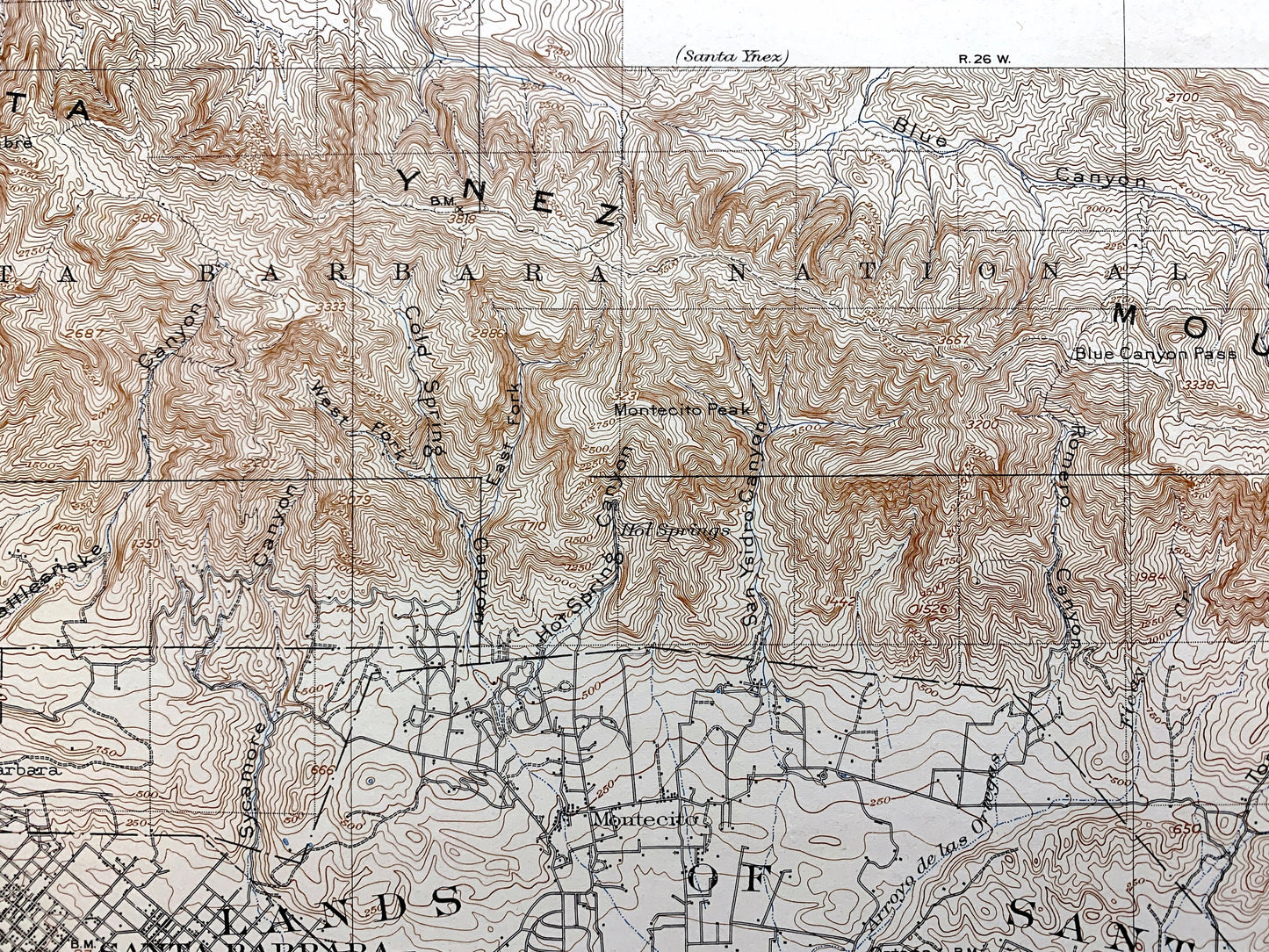
Antique Santa Barbara, California 1903 US Geological Survey Topographic Map – Montecito, Summerland, El Rincon, Santa Ynez Mountains CA
Beautiful, antique map of Santa Barbara, California and surrounding Los Padres National Forest area. This is an authentic 1903 edition, 1936 print from the U.S. Geological Survey and NOT a computer reproduction.
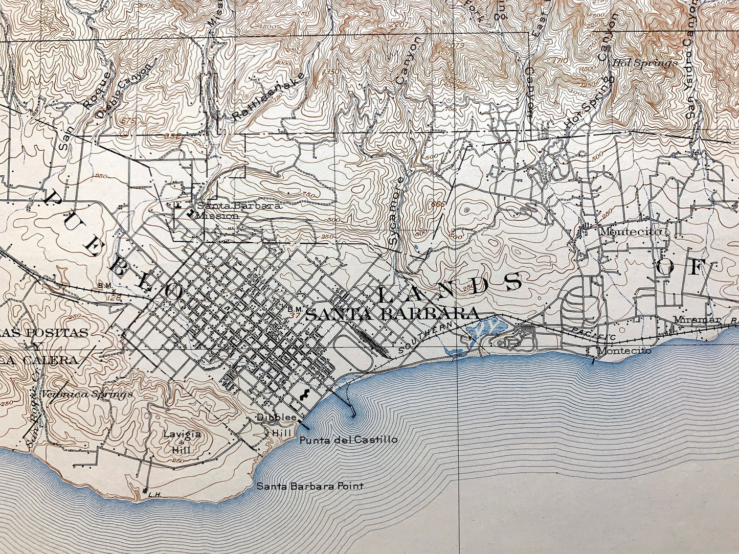
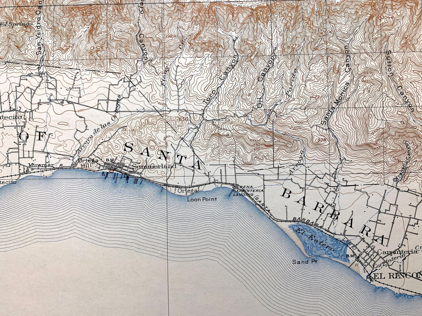
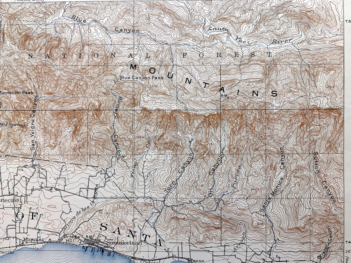
See what the Pacific Coast looked like more than 120 years ago, before development. Lots of intricate details and geological contours. Map even has little squares for every house that existed at the time. The cartographers were very thorough back then! On the back is a description of topographic symbols and map guide.
Perfect for the historian, map-lover, the curious or just as a conversation starter. Wonderful and rare. Vintage maps such as these make great gifts.
Edition of 1903, printed 1936
Dimensions: 16 1/2" width x 20" height
----
Features
Cities & Towns: Las Positas y La Calera, Pueblo, Santa Barbara, Montecito, Summerland, El Rincon, Carpinteria.
Points of Interest: California Coast, Santa Ynez Mountains, Los Padres National Forest, Lavigia Hill, Blue Canyon, El Estero, Sant Point, Loon Point, Punta de Castillo, Diablo Hill, and lots more mountains, canyons, rivers, small towns and train tracks.
Condition: Very Good Vintage condition, commensurate with age. This map is in great shape for being about 90 years old. Has some light wear but this will add to vintage character when framed.
----
We will happily adjust shipping price for multiple purchases. Maps are rolled up and shipped in sturdy mailing tubes, never folded.
Couldn't load pickup availability
Share